-
Geology of Sauk County, Wisconsin
Geologic history and description of Sauk County, the home of Devils Lake and Parfreys Glen. Includes four-color bedrock map and cross sections. Map and cross sections are folded.-
Geology of Sauk County, Wisconsin
1990
Report: 68 p. + map (24.5 in x 34.5 in, scale 1:100,000) and Cross Sections (24 in x 38 in)
-
-
Pleistocene Geology of Marathon County, Wisconsin
-
Pleistocene Geology of Marathon County, Wisconsin (version 2) [GIS data]
1989
GIS Data: GeMS file geodatabase and metadata; supersedes previous coverage format
-
Hydrogeology of the Wisconsin River Valley in Marathon County, Wisconsin
-
Hydrogeology of the Wisconsin River Valley in Marathon County, Wisconsin
1988
Report: 66 p. + maps (scale 1:100,000)
-
Elevation of the Base of the Wausau Aquifer, Marathon County, Wisconsin [plate 1]
1988
Map: Scale 1:62,500
-
Elevation of the Water Table in the Wisconsin River Valley, Marathon County, Wisconsin [plate 2]
1988
Map: Scale 1:62,500
-
-
Pleistocene Geology of Forest County, Wisconsin
-
Pleistocene Geology of Forest County, Wisconsin (version 2) [GIS data]
1987
GIS Data: GeMS file geodatabase and metadata; supersedes previous coverage format
-
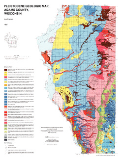
Pleistocene Geology of Adams County, Wisconsin
-
Pleistocene Geology of Adams County, Wisconsin
1987
Report: 14 p. + map and cross sections (Scale 1:100,000)
-
-
Hydrogeology and Ground-Water Use and Quality, Brown County, Wisconsin
-
Hydrogeology and Ground-Water Use and Quality, Brown County, Wisconsin
1986
Report: 42 p. + maps (scale 1:100,000)
-
Potentiometric Surface of Upper Aquifer, Brown County, Wisconsin, 1980 [plate 1]
1986
Map: Scale 1:100,000
-
-
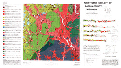
Pleistocene Geology of Barron County, Wisconsin
-
Pleistocene Geology of Barron County, Wisconsin (version 2) [GIS data]
1986
GIS Data: GeMS file geodatabase and metadata, supersedes previous coverage format (DI version 1)
-
Glacial and Related Deposits of Langlade County, Wisconsin
-
Glacial and Related Deposits of Langlade County, Wisconsin
1986
Report: 30 p. + map (scale 1:100,000)
-
Pleistocene Geology of Langlade County, Wisconsin (version 2) [GIS data]
1986
GIS Data: GeMS file geodatabase and metadata; supersedes previous coverage format
-
-
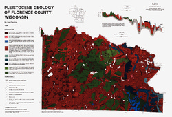
Pleistocene Geology of Florence County, Wisconsin
-
Pleistocene Geology of Florence County, Wisconsin (version 2) [GIS data]
1986
GIS Data: GeMS file geodatabase and metadata; supersedes previous coverage format
-
Pleistocene Geology of Vilas County, Wisconsin
-
Pleistocene Geology of Vilas County, Wisconsin (version 2) [GIS data]
1985
GIS Data: GeMS file geodatabase and metadata; supersedes previous coverage format
-
Pleistocene Geology of Brown County, Wisconsin
-
Pleistocene Geology of Brown County, Wisconsin
1985
Report: 19 p. + map of geology (scale 1:100,000)
-
-
A Subsurface Study of the St. Peter Sandstone in Southern and Eastern Wisconsin
-
A Subsurface Study of the St. Peter Sandstone in Southern and Eastern Wisconsin
1985
Report: 26 p. + maps (scale 1:750,000)
-
-
Pleistocene Geology of the Superior Region, Wisconsin
-
Pleistocene Geology of the Superior Region, Wisconsin [GIS data]
1985
GIS Data: GeMS file geodatabase, metadata
-
Pleistocene Geology of the Superior Region, Wisconsin [plate 1]
1985
Map: 36 in x 28 in, scale 1:250,000

Publications Catalog
Wisconsin Geological and Natural History Survey