-
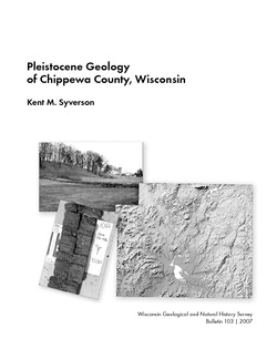
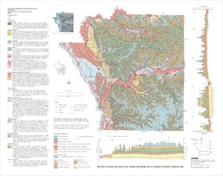
Pleistocene Geology of Chippewa County, Wisconsin
-
Pleistocene Geology of Chippewa County, Wisconsin
2007
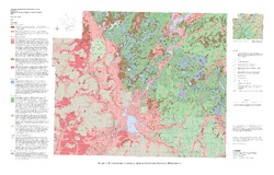
Report: 53 p. + map and cross sections (scale 1:100,000)
-
Pleistocene Geology of Chippewa County, Wisconsin (version 2) [GIS data]
2007
GIS Data: GeMS file geodatabase and metadata; supersedes previous coverage format
-
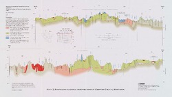
Pleistocene Geologic Cross Sections of Chippewa County, Wisconsin [plate 2]
2007
Plate: Scale 1:100,000
-
-
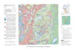
Geology of La Crosse County, Wisconsin
-
Geology of La Crosse County, Wisconsin
2003
Report: 33 p. + map and cross sections (scale 1:100,000)
-
Geology of La Crosse County, Wisconsin (version 2) [GIS Data]
2003
GIS Data: GeMS file geodatabase and metadata, supersedes previous coverage format (DI version 1)
-
-
Pleistocene Geology of Waukesha County, Wisconsin
-
Pleistocene Geology of Waukesha County, Wisconsin
2001
Report: 33 p. + map and cross sections (scale 1:100,000)
-
Pleistocene Geology of Waukesha County, Wisconsin (version 2) [GIS data]
2001
GIS Data: GeMS file geodatabase and metadata, supersedes previous coverage format (DI version 1)
-
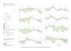
Pleistocene Geologic Cross Sections of Waukesha County, Wisconsin [plate 2]
2001
Plate: Scale 1:200,000
-
-
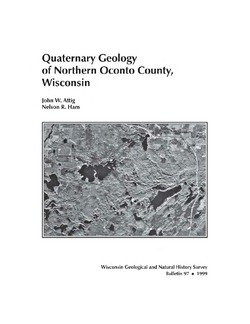
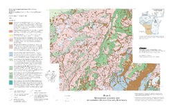
Quaternary Geology of Northern Oconto County, Wisconsin
-
Quaternary Geology of Northern Oconto County, Wisconsin (version 2) [GIS data]
1999
GIS Data: GeMS file geodatabase and metadata, supersedes previous coverage format (DI version 1)
-
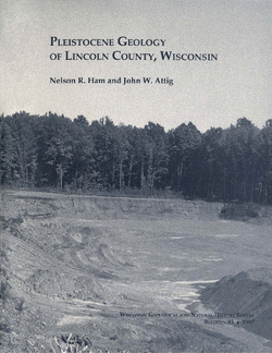
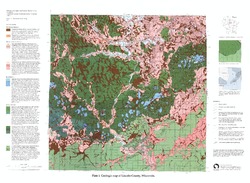
Pleistocene Geology of Lincoln County, Wisconsin
-
Pleistocene Geology of Lincoln County, Wisconsin (version 2) [GIS data]
1997
GIS Data: GeMS file geodatabase and metadata; supersedes previous coverage format
-
Pleistocene Geology of Polk County, Wisconsin
-
Pleistocene Geology of Polk County, Wisconsin
2000
Report: 70 p. + map and cross sections (scale 1:100,000)
-
Pleistocene Geology of Polk County, Wisconsin [GIS data]
2000
GIS Data: GeMS file geodatabase and metadata
-
Pleistocene Geology and Cross Sections of Polk County, Wisconsin [plate 1]
1998
Map: Scale 1:100,000
-
-
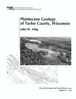
Pleistocene Geology of Taylor County, Wisconsin
-
Pleistocene Geology of Taylor County, Wisconsin
1993
Report: 25 p. + map and cross sections (scale 1:100,000)
-
Pleistocene Geology of Taylor County, Wisconsin (version 2) [GIS data]
1993
GIS Data: GeMS Level 3 file geodatabase and metadata. Supersedes previous coverage format (DI version 1).
-
-
Geologic Map of the Fennimore and Mount Hope 7.5-Minute Quadrangles, Grant County, Wisconsin
The geologic map of the Fennimore and Mount Hope quadrangles includes 1:24,000-scale mapping of both surficial and bedrock geology. The mapping was initiated to support groundwater studies in the area. The map and accompanying report present the Paleozoic bedrock stratigraphy, including structures, as well as data from three new bedrock drill cores...-
Geologic Map of the Fennimore and Mount Hope 7.5-Minute Quadrangles, Grant County, Wisconsin
2023
Map: 50.55 x 36 in, scale 1:24,000
-
GIS Data for the Geologic Map of the Fennimore and Mount Hope 7.5-Minute Quadrangles, Grant County, Wisconsin [dataset 2]
2023
GIS Data: GeMS file geodatabase, metadata
-
-
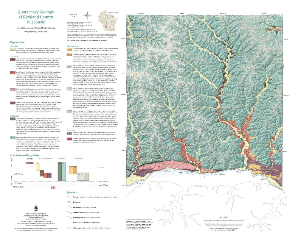
Quaternary Geology of Richland County, Wisconsin
The topography of the Driftless Area, which was never glaciated during the Quaternary Period, is dominated by fluvial incision into flat-lying Paleozoic bedrock, resulting in deep, dendritic valleys. Local relief reaches 115 meters. Sediment coring across the region reveals that the geology of unconsolidated surficial materials is often controlled by the...-
GIS Data for Quaternary Geology of Richland County, Wisconsin [dataset 1]
2025
GIS Data: GeMS Level 3 file geodatabase (.gdb file format)
-
Core Data for Quaternary Geology of Richland County, Wisconsin [dataset 2]
2025
Data: Spreadsheet (.csv file format)
-
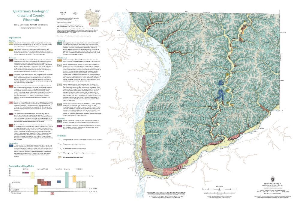
Quaternary Geology of Crawford County, Wisconsin
The topography of the Driftless Area, which was never glaciated during the Quaternary Period, is dominated by fluvial incision into flat-lying Paleozoic bedrock, resulting in deep, dendritic valleys. Local relief reaches 115 meters. Sediment coring across the region reveals that the geology of unconsolidated surficial materials is often controlled by the...-
GIS Data for Quaternary Geology of Crawford County, Wisconsin [dataset 1]
2025
GIS Data: GeMS Level 3 file geodatabase (.gdb file format)
-
Core Data for Quaternary Geology of Crawford County, Wisconsin [dataset 2]
2025
Data: Spreadsheet (.csv file format)
-
Geologic Map of the Durwards Glen 7.5-Minute Quadrangle, Columbia and Sauk Counties, Wisconsin
The Durwards Glen 7.5-minute quadrangle map is located in Columbia and Sauk counties, southeast of the city of Baraboo. This geologic map includes Precambrian through Quaternary units. New mapping has focused on subdividing the Baraboo Quartzite into four separate members and delineating Quaternary deposits in greater detail than prior work.-
Geologic Map of the Durwards Glen 7.5-Minute Quadrangle, Columbia and Sauk Counties, Wisconsin
2024
Map: 35 x 40 in, scale 1:24,000
-
GIS Data for the Geologic Map of the Durwards Glen 7.5-Minute Quadrangle, Columbia and Sauk Counties, Wisconsin [dataset 1]
2024
GIS Data: GeMS file geodatabase, shapefiles, geopackage, metadata
-
-
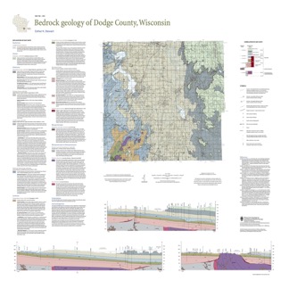
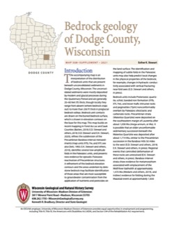
Bedrock Geology of Dodge County, Wisconsin
Dodge County lies in southeast Wisconsin, an area almost entirely covered by glacial deposits. This map interprets the distribution of the buried bedrock units across the county. Geologist Esther Stewart’s refinement of the bedrock elevation contours may help land-use planners identify areas most susceptible to groundwater contamination from applications...-
Supporting Data for the Bedrock Geology of Dodge County, Wisconsin
2021
Data: Tabular data files (Excel)
-
GIS Data for the Bedrock Geology of Dodge County, Wisconsin [dataset 2]
2021
GIS Data: GeMS file geodatabase, shapefiles, GeoPackage, and metadata
-
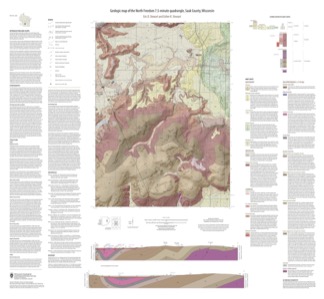
Geologic Map of the North Freedom 7.5-Minute Quadrangle, Sauk County, Wisconsin
The North Freedom quadrangle is located on the South Range of the Baraboo Hills in south-central Wisconsin. The Baraboo Hills are recognized for their ecologic and geologic significance, with superb exposure of Precambrian and Paleozoic rocks and Quaternary sediments. Mapping focused on the Precambrian section, building on past work by subdividing and...-
Geologic Map of the North Freedom 7.5-Minute Quadrangle, Sauk County, Wisconsin
2020
Map: 40 in x 37 in, scale 1:24,000
-
GIS Data for the Geologic Map of the North Freedom 7.5-Minute Quadrangle, Sauk County, Wisconsin (version 2) [dataset 1]
2020
GIS Data: GeMS file geodatabase, shapefiles, and metadata. Supersedes previous file geodatabase format (DI version 1)
-
-
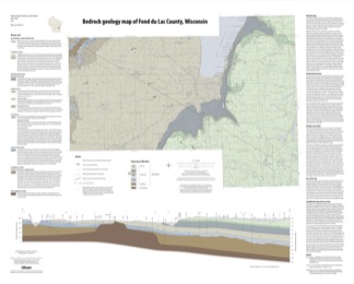
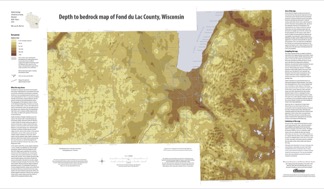
Bedrock Geology of Fond du Lac County, Wisconsin
Two plates showing the bedrock geology and depth to bedrock in Fond du Lac County, Wisconsin. Includes GIS data (shapefiles and grid files).-
GIS Data for the Bedrock Geology of Fond du Lac County, Wisconsin (version 2) [dataset 1]
2018
GIS Data: GeMS file geodatabase, shapefiles, and metadata. Supersedes previous shapefile format (DI version 1)
-
Bedrock Geology Map of Fond du Lac County, Wisconsin [plate 1]
2018
Plate: Scale 1:100,000, 35.75 in x 28.75 in
-
Depth to Bedrock Map of Fond du Lac County, Wisconsin [plate 2]
2018
Plate: Scale 1:100,000, 33 in x 19.25 in
-
-
Preliminary Geology of Iowa County, Wisconsin
Open-file report; contains unpublished data that has not yet been peer-reviewed.-
Preliminary Bedrock Geology of Iowa County, Wisconsin (version 2) [GIS data]
2010
GIS Data: GeMS file geodatabase and metadata, supersedes previous shapefile format (DI version 1)
-
Preliminary Geologic Map of Iowa County, Wisconsin [plate 1]
2010
Map: 28 in x 22 in, scale 1:100,000
-
-
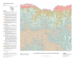
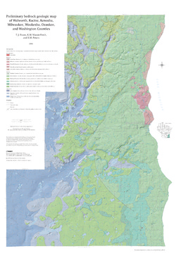
Preliminary Bedrock Geologic Map of Walworth, Racine, Kenosha, Milwaukee, Waukesha, Ozaukee, and Washington Counties
Open-file report; contains unpublished data that has not yet been peer-reviewed.-
Preliminary Bedrock Geologic Map of Walworth, Racine, Kenosha, Milwaukee, Waukesha, Ozaukee, and Washington Counties
2004
Map: 34.75 in x 52 in, scale 1:100,000
-
Preliminary Bedrock Geologic Map of Walworth, Racine, Kenosha, Milwaukee, Waukesha, Ozaukee, and Washington Counties [GIS data]
2004
GIS Data: GeMS file geodatabase and metadata
-
-
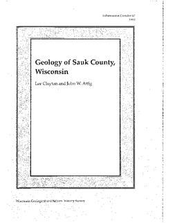
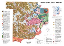
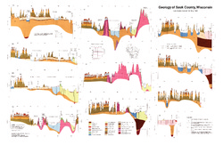
Geology of Sauk County, Wisconsin
Geologic history and description of Sauk County, the home of Devils Lake and Parfreys Glen. Includes four-color bedrock map and cross sections. Map and cross sections are folded.-
Geology of Sauk County, Wisconsin
1990
Report: 68 p. + map (24.5 in x 34.5 in, scale 1:100,000) and Cross Sections (24 in x 38 in)
-
GIS Data for the Geology of Sauk County, Wisconsin (version 2) [dataset 1]
1990
GIS Data: GeMS file geodatabase, shapefiles, and metadata. Supersedes previous shapefile format (DI version 1)
-
-
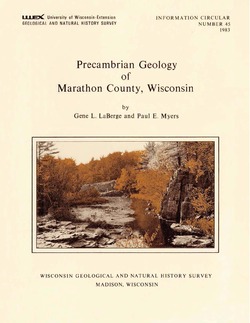
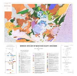
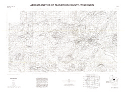
Precambrian Geology of Marathon County, Wisconsin
-
GIS Data for the Precambrian Geology of Marathon County, Wisconsin (version 2) [dataset 1]
1983
GIS Data: GeMS file geodatabase, shapefiles, GeoPackage, and metadata. Supersedes previous shapefile format (DI version 1)
-
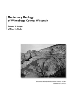
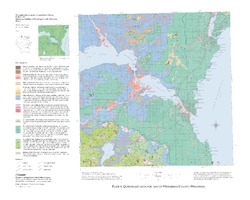
Quaternary Geology of Winnebago County, Wisconsin
-
Quaternary Geology of Winnebago County, Wisconsin (version 2) [GIS data]
2008
GIS Data: GeMS Level 3 file geodatabase and metadata. Supersedes previous shapefile format (DI version 1).
-
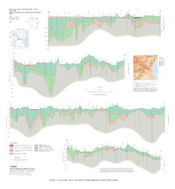
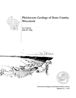
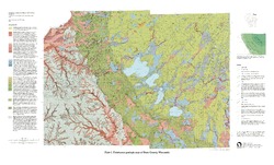
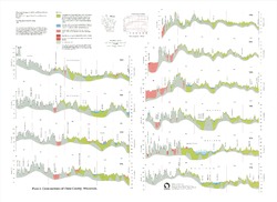
Pleistocene Geology of Dane County, Wisconsin
Description of the geologic history of Dane County. The preface points out the significance of glacial landscape research at WGNHS over the past century. Many pictures and diagrams and a four-color map and cross sections show the striking differences between glaciated and unglaciated regions of the county. Map and cross sections are folded.-
Pleistocene Geology of Dane County, Wisconsin
1997
Report: 64 p. + map and cross sections (scale: 1:100,000)
-
Pleistocene Geology of Dane County, Wisconsin (version 2) [GIS data]
1997
GIS Data: GeMS file geodatabase and metadata; supersedes previous coverage format
-
Pleistocene Geologic Map of Dane County, Wisconsin [plate 1]
1997
Map: Scale 1:100,000, 39 in x 24 in
-

Publications Catalog
Wisconsin Geological and Natural History Survey