-
Quaternary Geology of Ozaukee and Washington Counties, Wisconsin
-
Quaternary Geology of Ozaukee and Washington Counties, Wisconsin
1997
Report: 56 p. + map and cross sections (scale 1:100,000)
-
Quaternary Geology of Ozaukee and Washington Counties, Wisconsin (version 2) [GIS data]
1997
GIS Data: GeMS Level 3 file geodatabase and metadata. Supersedes previous shapefile format (DI version 1).
-
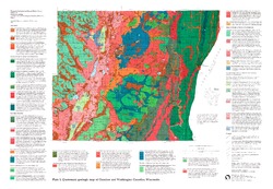
Quaternary Geologic Map of Ozaukee and Washington Counties, Wisconsin [plate 1]
1997
Map: Scale 1:100,000
-
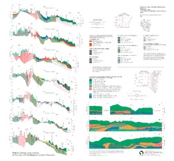
Geologic Cross Sections of Ozaukee and Washington Counties, Wisconsin [plate 2]
1997
Plate: 26 in x 24 in
-
-
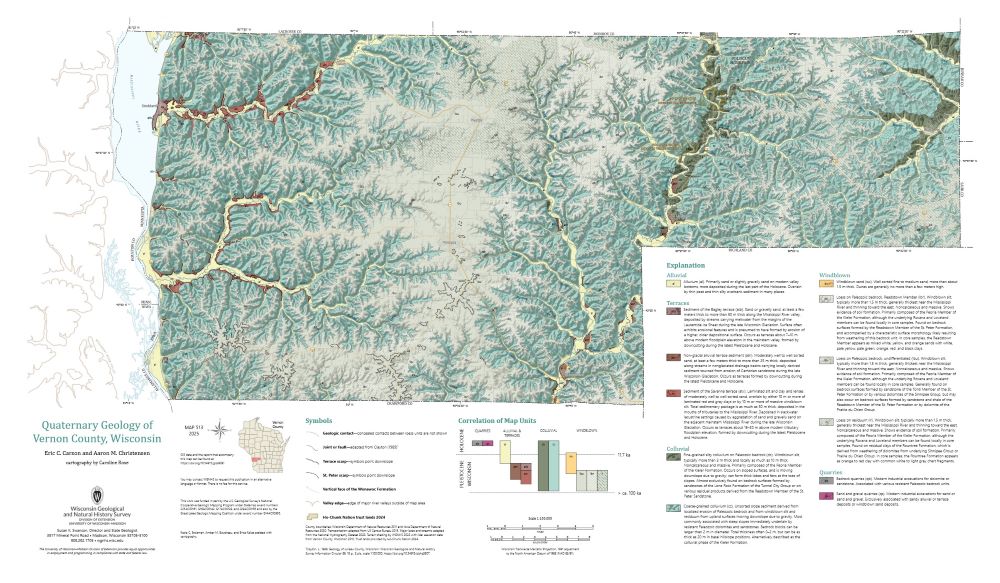
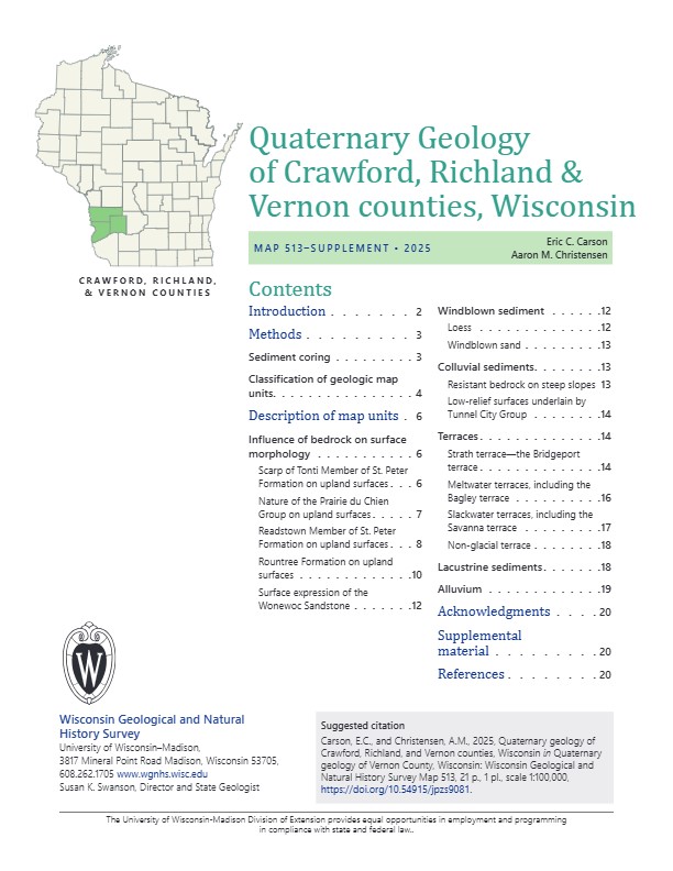
Quaternary Geology of Vernon County, Wisconsin
The topography of the Driftless Area, which was never glaciated during the Quaternary Period, is dominated by fluvial incision into flat-lying Paleozoic bedrock, resulting in deep, dendritic valleys. Local relief reaches 115 meters. Sediment coring across the region reveals that the geology of unconsolidated surficial materials is often controlled by the...-
GIS Data for Quaternary Geology of Vernon County, Wisconsin [dataset 1]
2025
GIS Data: GeMS Level 3 file geodatabase (.gdb file format)
-
Core Data for Quaternary Geology of Vernon County, Wisconsin [dataset 2]
2025
Data: Spreadsheet (.csv file format)
-
Geology of the Baraboo Hills, Sauk and Columbia Counties, Wisconsin
Located in the south-central portion of the state, new geologic mapping of the frequently-visited Baraboo Hills has resulted in a revision of the stratigraphy of the Precambrian-aged bedrock. The Baraboo Quartzite is now divided into four informal members, and the maximum depositional age for the Baraboo Quartzite is 1714±17 million years old. These...-
Geology of the Baraboo Hills, Sauk and Columbia Counties, Wisconsin [plate 1]
2025
Map: 48.25 in x 29.25 in, scale 1:50,000
-
GIS Data for Geology of the Baraboo Hills, Sauk and Columbia Counties, Wisconsin [dataset 1]
2025
GIS Data: GeMS Level 3 file geodatabase (.gdb file format) and GeoPackage (.gpkg file fomat)
-
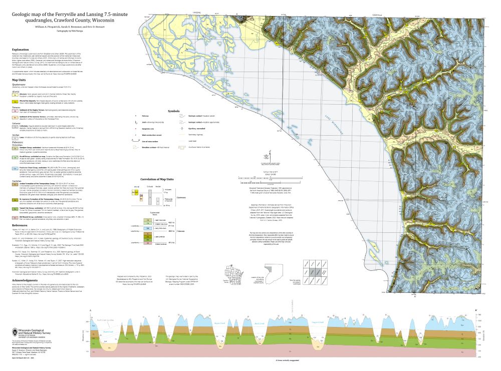
Geologic Map of the Ferryville and Lansing 7.5-Minute Quadrangles, Crawford County, Wisconsin
The geologic map of the Ferryville and Lansing 7.5-minute quadrangles (Crawford County), located in the Driftless Area of southwestern Wisconsin, provides new observations and lithologic descriptions of the area's geology. This work supports the Wisconsin Department of Transportation's ongoing efforts to mitigate slope failures along the Wisconsin State...-
Geologic Map of the Ferryville and Lansing 7.5-Minute Quadrangles, Crawford County, Wisconsin
2025
Map: 41.5 in x 30.75 in, scale 1:24,000
-
GIS Data for the Geologic Map of the Ferryville and Lansing 7.5-Minute Quadrangles, Crawford County, Wisconsin [dataset 1]
2025
GIS Data: GeMS Level 3 file geodatabase (.gdb file format) and GeoPackage (.gpkg file format)
-
-
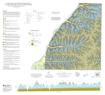
Geologic Map of the Eastman and Harpers Ferry 7.5-Minute Quadrangles, Crawford County, Wisconsin
The geologic map of the Eastman and Harpers Ferry 7.5-minute quadrangles (Crawford County), located in the Driftless Area of southwestern Wisconsin, provides new observations and lithologic descriptions of the area's geology. This work supports the Wisconsin Department of Transportation's ongoing efforts to mitigate slope failures along the Wisconsin...-
Geologic Map of the Eastman and Harpers Ferry 7.5-Minute Quadrangles, Crawford County, Wisconsin
2025
Map: 36 in x 32.5 in, scale 1:24,000
-
GIS Data for the Geologic Map of the Eastman and Harpers Ferry 7.5-Minute Quadrangles, Crawford County, Wisconsin [dataset 1]
2025
GIS Data: GeMS Level 3 file geodatabase (.gdb file format) and GeoPackage (.gpkg file format)
-
-
Bedrock Geology of Grant County, Wisconsin
Three-dimensional bedrock mapping of Grant County at a scale of 1:100,000 provides new baseline information on the distribution of geologic units. Grant County contains Paleozoic bedrock units ranging in age from Silurian to Cambrian. Gentle folds and small faults deform the Paleozoic sequence and were mapped based on structure contours of the base of the...-
GIS Data for Bedrock Geology of Grant County, Wisconsin [dataset 1]
2025
GIS Data: GeMS Level 3 file geodatabase (.gdb), GeoPackage, metadata
-
Geochemical Data for Bedrock Geology of Grant County, Wisconsin [dataset 2]
2025
Data: Spreadsheet (.csv)
-
GIS Data for Bedrock Geology of Grant County, Wisconsin [dataset 3]
2025
GIS Data: File geodatabase (.gdb) raster datasets, metadata
-
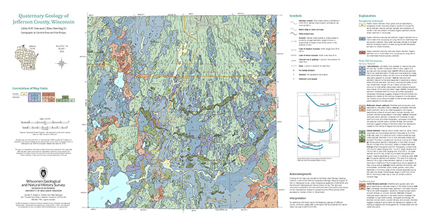
Quaternary Geology of Jefferson County, Wisconsin
The Quaternary geologic map of Jefferson County, Wisconsin, provides details about the surficial sediment and landscapes that were formed largely in the footprint of the Laurentide Ice Sheet's southern Green Bay Lobe during the late Wisconsin Glaciation (ca. 20,000 years before present). These landscapes include lowlands underlain by glacial and...-
GIS Data for Quaternary Geology of Jefferson County, Wisconsin [dataset 1]
2022
GIS Data: GeMS file geodatabase, shapefiles, metadata
-
Quaternary Geology of Jefferson County, Wisconsin [plate 1]
2022
Map: 34.5 in x 18 in, scale 1:100,000
-
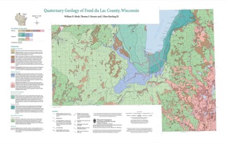
Quaternary Geology of Fond du Lac County, Wisconsin
The Quaternary geology of Fond du Lac County consists of glacial deposits and landforms dating to the last part of the Wisconsin Glaciation (ca. 20,000 to 12,000 yr BP) and nonglacial deposits and landforms of Holocene age (11,700 yr BP to present). Glacial till and meltwater sediment were deposited by the Green Bay and Lake Michigan Lobes of the...-
GIS Data for the Quaternary Geology of Fond du Lac County, Wisconsin [dataset 2]
2021
GIS Data: GeMS file geodatabase, shapefiles, text files, and metadata
-
Quaternary Geology of Fond du Lac County, Wisconsin [plate 1]
2021
Map: 32 in x 20.25 in, scale 1:100,000
-
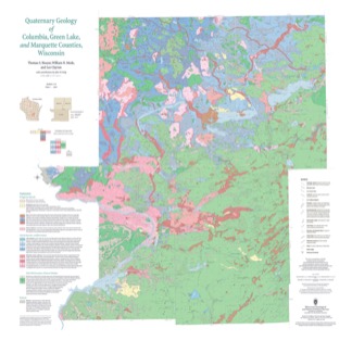
Quaternary Geology of Columbia, Green Lake, and Marquette Counties, Wisconsin
Columbia, Green Lake, and Marquette Counties were glaciated during the last ice age, and large areas were inundated with water from proglacial lakes and large meltwater rivers that occupied the valleys of the existing Wisconsin and Fox Rivers. These processes resulted in rolling upland hills, including drumlins punctuated by low-lying areas dominated by...-
GIS Data for the Quaternary Geology of Columbia, Green Lake, and Marquette Counties, Wisconsin [dataset 1]
2021
GIS Data: GeMS file geodatabase, shapefiles, GeoPackage, and metadata
-
Quaternary Geology of Columbia, Green Lake, and Marquette Counties, Wisconsin [plate 1]
2021
Map: 35 in x 34 in, scale 1:100,000

Publications Catalog
Wisconsin Geological and Natural History Survey