-
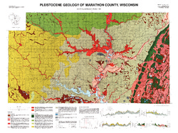
Pleistocene Geology of Marathon County, Wisconsin
-
Pleistocene Geology of Marathon County, Wisconsin (version 3) [GIS data]
1989
GIS Data: GeMS Level 3 file geodatabase and metadata. Supersedes previous GeMS Level 1 format (DI version 2).
-
Glacial and Related Deposits of Langlade County, Wisconsin
-
Glacial and Related Deposits of Langlade County, Wisconsin
1986
Report: 30 p. + map (scale 1:100,000)
-
Pleistocene Geology of Langlade County, Wisconsin (version 3) [GIS data]
1986
GIS Data: GeMS Level 3 file geodatabase and metadata. Supersedes previous GeMS Level 1 format (DI version 2).
-
-
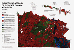
Pleistocene Geology of Florence County, Wisconsin
-
Pleistocene Geology of Florence County, Wisconsin (version 3) [GIS data]
1986
GIS Data: GeMS Level 3 file geodatabase and metadata. Supersedes previous GeMS Level 1 format (DI version 2).
-
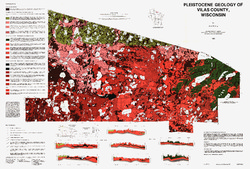
Pleistocene Geology of Vilas County, Wisconsin
-
Pleistocene Geology of Vilas County, Wisconsin (version 3) [GIS data]
1985
GIS Data: GeMS Level 3 file geodatabase and metadata. Supersedes previous GeMS Level 1 format (DI version 2).
-
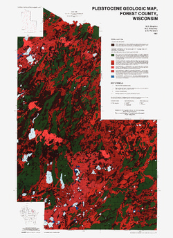
Pleistocene Geology of Forest County, Wisconsin
-
Pleistocene Geology of Forest County, Wisconsin (version 3) [GIS data]
1987
GIS Data: GeMS Level 3 file geodatabase and metadata. Supersedes previous GeMS Level 1 format (DI version 2).
-
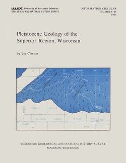
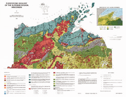
Pleistocene Geology of the Superior Region, Wisconsin
-
Pleistocene Geology of the Superior Region, Wisconsin (version 2) [GIS data]
1985
GIS Data: GeMS Level 3 file geodatabase and metadata. Supersedes previous GeMS Level 1 format (DI version 1).
-
Pleistocene Geology of the Superior Region, Wisconsin [plate 1]
1985
Map: 36 in x 28 in, scale 1:250,000
-
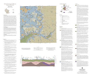
Bedrock Geology of Jefferson County, Wisconsin
Located in southeast Wisconsin, Jefferson County is almost entirely blanketed by sediments that were delivered or shaped by the ice sheet that covered this area during the last ice age. New mapping interprets the distribution of the bedrock surface that is buried beneath those glacial sediments as interpreted by three drill cores, over 13,000 well...-
GIS Data for the Bedrock Geology of Jefferson County, Wisconsin [dataset 1]
2024
GIS Data: GeMS file geodatabase, geopackage, shapefiles, metadata
-
Bedrock Elevation Raster for the Bedrock Geology of Jefferson County, Wisconsin [dataset 2]
2024
GIS Data: File geodatabase, metadata
-
Geochemical Data for the Bedrock Geology of Jefferson County, Wisconsin [dataset 3]
2024
Data: Excel spreadsheet
-
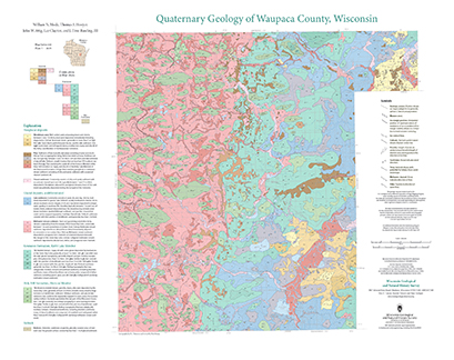
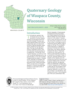
Quaternary Geology of Waupaca County, Wisconsin
The Quaternary geologic map of Waupaca County, Wisconsin, provides details about the surficial sediment and landscapes that were formed underneath and adjacent to the Laurentide Ice Sheet during the late Wisconsin Glaciation (ca. 20,000 years before present). These landscapes include lowlands underlain by glacial and postglacial lake sediment, uplands...-
Geologic Log Data for Quaternary Geology of Waupaca County, Wisconsin [dataset 1]
2023
Data: Excel spreadsheet
-
GIS Data for Quaternary Geology of Waupaca County, Wisconsin [dataset 2]
2023
GIS Data: GeMS file geodatabase, shapefiles, geopackage, metadata
-
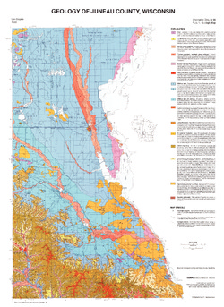
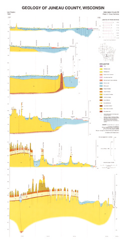
Geology of Juneau County, Wisconsin
-
GIS Data for the Geology of Juneau County, Wisconsin (version 2) [dataset 1]
1989
GIS Data: GeMS file geodatabase, shapefiles, and metadata. Supersedes previous shapefile format (DI version 1)
-
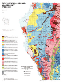
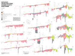
Pleistocene Geology of Adams County, Wisconsin
-
Pleistocene Geology of Adams County, Wisconsin
1987
Report: 14 p. + map and cross sections (Scale 1:100,000)
-
GIS Data for the Pleistocene Geology of Adams County, Wisconsin (version 2) [dataset 1]
1987
GIS Data: GeMS file geodatabase, shapefiles, and metadata. Supersedes previous shapefile format (DI version 1)
-
-
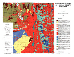
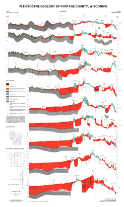
Pleistocene Geology of Portage County, Wisconsin
-
GIS Data for the Pleistocene Geology of Portage County, Wisconsin (version 2) [dataset 1]
1986
GIS Data: GeMS file geodatabase, shapefiles, GeoPackage, and metadata. Supersedes previous shapefile format (DI version 1)
-
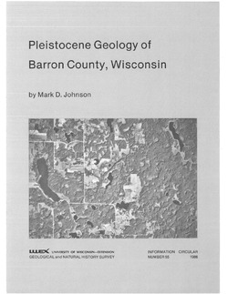
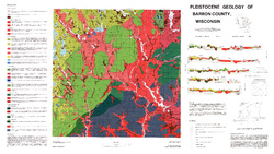
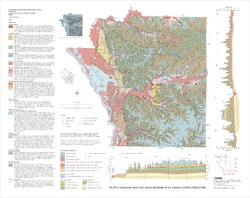
Pleistocene Geology of Barron County, Wisconsin
-
Pleistocene Geology of Barron County, Wisconsin (version 2) [GIS data]
1986
GIS Data: GeMS file geodatabase and metadata, supersedes previous coverage format (DI version 1)
-
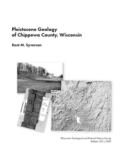
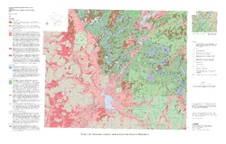
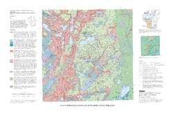
Pleistocene Geology of Chippewa County, Wisconsin
-
Pleistocene Geology of Chippewa County, Wisconsin
2007
Report: 53 p. + map and cross sections (scale 1:100,000)
-
Pleistocene Geology of Chippewa County, Wisconsin (version 2) [GIS data]
2007
GIS Data: GeMS file geodatabase and metadata; supersedes previous coverage format
-
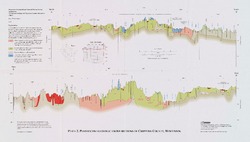
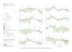
Pleistocene Geologic Cross Sections of Chippewa County, Wisconsin [plate 2]
2007
Plate: Scale 1:100,000
-
-
Geology of La Crosse County, Wisconsin
-
Geology of La Crosse County, Wisconsin
2003
Report: 33 p. + map and cross sections (scale 1:100,000)
-
Geology of La Crosse County, Wisconsin (version 2) [GIS Data]
2003
GIS Data: GeMS file geodatabase and metadata, supersedes previous coverage format (DI version 1)
-
-
Pleistocene Geology of Waukesha County, Wisconsin
-
Pleistocene Geology of Waukesha County, Wisconsin
2001
Report: 33 p. + map and cross sections (scale 1:100,000)
-
Pleistocene Geology of Waukesha County, Wisconsin (version 2) [GIS data]
2001
GIS Data: GeMS file geodatabase and metadata, supersedes previous coverage format (DI version 1)
-
Pleistocene Geologic Cross Sections of Waukesha County, Wisconsin [plate 2]
2001
Plate: Scale 1:200,000
-
-
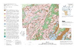
Quaternary Geology of Northern Oconto County, Wisconsin
-
Quaternary Geology of Northern Oconto County, Wisconsin (version 2) [GIS data]
1999
GIS Data: GeMS file geodatabase and metadata, supersedes previous coverage format (DI version 1)
-
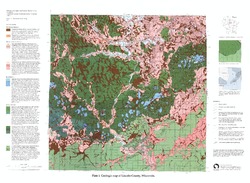
Pleistocene Geology of Lincoln County, Wisconsin
-
Pleistocene Geology of Lincoln County, Wisconsin (version 2) [GIS data]
1997
GIS Data: GeMS file geodatabase and metadata; supersedes previous coverage format
-
Pleistocene Geology of Polk County, Wisconsin
-
Pleistocene Geology of Polk County, Wisconsin
2000
Report: 70 p. + map and cross sections (scale 1:100,000)
-
Pleistocene Geology of Polk County, Wisconsin [GIS data]
2000
GIS Data: GeMS file geodatabase and metadata
-
Pleistocene Geology and Cross Sections of Polk County, Wisconsin [plate 1]
1998
Map: Scale 1:100,000
-
-
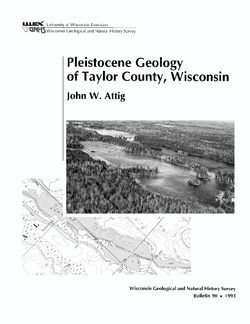
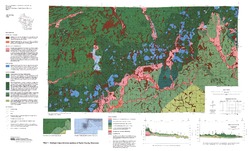
Pleistocene Geology of Taylor County, Wisconsin
-
Pleistocene Geology of Taylor County, Wisconsin
1993
Report: 25 p. + map and cross sections (scale 1:100,000)
-
Pleistocene Geology of Taylor County, Wisconsin (version 2) [GIS data]
1993
GIS Data: GeMS Level 3 file geodatabase and metadata. Supersedes previous coverage format (DI version 1).
-
-
Geologic Map of the Highland West and Highland East 7.5-Minute Quadrangles, Grant and Iowa Counties, Wisconsin
The geologic map of the Highland West and Highland East 7.5-minute quadrangles includes 1:24,000-scale mapping of both surficial and bedrock geology. Highland was a long-lived and important sub-district of the Upper Mississippi lead-zinc mining area in the 19th and 20th centuries. Recent and renewed interest in the presence and distrubution of critical...-
Geologic Map of the Highland West and Highland East 7.5-Minute Quadrangles, Grant and Iowa Counties, Wisconsin
2024
Map: 46 in x 36 in, scale 1:24,000
-
GIS Data for the Geologic Map of the Highland West and Highland East 7.5-Minute Quadrangles, Grant and Iowa Counties, Wisconsin [dataset 1]
2024
GIS Data: GeMS file geodatabase, shapefiles, metadata
-

Publications Catalog
Wisconsin Geological and Natural History Survey