-
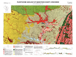
Pleistocene Geology of Marathon County, Wisconsin
-
Pleistocene Geology of Marathon County, Wisconsin (version 3) [GIS data]
1989
GIS Data: GeMS Level 3 file geodatabase and metadata. Supersedes previous GeMS Level 1 format (DI version 2).
-
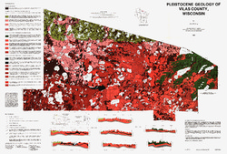
Pleistocene Geology of Vilas County, Wisconsin
-
Pleistocene Geology of Vilas County, Wisconsin (version 3) [GIS data]
1985
GIS Data: GeMS Level 3 file geodatabase and metadata. Supersedes previous GeMS Level 1 format (DI version 2).
-
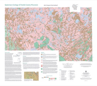
Quaternary Geology of Oneida County, Wisconsin
Oneida County, in northern Wisconsin, is a mostly forested area dotted with lakes and wetlands. The watery landscape is a legacy of a time when glaciers flowed across the area. Geologists Attig and Rawling mapped the Quaternary geology of the county, documenting where the glaciers paused, the sediments that were deposited, and the landforms that were...-
Quaternary Geology of Oneida County, Wisconsin (version 2) [GIS data]
2020
GIS Data: GeMS Level 3 file geodatabase and metadata. Supersedes previous GeMS Level 1 format (DI version 1).
-
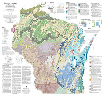
Quaternary Geology of Wisconsin
This 1:500,000 scale map of Wisconsin depicts sediment deposited by glaciers, streams, wind, and other processes during the Quaternary Period (2.58 million years ago to present). The map was made by compiling detailed Quaternary mapping and lithostratigraphic studies previously conducted by the WGNHS to generate consistent statewide Quaternary map units....-
GIS Data for the Quaternary Geology of Wisconsin (revised 2025) [dataset 1]
2025
GIS Data: GeMS file geodatabase, GeoPackage, shapefiles, metadata
-
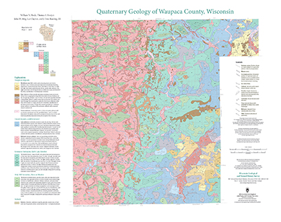
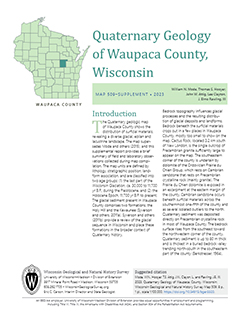
Quaternary Geology of Waupaca County, Wisconsin
The Quaternary geologic map of Waupaca County, Wisconsin, provides details about the surficial sediment and landscapes that were formed underneath and adjacent to the Laurentide Ice Sheet during the late Wisconsin Glaciation (ca. 20,000 years before present). These landscapes include lowlands underlain by glacial and postglacial lake sediment, uplands...-
Geologic Log Data for Quaternary Geology of Waupaca County, Wisconsin [dataset 1]
2023
Data: Excel spreadsheet
-
GIS Data for Quaternary Geology of Waupaca County, Wisconsin [dataset 2]
2023
GIS Data: GeMS file geodatabase, shapefiles, geopackage, metadata
-
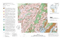
Quaternary Geology of Northern Oconto County, Wisconsin
-
Quaternary Geology of Northern Oconto County, Wisconsin (version 2) [GIS data]
1999
GIS Data: GeMS file geodatabase and metadata, supersedes previous coverage format (DI version 1)
-
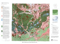
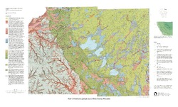
Pleistocene Geology of Lincoln County, Wisconsin
-
Pleistocene Geology of Lincoln County, Wisconsin (version 2) [GIS data]
1997
GIS Data: GeMS file geodatabase and metadata; supersedes previous coverage format
-
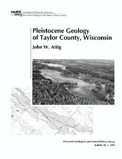
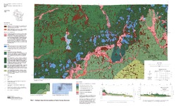
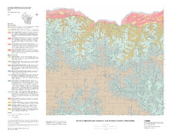
Pleistocene Geology of Taylor County, Wisconsin
-
Pleistocene Geology of Taylor County, Wisconsin
1993
Report: 25 p. + map and cross sections (scale 1:100,000)
-
Pleistocene Geology of Taylor County, Wisconsin (version 2) [GIS data]
1993
GIS Data: GeMS Level 3 file geodatabase and metadata. Supersedes previous coverage format (DI version 1).
-
-
Preliminary Geology of Iowa County, Wisconsin
Open-file report; contains unpublished data that has not yet been peer-reviewed.-
Preliminary Bedrock Geology of Iowa County, Wisconsin (version 2) [GIS data]
2010
GIS Data: GeMS file geodatabase and metadata, supersedes previous shapefile format (DI version 1)
-
Preliminary Geologic Map of Iowa County, Wisconsin [plate 1]
2010
Map: 28 in x 22 in, scale 1:100,000
-
-
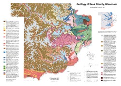
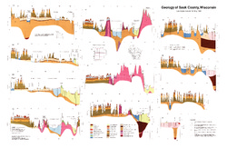
Geology of Sauk County, Wisconsin
Geologic history and description of Sauk County, the home of Devils Lake and Parfreys Glen. Includes four-color bedrock map and cross sections. Map and cross sections are folded.-
Geology of Sauk County, Wisconsin
1990
Report: 68 p. + map (24.5 in x 34.5 in, scale 1:100,000) and Cross Sections (24 in x 38 in)
-
GIS Data for the Geology of Sauk County, Wisconsin (version 2) [dataset 1]
1990
GIS Data: GeMS file geodatabase, shapefiles, and metadata. Supersedes previous shapefile format (DI version 1)
-
-
Pleistocene Geology of Dane County, Wisconsin
Description of the geologic history of Dane County. The preface points out the significance of glacial landscape research at WGNHS over the past century. Many pictures and diagrams and a four-color map and cross sections show the striking differences between glaciated and unglaciated regions of the county. Map and cross sections are folded.-
Pleistocene Geology of Dane County, Wisconsin
1997
Report: 64 p. + map and cross sections (scale: 1:100,000)
-
Pleistocene Geology of Dane County, Wisconsin (version 2) [GIS data]
1997
GIS Data: GeMS file geodatabase and metadata; supersedes previous coverage format
-
Pleistocene Geologic Map of Dane County, Wisconsin [plate 1]
1997
Map: Scale 1:100,000, 39 in x 24 in
-

Publications Catalog
Wisconsin Geological and Natural History Survey