-
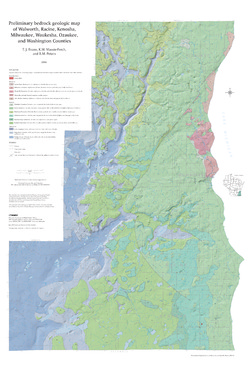
Preliminary Bedrock Geologic Map of Walworth, Racine, Kenosha, Milwaukee, Waukesha, Ozaukee, and Washington Counties
Open-file report; contains unpublished data that has not yet been peer-reviewed.-
Preliminary Bedrock Geologic Map of Walworth, Racine, Kenosha, Milwaukee, Waukesha, Ozaukee, and Washington Counties
2004
Map: 34.75 in x 52 in, scale 1:100,000
-
Preliminary Bedrock Geologic Map of Walworth, Racine, Kenosha, Milwaukee, Waukesha, Ozaukee, and Washington Counties [GIS data]
2004
GIS Data: GeMS file geodatabase and metadata
-
-
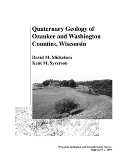
Quaternary Geology of Ozaukee and Washington Counties, Wisconsin
-
Quaternary Geology of Ozaukee and Washington Counties, Wisconsin
1997
Report: 56 p. + map and cross sections (scale 1:100,000)
-
Quaternary Geology of Ozaukee and Washington Counties, Wisconsin (version 2) [GIS data]
1997
GIS Data: GeMS Level 3 file geodatabase and metadata. Supersedes previous shapefile format (DI version 1).
-
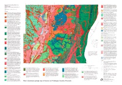
Quaternary Geologic Map of Ozaukee and Washington Counties, Wisconsin [plate 1]
1997
Map: Scale 1:100,000
-
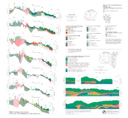
Geologic Cross Sections of Ozaukee and Washington Counties, Wisconsin [plate 2]
1997
Plate: 26 in x 24 in
-

Publications Catalog
Wisconsin Geological and Natural History Survey