-
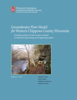
Groundwater Flow Model for Western Chippewa County
This report documents the groundwater flow model that was developed for western Chippewa County, Wisconsin. It also presents analyses that were run to evaluate how industrial sand (frac sand) mining and irrigated agriculture--might affect the water table and base flows of nearby headwater streams. -
Atlas of Groundwater Resources and Geology of Barron County, Wisconsin
Includes Physical Setting; Soils of Barron County and Their Ability to Attenuate Pollutants; Bedrock Geology; Depth to Bedrock; Hydrogeology; Water Quality; Potential Sources of Groundwater Pollution; Groundwater Levels; Groundwater Pollution Potential.-
Atlas of Groundwater Resources and Geology of Barron County, Wisconsin: Soils of Barron County and Their Ability to Attenuate Pollutants
1987
Map: 30.8 in x 20.8 in, scale 1:100,000
-
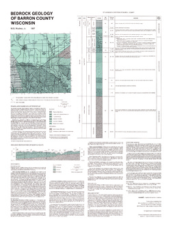
Atlas of Groundwater Resources and Geology of Barron County, Wisconsin: Bedrock Geology of Barron County, Wisconsin
1987
Map: 21.5 in x 28.5 in, scale 1:250,000
-
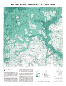
Atlas of Groundwater Resources and Geology of Barron County, Wisconsin: Depth to Bedrock in Barron County, Wisconsin
1987
Map: 21.1 in x 27.6 in, scale 1:100,000
-
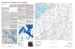
Atlas of Groundwater Resources and Geology of Barron County, Wisconsin: Hydrogeology of Barron County, Wisconsin
1987
Map: 37.5 in x 24.5 in, scale 1:100,000
-
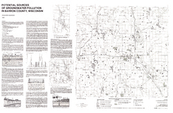
Atlas of Groundwater Resources and Geology of Barron County, Wisconsin: Potential Sources of Groundwater Pollution in Barron County, Wisconsin
1987
Map: 35.75 in x 23.3 in, scale 1:100,000
-
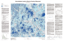
Atlas of Groundwater Resources and Geology of Barron County, Wisconsin: Groundwater Levels in Barron County, Wisconsin
1987
Map: 35.8 in x 23.3 in, scale 1:100,000
-
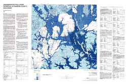
Atlas of Groundwater Resources and Geology of Barron County, Wisconsin: Groundwater Pollution Potential of Barron County, Wisconsin
1987
Map: 36.7 in x 24.25 in, scale 1:100,000
-
Wisconsin Groundwater-Level Monitoring Network Improvements, 2020-2022
This report documents work completed as part of a grant from the U.S. Geological Survey's National Groundwater Monitoring Network (NGWMN) program. It provides an overview of the Wisconsin Groundwater-Level Monitoring Network (WGLMN) and provides detailed description of well evaluation and repair activities, and drilling of new monitoring wells across the... -
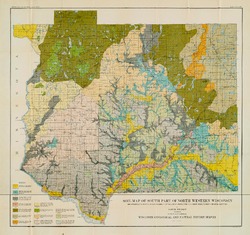
Reconnoissance [sic] Soil Survey of Part of North Western Wisconsin
-
Reconnoissance [sic] Soil Survey of Part of North Western Wisconsin (2nd edition)
1911
Report: 102 p. + map (scale 1 in = 3 miles)
-
-
Geochemistry and Mineralogy of the Wonewoc-Tunnel City Contact Interval Strata in Western Wisconsin
Results of regional study characterizing the elemental composition of rocks found at the Wonewoc-Tunnel City contact interval in west-central and southwest Wisconsin.-
Geochemistry and Mineralogy of the Wonewoc-Tunnel City Contact Interval Strata in Western Wisconsin [appendices]
2019
Data: PDF files + Excel spreadsheet

Publications Catalog
Wisconsin Geological and Natural History Survey