-
Mechanisms of Groundwater Flow Across the Maquoketa Formation
Open-file report; contains unpublished data that has not yet been peer-reviewed. -
Ground-Water Resources and Geology of Dodge County, Wisconsin
-
Ground-Water Resources and Geology of Dodge County, Wisconsin
1983
Report: 34 p. + map (scale 1:125,000)
-
-
Wisconsin Groundwater-Level Monitoring Network Improvements, 2020-2022
This report documents work completed as part of a grant from the U.S. Geological Survey's National Groundwater Monitoring Network (NGWMN) program. It provides an overview of the Wisconsin Groundwater-Level Monitoring Network (WGLMN) and provides detailed description of well evaluation and repair activities, and drilling of new monitoring wells across the... -
Depth to Silurian Bedrock in Eastern Wisconsin
Silurian-aged bedrock in eastern Wisconsin is shallow, fractured, and contains groundwater that is susceptible to surface water contamination. Revisions to Wisconsin state rules ATCP50 and NR151 to regulate manure spreading over this Silurian-aged bedrock create the need for a depth-to-bedrock map of eastern WI. The Wisconsin Geological and Natural...-
Depth to Silurian Bedrock in Eastern Wisconsin [dataset 1]
2025
GIS Data: File geodatabase, metadata
-
-
Stratigraphic Controls on Distribution of Hydraulic Conductivity in Carbonate Aquifers
Open-file report; contains unpublished data that has not yet been peer-reviewed. -
Merging Pleistocene Lithostratigraphy with Geotechnical and Hydrogeologic Data--Examples from Eastern Wisconsin
Open-file report; contains unpublished data that has not yet been peer-reviewed. -
Geoscience Wisconsin Volume 06
-
A Summary of the Duval Massive Sulfide Deposit, Marinette County, Wisconsin
1982
Journal Article: p. 11-20
-
Some Aspects of the Petrologic and Tectonic History of the Precambrian Rocks of Waterloo, Wisconsin
1982
Journal Article: p. 21-40
-
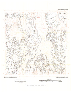
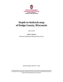
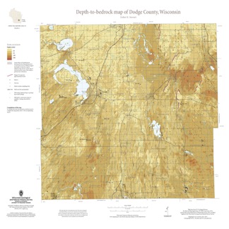
Depth-to-Bedrock Map of Dodge County, Wisconsin
This map shows thicknesses of deposits of unconsolidated materials above the bedrock. Across the county, depth to bedrock ranges from 0 feet, where bedrock is exposed, to over 250 feet within bedrock valleys. Areas with bedrock depths shallower than 20 feet are of particular importance for land-use planning and to the construction stone industry. Such... -
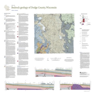
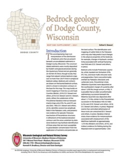
Bedrock Geology of Dodge County, Wisconsin
Dodge County lies in southeast Wisconsin, an area almost entirely covered by glacial deposits. This map interprets the distribution of the buried bedrock units across the county. Geologist Esther Stewart’s refinement of the bedrock elevation contours may help land-use planners identify areas most susceptible to groundwater contamination from applications...-
Supporting Data for the Bedrock Geology of Dodge County, Wisconsin
2021
Data: Tabular data files (Excel)
-
GIS Data for the Bedrock Geology of Dodge County, Wisconsin [dataset 2]
2021
GIS Data: GeMS file geodatabase, shapefiles, GeoPackage, and metadata

Publications Catalog
Wisconsin Geological and Natural History Survey