-
Bedrock Geology of Wisconsin, Northwest Sheet
Types of bedrock, formation names, major faults, and time period of formation.-
Bedrock Geology of Wisconsin, Northwest Sheet
1987
Map: 37.5 in x 22 in, scale 1:250,000 (map), 35.5 in x 20 in (explanation and cross sections)
-
-
Bedrock Geology of Wisconsin, Northeast Sheet
Types of bedrock, formation names, major faults, and time period of formation.-
Bedrock Geology of Wisconsin, Northeast Sheet [GIS data]
1984
GIS Data: GeMS file geodatabase and metadata
-
Bedrock Geologic Map of Wisconsin
Describes the types of rocks found throughout the state by age and explains how to interpret the accompanying cross section. -
Geology of Sauk County, Wisconsin
Geologic history and description of Sauk County, the home of Devils Lake and Parfreys Glen. Includes four-color bedrock map and cross sections. Map and cross sections are folded.-
Geology of Sauk County, Wisconsin
1990
Report: 68 p. + map (24.5 in x 34.5 in, scale 1:100,000) and Cross Sections (24 in x 38 in)
-
-
Pleistocene Geology of Marathon County, Wisconsin
-
Pleistocene Geology of Marathon County, Wisconsin (version 2) [GIS data]
1989
GIS Data: GeMS file geodatabase and metadata; supersedes previous coverage format
-
Pleistocene Geology of Forest County, Wisconsin
-
Pleistocene Geology of Forest County, Wisconsin (version 2) [GIS data]
1987
GIS Data: GeMS file geodatabase and metadata; supersedes previous coverage format
-
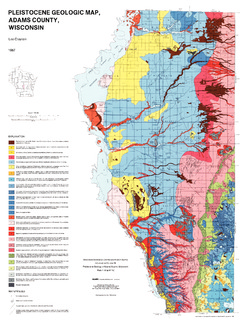
Pleistocene Geology of Adams County, Wisconsin
-
Pleistocene Geology of Adams County, Wisconsin
1987
Report: 14 p. + map and cross sections (Scale 1:100,000)
-
-
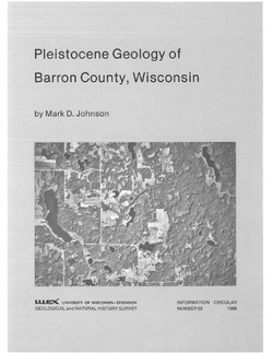
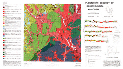
Pleistocene Geology of Barron County, Wisconsin
-
Pleistocene Geology of Barron County, Wisconsin (version 2) [GIS data]
1986
GIS Data: GeMS file geodatabase and metadata, supersedes previous coverage format (DI version 1)
-
Glacial and Related Deposits of Langlade County, Wisconsin
-
Glacial and Related Deposits of Langlade County, Wisconsin
1986
Report: 30 p. + map (scale 1:100,000)
-
Pleistocene Geology of Langlade County, Wisconsin (version 2) [GIS data]
1986
GIS Data: GeMS file geodatabase and metadata; supersedes previous coverage format
-
-
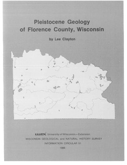
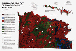
Pleistocene Geology of Florence County, Wisconsin
-
Pleistocene Geology of Florence County, Wisconsin (version 2) [GIS data]
1986
GIS Data: GeMS file geodatabase and metadata; supersedes previous coverage format
-
Pleistocene Geology of Vilas County, Wisconsin
-
Pleistocene Geology of Vilas County, Wisconsin (version 2) [GIS data]
1985
GIS Data: GeMS file geodatabase and metadata; supersedes previous coverage format
-
Pleistocene Geology of Brown County, Wisconsin
-
Pleistocene Geology of Brown County, Wisconsin
1985
Report: 19 p. + map of geology (scale 1:100,000)
-
-
Pleistocene Geology of the Superior Region, Wisconsin
-
Pleistocene Geology of the Superior Region, Wisconsin [GIS data]
1985
GIS Data: GeMS file geodatabase, metadata
-
Pleistocene Geology of the Superior Region, Wisconsin [plate 1]
1985
Map: 36 in x 28 in, scale 1:250,000
-
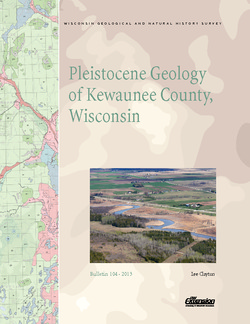
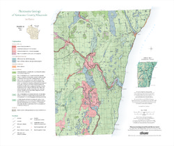
Pleistocene Geology of Kewaunee County, Wisconsin
Kewaunee County, at the southern end of the Door Peninsula, was overrun by glaciers many times. Author Lee Clayton describes the county's complex glacial geology, from the surface soil down to solid rock. The accompanying map shows the placement of glacial sediments as well as glacial and post-glacial stream and lake sediments.-
Pleistocene Geology of Kewaunee County, Wisconsin [plate 1]
2013
Map: Scale 1:100,000, 21.5 in x 18 in

Publications Catalog
Wisconsin Geological and Natural History Survey