-
Precambrian Geology of Marathon County, Wisconsin
-
GIS Data for the Precambrian Geology of Marathon County, Wisconsin (version 2) [dataset 1]
1983
GIS Data: GeMS file geodatabase, shapefiles, GeoPackage, and metadata. Supersedes previous shapefile format (DI version 1)
-
Geology of the Baraboo District, Wisconsin: A Description and Field Guide Incorporating Structural Analysis of the Precambrian Rocks and Sedimentologic Studies of the Paleozoic Strata
With summaries: Glacial Geology, R.F. Black; and Plant Ecology of the Baraboo Hills, J.H. Zimmerman.-
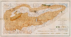
Geologic Map of the Baraboo District, Columbia and Sauk Counties, Wisconsin [plate 1]
1970
Map: Scale 1:62,500
-
Map of Main Phase Minor Structures in the Baraboo Syncline, Columbia and Sauk Counties, Wisconsin [plate 3]
1970
Map: large-format photocopy
-
Structural Map of the Baraboo Syncline, Columbia and Sauk Counties, Wisconsin [plate 4]
1970
Map: large-format photocopy
-
Structural Data: Lower Hemisphere Equal-Area Stereoplots of Structural Elements in the Baraboo Quartzite [plate 5]
1970
Plate: large-format photocopy
-
Orientations of Cross Stratification in Cambrian and Ordovician Sandstones [plate 7]
1970
Map: large-format photocopy
-
The Clays and Clay Industries of Wisconsin
Bulletin is titled Part 1; however, Part 2 was never published. -
Preliminary Report on the Copper-Bearing Rocks of Douglas County, Wisconsin
-
Geological Map of Part of the St. Croix Copper Range, in Douglas Co., Wis. [plate 7]
1900
Map: Scale 1 in = 4 miles
-
Geological Map of the Western Part of the Douglas Copper Range, in Douglas Co., Wis. [plate 8]
1900
Map: Scale 1 in = 4 miles
-
Geological Map of the Eastern Part of the Douglas Copper Range, in Douglas Co., Wis. [plate 9]
1900
Map: Scale 1 in = 4 miles
-
Geological Map of Part of the Minong Copper Range in Washburn, Douglas and Bayfield Counties, Wis. [plate 13]
1900
Map: Scale 1 in = 4 miles

Publications Catalog
Wisconsin Geological and Natural History Survey