-
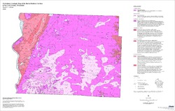
Preliminary Geologic Map of the Buried Bedrock Surface, Brown County, Wisconsin
Open-file report; contains unpublished data that has not yet been peer-reviewed.-
Preliminary Geologic Map of the Buried Bedrock Surface, Brown County, Wisconsin
2011
Map: 26 in x 30 in, scale 1:100,000
-
-
Preliminary Hydrogeologic Maps of Iowa County, Wisconsin
Open-file report; contains unpublished data that has not yet been peer-reviewed.-
Preliminary Hydrogeologic Maps of Iowa County, Wisconsin: Preliminary Groundwater Recharge in Iowa County, Wisconsin [figure 1]
2010
Map: 28 in x 22 in, scale 1:225,000
-
Preliminary Hydrogeologic Maps of Iowa County, Wisconsin: Preliminary Water-Table Elevation Map of Iowa County, Wisconsin [plate 1]
2010
Map: 26 in x 21 in, scale 1:100,000
-
Preliminary Hydrogeologic Maps of Iowa County, Wisconsin: Preliminary Groundwater Susceptibility Map of Iowa County, Wisconsin [plate 2]
2010
Map: 26 in x 21 in, scale 1:100,000
-
-
Preliminary Geology of Iowa County, Wisconsin
Open-file report; contains unpublished data that has not yet been peer-reviewed.-
Preliminary Bedrock Geology of Iowa County, Wisconsin (version 2) [GIS data]
2010
GIS Data: GeMS file geodatabase and metadata, supersedes previous shapefile format (DI version 1)
-
Preliminary Geologic Map of Iowa County, Wisconsin [plate 1]
2010
Map: 28 in x 22 in, scale 1:100,000
-
-
Preliminary Geology of the Buried Bedrock Surface, Pierce County, Wisconsin
Open-file report; contains unpublished data that has not yet been peer-reviewed.-
Preliminary Geology of the Buried Bedrock Surface, Pierce County, Wisconsin
2007
Map: 34 in x 22 in, scale 1:100,000
-
-
Preliminary Quaternary Geologic Map of the Northern Fox River Lowland, Wisconsin
Open-file report; contains unpublished data that has not yet been peer-reviewed.-
Preliminary Quaternary Geologic Map of the Northern Fox River Lowland, Wisconsin
2007
Map: 42 in x 30.5 in, scale 1:100,000
-
-
Geology of the Rock Elm Complex, Pierce County, Wisconsin
Open-file report; contains unpublished data that has not yet been peer-reviewed. -
Preliminary Geologic Map of the Buried Bedrock Surface of St. Croix County, Wisconsin
Open-file report; contains unpublished data that has not yet been peer-reviewed.-
Preliminary Geologic Map of the Buried Bedrock Surface of St. Croix County, Wisconsin
2006
Map: 33 in x 21 in, scale 1:100,000
-
-
Groundwater Data Compilation for the Geneva Lake, Wisconsin, Area
Open-file report; contains unpublished data that has not yet been peer-reviewed.-
Regional Overview, Geneva Lake Area, Walworth County, Wisconsin [plate 1]
2006
Map: 11 in x 17 in, scale 1:100,000
-
Bedrock Geology, Geneva Lake Area, Walworth County, Wisconsin [plate 2]
2006
Map: 11 in x 17 in, scale 1:100,000
-
Elevation of Bedrock Surface, Geneva Lake Area, Walworth County, Wisconsin [plate 3]
2006
Map: 11 in x 17 in, scale 1:100,000
-
Depth to Bedrock (Thickness of Surficial Materials), Geneva Lake Area, Walworth County, Wisconsin [plate 4]
2006
Map: 11 in x 17 in, scale 1:100,000
-
Water Table Elevation, Geneva Lake Area, Walworth County, Wisconsin [plate 5]
2006
Map: 11 in x 17 in, scale 1:100,000
-
Preliminary Quaternary Geologic Map of the Southern Fox River Lowland, Wisconsin
Open-file report; contains unpublished data that has not yet been peer-reviewed.-
Preliminary Quaternary Geologic Map of the Southern Fox River Lowland, Wisconsin
2005
Map: 48 in x 27 in, scale 1:100,000
-
-
Preliminary Bedrock Geologic Map of Outagamie County, Wisconsin
Open-file report; contains unpublished data that has not yet been peer-reviewed.-
Preliminary Bedrock Geologic Map of Outagamie County, Wisconsin
2005
Map: 38 in x 26 in, scale 1:100,000
-
-
Preliminary Bedrock Geologic Map of Winnebago County, Wisconsin
Open-file report; contains unpublished data that has not yet been peer-reviewed.-
Preliminary Bedrock Geologic Map of Winnebago County, Wisconsin
2004
Map: 33.75 in x 22.5 in, scale 1:100,000
-
-
Preliminary Paleozoic Geologic Map of Fond du Lac County, Wisconsin
Open-file report; contains unpublished data that has not yet been peer-reviewed.-
Preliminary Bedrock Geologic Map of Fond du Lac County, Wisconsin [plate 1]
2004
Map: 26 in x 21 in, scale 1:100,000
-
-
Preliminary Quaternary Geologic Map of St. Croix County, Wisconsin
Open-file report; contains unpublished data that has not yet been peer-reviewed.-
Preliminary Quaternary Geologic Map of St. Croix County, Wisconsin
2004
Map: 36 in x 24 in, scale 1:100,000
-
-
Preliminary Depth to Bedrock Map of Walworth, Racine, Kenosha, Milwaukee, Waukesha, Ozaukee, and Washington Counties
Open-file report; contains unpublished data that has not yet been peer-reviewed.-
Preliminary Depth to Bedrock Map of Walworth, Racine, Kenosha, Milwaukee, Waukesha, Ozaukee, and Washington Counties
2004
Map: 34.75 in x 52 in, scale 1:100,000
-
-
Preliminary Bedrock Topography Map of Walworth, Racine, Kenosha, Milwaukee, Waukesha, Ozaukee, and Washington Counties
Open-file report; contains unpublished data that has not yet been peer-reviewed.-
Preliminary Bedrock Topography Map of Walworth, Racine, Kenosha, Milwaukee, Waukesha, Ozaukee, and Washington Counties
2004
Map: 34.75 in x 52 in, scale 1:100,000
-
-
Preliminary Bedrock Geologic Map of Walworth, Racine, Kenosha, Milwaukee, Waukesha, Ozaukee, and Washington Counties
Open-file report; contains unpublished data that has not yet been peer-reviewed.-
Preliminary Bedrock Geologic Map of Walworth, Racine, Kenosha, Milwaukee, Waukesha, Ozaukee, and Washington Counties
2004
Map: 34.75 in x 52 in, scale 1:100,000
-
Preliminary Bedrock Geologic Map of Walworth, Racine, Kenosha, Milwaukee, Waukesha, Ozaukee, and Washington Counties [GIS data]
2004
GIS Data: GeMS file geodatabase and metadata
-
-
Preliminary Bedrock Geology of Washington County, Wisconsin
Open-file report; contains unpublished data that has not yet been peer-reviewed.-
Preliminary Bedrock Geologic Map of Washington County, Wisconsin
2004
Map: 19 in x 17 in, scale 1:100,000
-
Preliminary Bedrock Topography Map of Washington County, Wisconsin
2004
Map: 19 in x 17 in,scale 1:100,000
-
Preliminary Depth to Bedrock Map of Washington County, Wisconsin
2004
Map: 19 in x 17 in, scale 1:100,000
-
-
Preliminary Bedrock Geology of Ozaukee County, Wisconsin
Open-file report; contains unpublished data that has not yet been peer-reviewed.-
Preliminary Bedrock Geologic Map of Ozaukee County, Wisconsin
2004
Map: 15 in x 17 in, scale 1:100,000
-
Preliminary Bedrock Topography Map of Ozaukee County, Wisconsin
2004
Map: 15 in x 17 in, scale 1:100,000
-
Preliminary Depth to Bedrock Map of Ozaukee County, Wisconsin
2004
Map: 15 in x 17 in, scale 1:100,000
-
-
Preliminary Bedrock Geology of Waukesha County, Wisconsin
Open-file report; contains unpublished data that has not yet been peer-reviewed.-
Preliminary Bedrock Geologic Map of Waukesha County, Wisconsin
2004
Map: 17.75 in x 23 in, scale 1:100,000
-
Preliminary Bedrock Topography Map of Waukesha County, Wisconsin
2004
Map: 17.75 in x 23 in, scale 1:100,000
-
Preliminary Depth to Bedrock Map of Waukesha County, Wisconsin
2004
Map: 17.75 in x 23 in, scale 1:100,000
-
-
Preliminary Bedrock Geology of Milwaukee County, Wisconsin
Open-file report; contains unpublished data that has not yet been peer-reviewed.-
Preliminary Bedrock Geologic Map of Milwaukee County, Wisconsin
2004
Map: 14 in x 17 in, scale 1:100,000
-
Preliminary Bedrock Topography Map of Milwaukee County, Wisconsin
2004
Map: 14 in x 17 in, scale 1:100,000
-
Preliminary Depth to Bedrock Map of Milwaukee County, Wisconsin
2004
Map: 14 in x 17 in, scale 1:100,000
-

Publications Catalog
Wisconsin Geological and Natural History Survey