-
Potential Effects of Climate Change on Stream Temperature in the Marengo River Headwaters
Cold-water trout habitat in Wisconsin is projected to substantially decrease as a result of climate change. The extent of habitat loss depends, in part, on groundwater discharge to streams, which can provide cool-water refuges for trout. Survey hydrogeologists used field measurements and models of groundwater flow and stream temperature to evaluate how...-
GFLOW Groundwater Flow Model of the Marengo River Headwaters [dataset 1]
2021
Data: Groundwater flow model
-
Geodatabase - Three Baseflow Scenarios for the Marengo River Headwaters [dataset 2]
2021
GIS Data: File geodatabase
-
Measurements of Water Chemistry, Streamflow, and Stream Temperature from the Marengo River Headwaters [dataset 3]
2021
Data: Data (spreadsheets)
-
Simulated Baseflow of the Marengo River Headwaters with 21% Increase in Recharge [plate 2]
2021
Map: 11 in x 17 in
-
Simulated Baseflow of the Marengo River Headwaters with 12% Decrease in Recharge [plate 3]
2021
Map: 11 in x 17 in
-
Characterization of Groundwater Resources in the Chequamegon-Nicolet National Forest, Wisconsin
Results of a comprehensive review and analysis of groundwater resources in the Chequamegon-Nicolet National Forest. The study was divided by location into four reports corresponding to the four main land units: Medford, Nicolet, Park Falls, and Washburn/Great Divide. Each report describes the results of the inventory, modeling, and analysis.-
Characterization of Groundwater Resources in the Chequamegon-Nicolet National Forest, Wisconsin: Medford Unit [GIS data]
2018
GIS Data: Geodatabase, metadata
-
Characterization of Groundwater Resources in the Chequamegon-Nicolet National Forest, Wisconsin: Medford Unit [plates]
2018
Map: 10 maps, 11 in x 17 in
-
Characterization of Groundwater Resources in the Chequamegon-Nicolet National Forest, Wisconsin: Nicolet Unit [GIS data]
2018
GIS Data: Geodatabase, metadata
-
Characterization of Groundwater Resources in the Chequamegon-Nicolet National Forest, Wisconsin: Nicolet Unit [plates]
2018
Map: 20 maps (10 each, northern and southern Nicolet Unit), 11 in x 17 in
-
Characterization of Groundwater Resources in the Chequamegon-Nicolet National Forest, Wisconsin: Park Falls Unit [GIS data]
2018
GIS Data: Geodatabase, metadata
-
Characterization of Groundwater Resources in the Chequamegon-Nicolet National Forest, Wisconsin: Park Falls Unit [plates]
2018
Map: 10 maps, 11 in x 17 in
- 2 more...
-
Groundwater and Wells in Agricultural Regions of Bayfield County, Wisconsin: Report to the Large-Scale Livestock Study Committee
Information and recommendations concerning groundwater and water supply wells in two agricultural regions in Bayfield County, Wisconsin. Includes a report, a water-table map, a set of four cross sections, and GIS data. (Replaces WOFR2015-02.)-
Groundwater and Wells in Agricultural Regions of Bayfield County, Wisconsin [GIS data]
2016
GIS Data: Shapefiles, metadata
-
Generalized Water-Table Elevation Map in Agricultural Regions of Bayfield County, Wisconsin [plate 1]
2016
Map: 27 in x 30 in, scale 1:100,000
-
Hydrogeologic Cross Sections in Agricultural Regions of Bayfield County, Wisconsin [plate 2]
2016
Plate: 20.25 in x 40.25 in, scale 1:100,000
-
Groundwater Data Compilation for the Geneva Lake, Wisconsin, Area
Open-file report; contains unpublished data that has not yet been peer-reviewed.-
Regional Overview, Geneva Lake Area, Walworth County, Wisconsin [plate 1]
2006
Map: 11 in x 17 in, scale 1:100,000
-
Bedrock Geology, Geneva Lake Area, Walworth County, Wisconsin [plate 2]
2006
Map: 11 in x 17 in, scale 1:100,000
-
Elevation of Bedrock Surface, Geneva Lake Area, Walworth County, Wisconsin [plate 3]
2006
Map: 11 in x 17 in, scale 1:100,000
-
Depth to Bedrock (Thickness of Surficial Materials), Geneva Lake Area, Walworth County, Wisconsin [plate 4]
2006
Map: 11 in x 17 in, scale 1:100,000
-
Water Table Elevation, Geneva Lake Area, Walworth County, Wisconsin [plate 5]
2006
Map: 11 in x 17 in, scale 1:100,000
-
Hydrogeology of Dane County, Wisconsin
Open-file report; contains unpublished data that has not yet been peer-reviewed.-
Water-Table Elevation and Unlithified Aquifers in Dane County, Wisconsin [plate 1]
1999
Map: 34.5 in x 25.5 in, scale 1:100,000
-
Aquifer Contamination Susceptibility Map of Dane County, Wisconsin [plate 2]
1999
Map: 34.5 in x 25.5 in, scale 1:100,000
-
Hydrologic Assessment of the Kickapoo Watershed, Southwestern Wisconsin
Open-file report; contains unpublished data that has not yet been peer-reviewed.-
Hydrologic Assessment of the Kickapoo Watershed, Southwestern Wisconsin
1998
Report: 81 p. + 4 plates
-
Baseflow and Bedrock Geology of Basins Above La Farge, WI [figure 7]
1998
Map: 11 in x 17 in, scale 1:150,000
-
Baseflow and Bedrock Geology of Warner Creek Basin [figure 8]
1998
Map: 17 in x 11 in, scale 1:50,000
-
Baseflow and Bedrock Geology of Morris Creek Basin [figure 9]
1998
Map: 11 in x 17 in, scale 1:50,000
-
-
Ground Water Resources of Wisconsin
Open-file report; contains unpublished data that has not yet been peer-reviewed. -
Irrigable Lands Inventory--Phase I Groundwater and Related Information
This paper contains hydrogeologic information for the Golden Sands Resource Conservation and Development Area in central Wisconsin. The set of maps includes water-table elevation maps for the following counties: Adams, Jackson, Juneau, Marathon, Marquette, Monroe, Portage, Waupaca, Waushara, and Wood (scale 1:126,720). It also includes a regional aquifer...-
Irrigable Lands Inventory - Phase I Groundwater and Related Information
1981
Report: 13 p. + 11 maps (scale 1:126,720 and 1:500,000)
- 2 more...
-
-
Pleistocene Geology of Marathon County, Wisconsin
-
Pleistocene Geology of Marathon County, Wisconsin (version 2) [GIS data]
1989
GIS Data: GeMS file geodatabase and metadata; supersedes previous coverage format
-
Hydrogeology of the Wisconsin River Valley in Marathon County, Wisconsin
-
Hydrogeology of the Wisconsin River Valley in Marathon County, Wisconsin
1988
Report: 66 p. + maps (scale 1:100,000)
-
Elevation of the Base of the Wausau Aquifer, Marathon County, Wisconsin [plate 1]
1988
Map: Scale 1:62,500
-
Elevation of the Water Table in the Wisconsin River Valley, Marathon County, Wisconsin [plate 2]
1988
Map: Scale 1:62,500
-
-
Hydrogeology and Ground-Water Use and Quality, Brown County, Wisconsin
-
Hydrogeology and Ground-Water Use and Quality, Brown County, Wisconsin
1986
Report: 42 p. + maps (scale 1:100,000)
-
Potentiometric Surface of Upper Aquifer, Brown County, Wisconsin, 1980 [plate 1]
1986
Map: Scale 1:100,000
-
-
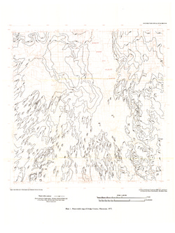
Ground-Water Resources and Geology of Dodge County, Wisconsin
-
Ground-Water Resources and Geology of Dodge County, Wisconsin
1983
Report: 34 p. + map (scale 1:125,000)
-
-
Ground-Water Quality of Rock County, Wisconsin
-
Ground-Water Quality of Rock County, Wisconsin
1982
Report: 92 p. + cross section and maps (scale 1:100,000)
-
Preliminary Map of the Thickness of Unconsolidated Material in Rock County, Wisconsin [plate 2]
1982
Map: Scale 1:100,000
-
-
Ground-Water Resources and Geology of Washington and Ozaukee Counties, Wisconsin
-
Ground-Water Resources and Geology of Washington and Ozaukee Counties, Wisconsin
1980
Report: 37 p. + map and cross sections (scale 1:125,000)
-
Water-Table Map of Washington and Ozaukee Counties, Wisconsin, Winter 1976-77
1980
Map: Scale 1:125,000
-
-
Effects of Irrigation on Water Quality in the Sand Plain of Central Wisconsin
-
Effects of Irrigation on Water Quality in the Sand Plain of Central Wisconsin
1978
Report: 50 p. + map (scale 1:24,000)
-

Publications Catalog
Wisconsin Geological and Natural History Survey