-
Geology of Sauk County, Wisconsin
Geologic history and description of Sauk County, the home of Devils Lake and Parfreys Glen. Includes four-color bedrock map and cross sections. Map and cross sections are folded.-
Geology of Sauk County, Wisconsin
1990
Report: 68 p. + map (24.5 in x 34.5 in, scale 1:100,000) and Cross Sections (24 in x 38 in)
-
-
A Subsurface Study of the St. Peter Sandstone in Southern and Eastern Wisconsin
-
A Subsurface Study of the St. Peter Sandstone in Southern and Eastern Wisconsin
1985
Report: 26 p. + maps (scale 1:750,000)
-
-
Ground-Water Quality of Rock County, Wisconsin
-
Ground-Water Quality of Rock County, Wisconsin
1982
Report: 92 p. + cross section and maps (scale 1:100,000)
-
Preliminary Map of the Thickness of Unconsolidated Material in Rock County, Wisconsin [plate 2]
1982
Map: Scale 1:100,000
-
-
Ground-Water Resources and Geology of Washington and Ozaukee Counties, Wisconsin
-
Ground-Water Resources and Geology of Washington and Ozaukee Counties, Wisconsin
1980
Report: 37 p. + map and cross sections (scale 1:125,000)
-
Water-Table Map of Washington and Ozaukee Counties, Wisconsin, Winter 1976-77
1980
Map: Scale 1:125,000
-
-
Ground-Water Resources and Geology of Walworth County, Wisconsin
-
Ground-Water Resources and Geology of Walworth County, Wisconsin
1976
Report: 45 p. + map (scale 1:125,000)
-
-
Ground-Water Resources and Geology of Jefferson County, Wisconsin
-
Ground-Water Resources and Geology of Jefferson County, Wisconsin
1976
Report: 31 p. + map (scale 1 in = 2 miles)
-
-
Ground-Water Resources and Geology of St. Croix County, Wisconsin
-
Ground-Water Resources and Geology of St. Croix County, Wisconsin
1976
Report: 30 p. + map (scale 1:125,000)
-
-
Preliminary Report on Results of Physical and Chemical Tests of Wisconsin Silica Sandstones
-
Preliminary Report on Results of Physical and Chemical Tests of Wisconsin Silica Sandstones
1971
Report: 61 p. + map (scale 1 in = 13 miles)
-
-
Geology of the Baraboo District, Wisconsin: A Description and Field Guide Incorporating Structural Analysis of the Precambrian Rocks and Sedimentologic Studies of the Paleozoic Strata
With summaries: Glacial Geology, R.F. Black; and Plant Ecology of the Baraboo Hills, J.H. Zimmerman.-
Geologic Map of the Baraboo District, Columbia and Sauk Counties, Wisconsin [plate 1]
1970
Map: Scale 1:62,500
-
Map of Main Phase Minor Structures in the Baraboo Syncline, Columbia and Sauk Counties, Wisconsin [plate 3]
1970
Map: large-format photocopy
-
Structural Map of the Baraboo Syncline, Columbia and Sauk Counties, Wisconsin [plate 4]
1970
Map: large-format photocopy
-
Structural Data: Lower Hemisphere Equal-Area Stereoplots of Structural Elements in the Baraboo Quartzite [plate 5]
1970
Plate: large-format photocopy
-
Orientations of Cross Stratification in Cambrian and Ordovician Sandstones [plate 7]
1970
Map: large-format photocopy
-
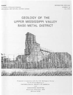
Field Trip Guidebook for Cambrian-Ordovician Geology of Western Wisconsin
With special papers: Lithologic Cycles in Lower Paleozoic Rocks of Western Wisconsin, M.E. Ostrom; and Lithostratigraphy of the Prairie du Chien Group, R.A. Davis, Jr. -
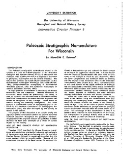
Paleozoic Stratigraphic Nomenclature for Wisconsin
The Paleozoic rocks of Wisconsin organized and explained in this 1967 stratigraphic column. -
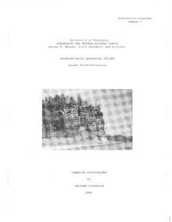
Cambrian Stratigraphy in Western Wisconsin
Notes accompanying a 1966 conference field trip covering geology between Chippewa Falls and Trempealeau and between Elroy and Portage. Routes shown. -
Cambro-Ordovician Stratigraphy of Southwest Wisconsin
In 1965, the authors wrote that the "Cambrian and Ordovician rocks of the Upper Mississippi Valley area have been subjected to what at one time would have been considered 'exhaustive study.'" This report reexamines the "classic" explanations.

Publications Catalog
Wisconsin Geological and Natural History Survey