-
Geologic map of the Castle Rock and Long Hollow 7.5-minute quadrangles, Grant County, Wisconsin
The geologic map of the Castle Rock and Long Hollow quadrangles includes 1:24,000 scale mapping of both surficial and bedrock geology. The accompanying report presents new observations about bedrock folds and fracture sets in this portion of the Driftless Area that lies just north of the main Upper Mississippi Valley zinc-lead mineral district. The...-
Geologic map of the Castle Rock and Long Hollow 7.5-minute quadrangles, Grant County, Wisconsin (revised 2022)
2022
Map: 48 in x 36 in, scale 1:24,000
-
GIS data for the geologic map of the Castle Rock and Long Hollow 7.5-minute quadrangles, Grant County, Wisconsin [dataset 1]
2022
GIS Data: File geodatabase
-
-
Groundwater Data Compilation for the Geneva Lake, Wisconsin, Area
Open-file report; contains unpublished data that has not yet been peer-reviewed.-
Regional Overview, Geneva Lake Area, Walworth County, Wisconsin [plate 1]
2006
Map: 11 in x 17 in, scale 1:100,000
-
Bedrock Geology, Geneva Lake Area, Walworth County, Wisconsin [plate 2]
2006
Map: 11 in x 17 in, scale 1:100,000
-
Elevation of Bedrock Surface, Geneva Lake Area, Walworth County, Wisconsin [plate 3]
2006
Map: 11 in x 17 in, scale 1:100,000
-
Depth to Bedrock (Thickness of Surficial Materials), Geneva Lake Area, Walworth County, Wisconsin [plate 4]
2006
Map: 11 in x 17 in, scale 1:100,000
-
Water Table Elevation, Geneva Lake Area, Walworth County, Wisconsin [plate 5]
2006
Map: 11 in x 17 in, scale 1:100,000
-
Geologic Summary of the Ashland 2° Quadrangle
Open-file report; contains unpublished data that has not yet been peer-reviewed. -
Geology of Sauk County, Wisconsin
Geologic history and description of Sauk County, the home of Devils Lake and Parfreys Glen. Includes four-color bedrock map and cross sections. Map and cross sections are folded.-
Geology of Sauk County, Wisconsin
1990
Report: 68 p. + map (24.5 in x 34.5 in, scale 1:100,000) and Cross Sections (24 in x 38 in)
-
-
Ground-Water Quality of Rock County, Wisconsin
-
Ground-Water Quality of Rock County, Wisconsin
1982
Report: 92 p. + cross section and maps (scale 1:100,000)
-
Preliminary Map of the Thickness of Unconsolidated Material in Rock County, Wisconsin [plate 2]
1982
Map: Scale 1:100,000
-
-
Ground-Water Resources and Geology of Washington and Ozaukee Counties, Wisconsin
-
Ground-Water Resources and Geology of Washington and Ozaukee Counties, Wisconsin
1980
Report: 37 p. + map and cross sections (scale 1:125,000)
-
Water-Table Map of Washington and Ozaukee Counties, Wisconsin, Winter 1976-77
1980
Map: Scale 1:125,000
-
-
Ground-Water Resources and Geology of Walworth County, Wisconsin
-
Ground-Water Resources and Geology of Walworth County, Wisconsin
1976
Report: 45 p. + map (scale 1:125,000)
-
-
Ground-Water Resources and Geology of Jefferson County, Wisconsin
-
Ground-Water Resources and Geology of Jefferson County, Wisconsin
1976
Report: 31 p. + map (scale 1 in = 2 miles)
-
-
Geology of the Baraboo District, Wisconsin: A Description and Field Guide Incorporating Structural Analysis of the Precambrian Rocks and Sedimentologic Studies of the Paleozoic Strata
With summaries: Glacial Geology, R.F. Black; and Plant Ecology of the Baraboo Hills, J.H. Zimmerman.-
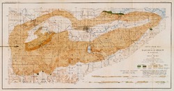
Geologic Map of the Baraboo District, Columbia and Sauk Counties, Wisconsin [plate 1]
1970
Map: Scale 1:62,500
-
Map of Main Phase Minor Structures in the Baraboo Syncline, Columbia and Sauk Counties, Wisconsin [plate 3]
1970
Map: large-format photocopy
-
Structural Map of the Baraboo Syncline, Columbia and Sauk Counties, Wisconsin [plate 4]
1970
Map: large-format photocopy
-
Structural Data: Lower Hemisphere Equal-Area Stereoplots of Structural Elements in the Baraboo Quartzite [plate 5]
1970
Plate: large-format photocopy
-
Orientations of Cross Stratification in Cambrian and Ordovician Sandstones [plate 7]
1970
Map: large-format photocopy
-
The Clays and Clay Industries of Wisconsin
Bulletin is titled Part 1; however, Part 2 was never published.

Publications Catalog
Wisconsin Geological and Natural History Survey