-
The Driftless Area: The extent of unglaciated and similar terrains in Wisconsin, Illinois, Iowa, and Minnesota
The Driftless Area of southwestern Wisconsin and northwestern Illinois got its name from the lack of glacial sediment ("drift") covering the landscape. The surficial geology and topography of the Driftless Area are thus distinct from the surrounding region where multiple phases of glaciation left their mark. This pamphlet, a collaborative effort between...-
GIS data for the outline of the Driftless Area and similar terrains in Wisconsin, Illinois, Iowa, and Minnesota
2023
GIS Data: shapefile, metadata
-
Page-sized and web-version maps of the Driftless Area and similar terrains in Wisconsin, Illinois, Iowa, and Minnesota
2023
Map: 1 p. (8.5 in x 11 in)
-
Wisconsin Groundwater-Level Monitoring Network Improvements, 2018-2021
This report documents work completed as part of a grant from the U.S. Geological Survey’s National Groundwater Monitoring Network (NGWMN) program. It provides an overview of the Wisconsin Groundwater-Level Monitoring Network (WGLMN) and provides detailed description of well evaluation and repair activities, and drilling of new monitoring wells across the... -
Geochemistry and Mineralogy of the Wonewoc-Tunnel City Contact Interval Strata in Western Wisconsin
Results of regional study characterizing the elemental composition of rocks found at the Wonewoc-Tunnel City contact interval in west-central and southwest Wisconsin.-
Geochemistry and Mineralogy of the Wonewoc-Tunnel City Contact Interval Strata in Western Wisconsin [appendices]
2019
Data: PDF files + Excel spreadsheet
-
Preliminary Bedrock Geology of Southern Trempealeau County, Wisconsin
This open-file report documents the first year of a two-year mapping project in Trempealeau County, Wisconsin. This preliminary document is being released to encourage input on the mapping methods and map to make the final product as useful as possible. Contains 27-page report, map of southern Trempeleau County, cross section, and photos of drill core.-
Preliminary Bedrock Geology of Southern Trempealeau County, Wisconsin [plate 1]
2018
Plate: 26 in x 30 in, scale 1:100,000
-
Preliminary Bedrock Geology of Southern Trempealeau County, Wisconsin [plate 2]
2018
Plate: 27.8 in x 24.85 in
-
Industrial Sand Resources of West-Central Wisconsin
Field trip guidebook showcasing four sites in Trempealeau County in west-central Wisconsin. The focus of this trip is on the sandstone formations that are prized for frac sand mining. (A draft of this book was originally prepared for the 2017 American Institute of Professional Geologists (AIPG) Sand Mine Life Cycle Seminar held in Eau Claire, Wisconsin.) -
Discussion of the Phenomena of Local Glaciation in the Driftless Region
Open-file report; contains unpublished data that has not yet been peer-reviewed. -
Studies in the Driftless Region of Wisconsin
Open-file report; contains unpublished data that has not yet been peer-reviewed. -
Geology of Wisconsin - Outcrop Descriptions
These descriptions illustrate various geologic formations, features, and characteristics. Individual descriptions are one to ten pages long, and include a map with specific location, a description of geologic features, and a discussion of the geologic significance. -
Field Trip Guidebook for Cambrian-Ordovician Geology of Western Wisconsin
With special papers: Lithologic Cycles in Lower Paleozoic Rocks of Western Wisconsin, M.E. Ostrom; and Lithostratigraphy of the Prairie du Chien Group, R.A. Davis, Jr. -
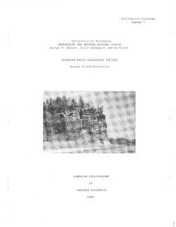
Cambrian Stratigraphy in Western Wisconsin
Notes accompanying a 1966 conference field trip covering geology between Chippewa Falls and Trempealeau and between Elroy and Portage. Routes shown.

Publications Catalog
Wisconsin Geological and Natural History Survey