-
Geochemical Prospecting by Spring Sampling in the Southwest Wisconsin Zinc Mining Area
-
Geochemical Prospecting by Spring Sampling in the Southwest Wisconsin Zinc Mining Area
1969
Report: 28 p. + map (scale 1:125,000)
-
-
Three Billion Years of Geology
Prepared for 47th Annual Tri-State Geology Conference, Black River Falls, Wisconsin. -
Upper Mississippi Valley Base-Metal District
Companion volume to Information Circular 16 (third edition). Prepared for 24th Annual Meeting, Institute on Lake Superior Geology. -
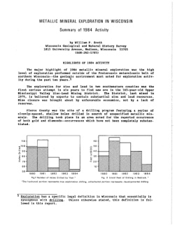
Metallic Mineral Exploration in Wisconsin [1980-1987]
Annual summaries of metallic mineral exploration in Wisconsin for 1980-1987. Each summary includes statistical reviews of exploration activity, highlights of the year's activity, and reviews of legislative actions affecting exploration. -
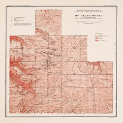
Report on Lead and Zinc Deposits of Wisconsin, with an Atlas of Detailed Geologic and Topographic Maps of Southwestern Wisconsin
-
Report on the Lead and Zinc Deposits of Wisconsin With an Atlas of Detailed Maps
1906
Report: 100 p. + 6 maps (scale 4 I = 1 mile)
-
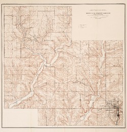
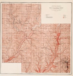
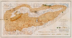
Mineral Point Sheet of the Lead and Zinc District [topography] [plate 5]
1906
Map: Scale 4 in = 1 mile
-
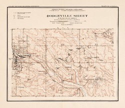
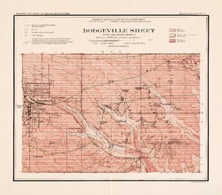
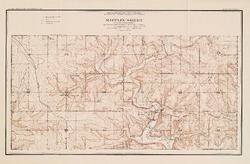
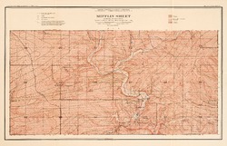
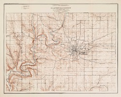
Platteville Sheet of the Lead and Zinc District [topography] [plate 9]
1906
Map: Scale 4 in = 1 mile
- 16 more...
-
-
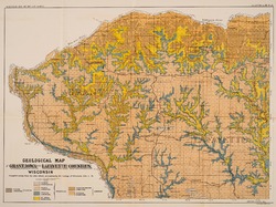
Preliminary Report on the Copper-Bearing Rocks of Douglas County, Wisconsin
-
Geological Map of Part of the St. Croix Copper Range, in Douglas Co., Wis. [plate 7]
1900
Map: Scale 1 in = 4 miles
-
Geological Map of the Western Part of the Douglas Copper Range, in Douglas Co., Wis. [plate 8]
1900
Map: Scale 1 in = 4 miles
-
Geological Map of the Eastern Part of the Douglas Copper Range, in Douglas Co., Wis. [plate 9]
1900
Map: Scale 1 in = 4 miles
-
Geological Map of Part of the Minong Copper Range in Washburn, Douglas and Bayfield Counties, Wis. [plate 13]
1900
Map: Scale 1 in = 4 miles

Publications Catalog
Wisconsin Geological and Natural History Survey