-
Stagnant Ice Landforms of the Chippewa Moraine, Taylor County, Wisconsin
Open-file report; contains unpublished data that has not yet been peer-reviewed. -
Location and Results of Analyses of Samples Taken in Forest County, Wisconsin
Open-file report; contains unpublished data that has not yet been peer-reviewed. -
Madison Lakes Ice Summary--1986-1987 Season
Open-file report; contains unpublished data that has not yet been peer-reviewed. -
Datalogger Programming for Automated Weather Stations: Program 1072 for the Campbell Scientific CR-10 Datalogger
Open-file report; contains unpublished data that has not yet been peer-reviewed. -
Number of Injuries and Deaths from Tornadoes in Wisconsin by Month for 1950 to 1987
Open-file report; contains unpublished data that has not yet been peer-reviewed. -
Wisconsin Tornadoes and Tornado-Days, 1950-1987, Monthly Data
Open-file report; contains unpublished data that has not yet been peer-reviewed. -
Summary of Laboratory Data for Langlade County Samples
Open-file report; contains unpublished data that has not yet been peer-reviewed. -
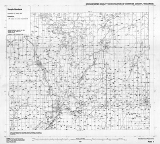
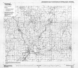
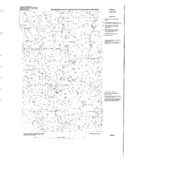
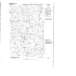
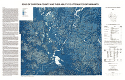
Groundwater Quality Investigation of Chippewa County, Wisconsin
Includes Plate 1: Sample Numbers. Plate 2: Nitrate–Nitrogen in mg/L. Plate 3: Chloride in mg/L. Plate 4: Laboratory Measurement of pH. Plate 5: Total Hardness in mg/L. Plate 6: Conductivity in µmhos/cm. Plate 7: Ferrous iron in mg/L.-
Groundwater Quality Investigation of Chippewa County, Wisconsin: Sample Numbers [plate 1]
1987
Map: 25.9 in x 23.3 in, scale 1:100,000
-
Groundwater Quality Investigation of Chippewa County, Wisconsin: Nitrate-Nitrogen in mg/L [plate 2]
1987
Map: 26.7 in x 23.3 in, scale 1:100,000
-
Groundwater Quality Investigation of Chippewa County, Wisconsin: Chloride in mg/L [plate 3]
1987
Map: 27 in x 23.3 in, scale 1:100,000
-
Groundwater Quality Investigation of Chippewa County, Wisconsin: Laboratory Measurement of pH [plate 4]
1987
Map: 26.7 in x 23.7 in, scale 1:100,000
-
Groundwater Quality Investigation of Chippewa County, Wisconsin: Total Hardness in mg/L [plate 5]
1987
Map: 26.9 in x 23.4 in, scale 1:100,000
-
Groundwater Quality Investigation of Chippewa County, Wisconsin: Conductivity in ?mhos/cm [plate 6]
1987
Map: 27.4 in x 23.3 in, scale 1:100,000
-
Groundwater Quality Investigation of Chippewa County, Wisconsin: Ferrous Iron in mg/L [plate 7]
1987
Map: 27.4 in x 23.6 in, scale 1:100,000
-
-
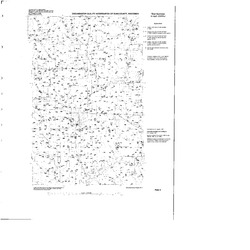
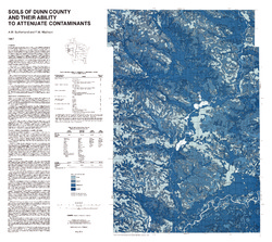
Groundwater Quality Investigation of Dunn County, Wisconsin
Includes Plate 1: Sample Numbers. Plate 2: Nitrate–N in mg/L. Plate 3: Chloride in mg/L. Plate 4: Laboratory Measurement of pH. Plate 5: Total Hardness in mg/L. Plate 6: Total Hardness/Conductivity. Plate 7: Ferrous iron in mg/L.-
Groundwater Quality Investigation of Dunn County, Wisconsin: Sample Numbers [plate 1]
1987
Map: 34 in x 34 in, scale 1:100,000
-
Groundwater Quality Investigation of Dunn County, Wisconsin: Nitrate-Nitrogen in mg/L [plate 2]
1987
Map: 34 in x 34 in, scale 1:100,000
-
Groundwater Quality Investigation of Dunn County, Wisconsin: Chloride in mg/L [plate 3]
1987
Map: 34 in x 34 in, scale 1:100,000
-
Groundwater Quality Investigation of Dunn County, Wisconsin: Laboratory Measurement of pH [plate 4]
1987
Map: 34 in x 34 in, scale 1:100,000
-
Groundwater Quality Investigation of Dunn County, Wisconsin: Total Hardness in mg/L [plate 5]
1987
Map: 34 in x 34 in, scale 1:100,000
-
Groundwater Quality Investigation of Dunn County, Wisconsin: Total Hardness/Conductivity in mg/L, in ?mhos/cm [plate 6]
1987
Map: 34 in x 34 in, scale 1:100,000
-
Groundwater Quality Investigation of Dunn County, Wisconsin: Ferrous Iron in mg/L [plate 7]
1987
Map: 34 in x 34 in, scale 1:100,000
-
-
Atlas of Groundwater Resources and Geology of Barron County, Wisconsin
Includes Physical Setting; Soils of Barron County and Their Ability to Attenuate Pollutants; Bedrock Geology; Depth to Bedrock; Hydrogeology; Water Quality; Potential Sources of Groundwater Pollution; Groundwater Levels; Groundwater Pollution Potential.-
Atlas of Groundwater Resources and Geology of Barron County, Wisconsin: Soils of Barron County and Their Ability to Attenuate Pollutants
1987
Map: 30.8 in x 20.8 in, scale 1:100,000
-
Atlas of Groundwater Resources and Geology of Barron County, Wisconsin: Bedrock Geology of Barron County, Wisconsin
1987
Map: 21.5 in x 28.5 in, scale 1:250,000
-
Atlas of Groundwater Resources and Geology of Barron County, Wisconsin: Depth to Bedrock in Barron County, Wisconsin
1987
Map: 21.1 in x 27.6 in, scale 1:100,000
-
Atlas of Groundwater Resources and Geology of Barron County, Wisconsin: Hydrogeology of Barron County, Wisconsin
1987
Map: 37.5 in x 24.5 in, scale 1:100,000
-
Atlas of Groundwater Resources and Geology of Barron County, Wisconsin: Potential Sources of Groundwater Pollution in Barron County, Wisconsin
1987
Map: 35.75 in x 23.3 in, scale 1:100,000
-
Atlas of Groundwater Resources and Geology of Barron County, Wisconsin: Groundwater Levels in Barron County, Wisconsin
1987
Map: 35.8 in x 23.3 in, scale 1:100,000
-
Atlas of Groundwater Resources and Geology of Barron County, Wisconsin: Groundwater Pollution Potential of Barron County, Wisconsin
1987
Map: 36.7 in x 24.25 in, scale 1:100,000
-
Bedrock Geology of Wisconsin, Northwest Sheet
Types of bedrock, formation names, major faults, and time period of formation.-
Bedrock Geology of Wisconsin, Northwest Sheet
1987
Map: 37.5 in x 22 in, scale 1:250,000 (map), 35.5 in x 20 in (explanation and cross sections)
-

Publications Catalog
Wisconsin Geological and Natural History Survey