-
Preliminary Bedrock Geology of Sheboygan County, Wisconsin
Open-file report; contains unpublished data that has not yet been peer-reviewed.-
Preliminary Bedrock Geology of Sheboygan County, Wisconsin (version 2) [GIS data]
2013
GIS Data: GeMS file geodatabase and metadata, supersedes previous shapefile format (DI version 1). Map supersedes WOFR2012-07
-
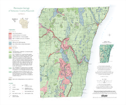
Managing Chippewa County's Groundwater--Today and Tomorrow: Evaluating the Impacts of Industrial Sand Mines and Irrigated Agriculture on the County's Water Resources
In 2012, Chippewa County commissioned the Wisconsin Geological Survey and the U.S. Geological Survey to conduct a 5-year study of the groundwater resources in the western part of the county. This 4-page publication describes the study and the computer models being developed for it. -
Wisconsin Rocks (set of 6 cards)
Trading cards profile five rocks (dolomite, granite, quartzite, shale, and sandstone) and one fossil (trilobite). Learn when and how the rocks formed, how the trilobite lived, plus a handful of interesting facts for each. -
Municipal Drinking Water Safety: The Link Between Groundwater, Pathogens, and Public Health
Most Wisconsin municipalities already disinfect their water supply. For those that don't, this publication describes how viruses from untreated sewage can contaminate groundwater, causing acute gastrointestinal illness. It also identifies available technology for treating water. -
Industrial Sand Potential in Wisconsin: Sandstone at or near the Surface
Shows where sandstone can be found within 100 ft (30 m) of the surface.-
Industrial Sand Potential in Wisconsin: Sandstone at or Near the Surface
2013
Map: 21 in x 22.5 in, scale 1:1,000,000
-
-
Preliminary Bedrock Geology of Dane County, Wisconsin
This map, produced at a scale of 1:100,000, reveals the intricate layers of bedrock below Dane County. Available as a map (plate 1), cross sections (plate 2), and GIS data. Open-file report; contains unpublished data that has not yet been peer-reviewed.-
Preliminary Bedrock Geology of Dane County, Wisconsin [plate 1]
2013
Map: 39 in x 25 in, scale 1:100,000
-
Geoscience Wisconsin Volume 22
This special edition of Geoscience Wisconsin provides an overview of the Niagara Escarpment in Wisconsin. The papers cover the geology, processes that shaped the escarpment, biota, bats, caves and karst, and the concept of conservation geology.-
Geoscience Wisconsin, Volume 22: Wisconsin's Niagara Escarpment
2016
Journal: 86 p. (introduction, 6 articles)
-
-
Geoscience Wisconsin Volume 21
Age and correlation of Silurian rocks / Overview of Wisconsin's spring resources -
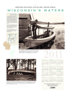
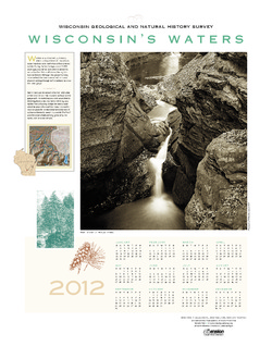
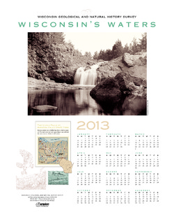
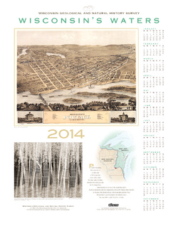
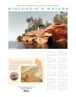
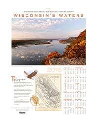
Wisconsin's Waters [2011-2016]
The Survey's annual poster calendar featuring Wisconsin scenery. The 2016 image showcases the Wisconsin River from the Ferry Bluff overlook.-
Wisconsin's Waters 2016
2015
Poster: 22 in x 28 in, features Wisconsin River from Ferry Bluff overlook
-
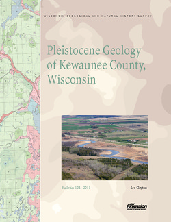
Pleistocene Geology of Kewaunee County, Wisconsin
Kewaunee County, at the southern end of the Door Peninsula, was overrun by glaciers many times. Author Lee Clayton describes the county's complex glacial geology, from the surface soil down to solid rock. The accompanying map shows the placement of glacial sediments as well as glacial and post-glacial stream and lake sediments.-
Pleistocene Geology of Kewaunee County, Wisconsin [plate 1]
2013
Map: Scale 1:100,000, 21.5 in x 18 in

Publications Catalog
Wisconsin Geological and Natural History Survey