-
Wisconsin Groundwater-Level Monitoring Network Improvements, 2018-2021
This report documents work completed as part of a grant from the U.S. Geological Survey’s National Groundwater Monitoring Network (NGWMN) program. It provides an overview of the Wisconsin Groundwater-Level Monitoring Network (WGLMN) and provides detailed description of well evaluation and repair activities, and drilling of new monitoring wells across the... -
Characterization of Groundwater Resources in the Chequamegon-Nicolet National Forest, Wisconsin
Results of a comprehensive review and analysis of groundwater resources in the Chequamegon-Nicolet National Forest. The study was divided by location into four reports corresponding to the four main land units: Medford, Nicolet, Park Falls, and Washburn/Great Divide. Each report describes the results of the inventory, modeling, and analysis.-
Characterization of Groundwater Resources in the Chequamegon-Nicolet National Forest, Wisconsin: Medford Unit [GIS data]
2018
GIS Data: Geodatabase, metadata
-
Characterization of Groundwater Resources in the Chequamegon-Nicolet National Forest, Wisconsin: Medford Unit [plates]
2018
Map: 10 maps, 11 in x 17 in
-
Characterization of Groundwater Resources in the Chequamegon-Nicolet National Forest, Wisconsin: Nicolet Unit [GIS data]
2018
GIS Data: Geodatabase, metadata
-
Characterization of Groundwater Resources in the Chequamegon-Nicolet National Forest, Wisconsin: Nicolet Unit [plates]
2018
Map: 20 maps (10 each, northern and southern Nicolet Unit), 11 in x 17 in
-
Characterization of Groundwater Resources in the Chequamegon-Nicolet National Forest, Wisconsin: Park Falls Unit [GIS data]
2018
GIS Data: Geodatabase, metadata
-
Characterization of Groundwater Resources in the Chequamegon-Nicolet National Forest, Wisconsin: Park Falls Unit [plates]
2018
Map: 10 maps, 11 in x 17 in
- 2 more...
-
Quaternary Geology in the Vicinity of the Bend Deposit, Taylor County, Wisconsin
Open-file report; contains unpublished data that has not yet been peer-reviewed. -
Stagnant Ice Landforms of the Chippewa Moraine, Taylor County, Wisconsin
Open-file report; contains unpublished data that has not yet been peer-reviewed. -
Bedrock Geology of Wisconsin, West-Central Sheet
Types of bedrock, formation names, major faults, and time period of formation.-
Bedrock Geology of Wisconsin, West-Central Sheet [GIS data]
1988
GIS Data: GeMS file geodatabase and metadata
-
Bedrock Geology of Wisconsin, Northwest Sheet
Types of bedrock, formation names, major faults, and time period of formation.-
Bedrock Geology of Wisconsin, Northwest Sheet
1987
Map: 37.5 in x 22 in, scale 1:250,000 (map), 35.5 in x 20 in (explanation and cross sections)
-
-
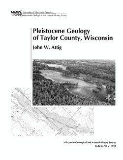
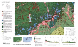
Pleistocene Geology of Taylor County, Wisconsin
-
Pleistocene Geology of Taylor County, Wisconsin
1993
Report: 25 p. + map and cross sections (scale 1:100,000)
-
-
Reconnoissance [sic] Soil Survey of South Part of North Central Wisconsin
-
Reconnoissance [sic] Soil Survey of South Part of North Central Wisconsin
1918
Report: 108 p. + map (scale 1 in = 3 miles)
-
Soil Map: Wisconsin, Reconnoissance [sic] Survey - South Part of the North-Central Wisconsin Sheet
1918
Map: Scale 1 in = 3 miles
-
-
Preliminary Report on the Soils and Agricultural Conditions of North Central Wisconsin
-
Preliminary Report on the Soils and Agricultural Conditions of North Central Wisconsin (2nd edition)
1903
Report: 72 p. + map (scale 1 in = 3 miles)
-
-
Soil Maps of Northern Wisconsin Counties (Page-Size)
Scale: 6 miles = 1 inch.-
Soil Map of Chippewa, Dunn, Eau Claire, and Pepin Counties
1910
Map: 9.5 x 13 in, scale: 6 miles = 1 inch
- 8 more...

Publications Catalog
Wisconsin Geological and Natural History Survey