-
Preliminary Report on the Copper-Bearing Rocks of Douglas County, Wisconsin
-
Geological Map of Part of the St. Croix Copper Range, in Douglas Co., Wis. [plate 7]
1900
Map: Scale 1 in = 4 miles
-
Geological Map of the Western Part of the Douglas Copper Range, in Douglas Co., Wis. [plate 8]
1900
Map: Scale 1 in = 4 miles
-
Geological Map of the Eastern Part of the Douglas Copper Range, in Douglas Co., Wis. [plate 9]
1900
Map: Scale 1 in = 4 miles
-
Geological Map of Part of the Minong Copper Range in Washburn, Douglas and Bayfield Counties, Wis. [plate 13]
1900
Map: Scale 1 in = 4 miles
-
On the Building and Ornamental Stones of Wisconsin
-
Map of Wisconsin Showing Location of Quarries [plate 1]
1898
Map: 16.2 in x 20.7 in, scale 1 in = 20 miles
-
Soil Survey of Crawford County, Wisconsin
-
Soil Map: Crawford County Wisconsin
Map: Scale 1 in = 1 mile
-
Soil Survey of Winnebago County, Wisconsin
-
Map 1: Soil Map: Winnebago County Wisconsin
Map: Scale 1 in = 1 mile
-
Soil Survey of Calumet County, Wisconsin
-
Map 1: Soil Map: Calumet County Wisconsin
Map: Scale 1 in = 1 mile
-
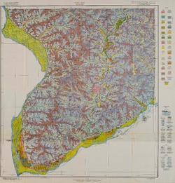
Soil Survey of Vernon County, Wisconsin
-
Map 1: Soil Map: Vernon County Wisconsin
Map: Scale 1:62,500
-
Soil Survey of Sauk County, Wisconsin
-
Map 1: Soil Map: Sauk County Wisconsin
Map: Scale 1 in = 1 mile
-
Soil Survey of Sheboygan County, Wisconsin
-
Map 1: Soil Map: Sheboygan County Wisconsin
Map: Scale 1 in = 1 mile

Publications Catalog
Wisconsin Geological and Natural History Survey