-
The Driftless Area: The extent of unglaciated and similar terrains in Wisconsin, Illinois, Iowa, and Minnesota
The Driftless Area of southwestern Wisconsin and northwestern Illinois got its name from the lack of glacial sediment ("drift") covering the landscape. The surficial geology and topography of the Driftless Area are thus distinct from the surrounding region where multiple phases of glaciation left their mark. This pamphlet, a collaborative effort between...-
GIS data for the outline of the Driftless Area and similar terrains in Wisconsin, Illinois, Iowa, and Minnesota
2023
GIS Data: shapefile, metadata
-
Page-sized and web-version maps of the Driftless Area and similar terrains in Wisconsin, Illinois, Iowa, and Minnesota
2023
Map: 1 p. (8.5 in x 11 in)
-
Assessing private well contamination in Grant, Iowa, and Lafayette counties: The southwest Wisconsin groundwater and geology study
The southwest Wisconsin groundwater and geology study (SWIGG) was a cooperative effort between Grant, Iowa, and Lafayette county governments, with scientists from the U.S. Geological Survey, U.S. Department of Agriculture, Marshfield Clinic Research Institute, and WGNHS. Researchers tested water quality in hundreds of private water wells across the three...-
Assessing private well contamination in Grant, Iowa, and Lafayette counties: The southwest Wisconsin groundwater and geology study
2023
Report: 47 p. (report) + 24 p. (appendices)
-
-
Discussion of the Phenomena of Local Glaciation in the Driftless Region
Open-file report; contains unpublished data that has not yet been peer-reviewed. -
Studies in the Driftless Region of Wisconsin
Open-file report; contains unpublished data that has not yet been peer-reviewed. -
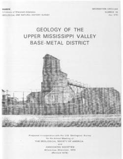
Upper Mississippi Valley Base-Metal District
Companion volume to Information Circular 16 (third edition). Prepared for 24th Annual Meeting, Institute on Lake Superior Geology. -
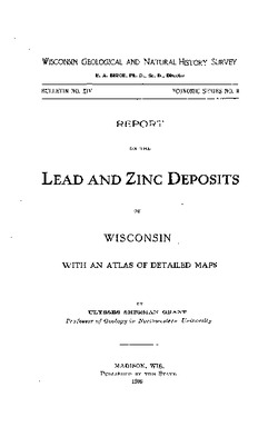
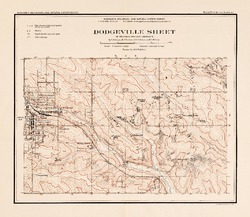
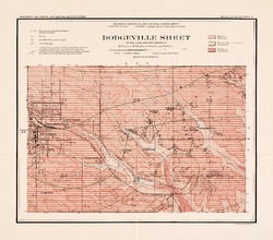
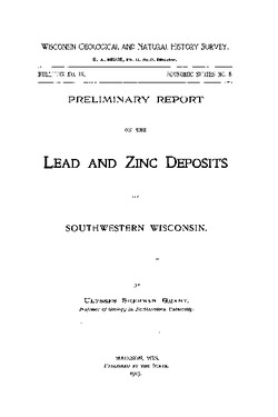
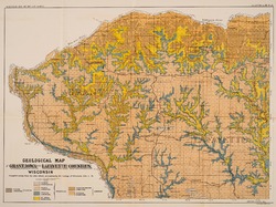
Report on Lead and Zinc Deposits of Wisconsin, with an Atlas of Detailed Geologic and Topographic Maps of Southwestern Wisconsin
-
Report on the Lead and Zinc Deposits of Wisconsin With an Atlas of Detailed Maps
1906
Report: 100 p. + 6 maps (scale 4 I = 1 mile)
-
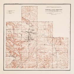
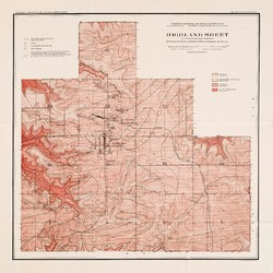
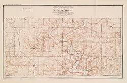
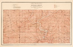
Mineral Point Sheet of the Lead and Zinc District [topography] [plate 5]
1906
Map: Scale 4 in = 1 mile
-
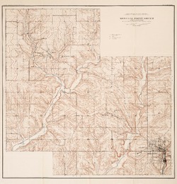
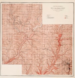
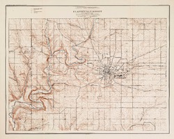
Platteville Sheet of the Lead and Zinc District [topography] [plate 9]
1906
Map: Scale 4 in = 1 mile
- 16 more...
-

Publications Catalog
Wisconsin Geological and Natural History Survey