-
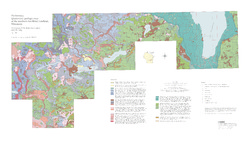
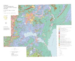
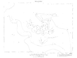
Preliminary Quaternary Geologic Map of the Southern Fox River Lowland, Wisconsin
Open-file report; contains unpublished data that has not yet been peer-reviewed.-
Preliminary Quaternary Geologic Map of the Southern Fox River Lowland, Wisconsin
2005
Map: 48 in x 27 in, scale 1:100,000
-
-
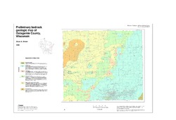
Preliminary Bedrock Geologic Map of Outagamie County, Wisconsin
Open-file report; contains unpublished data that has not yet been peer-reviewed.-
Preliminary Bedrock Geologic Map of Outagamie County, Wisconsin
2005
Map: 38 in x 26 in, scale 1:100,000
-
-
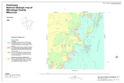
Preliminary Bedrock Geologic Map of Winnebago County, Wisconsin
Open-file report; contains unpublished data that has not yet been peer-reviewed.-
Preliminary Bedrock Geologic Map of Winnebago County, Wisconsin
2004
Map: 33.75 in x 22.5 in, scale 1:100,000
-
-
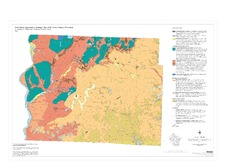
Preliminary Paleozoic Geologic Map of Fond du Lac County, Wisconsin
Open-file report; contains unpublished data that has not yet been peer-reviewed.-
Preliminary Bedrock Geologic Map of Fond du Lac County, Wisconsin [plate 1]
2004
Map: 26 in x 21 in, scale 1:100,000
-
-
Preliminary Quaternary Geologic Map of St. Croix County, Wisconsin
Open-file report; contains unpublished data that has not yet been peer-reviewed.-
Preliminary Quaternary Geologic Map of St. Croix County, Wisconsin
2004
Map: 36 in x 24 in, scale 1:100,000
-
-
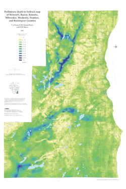
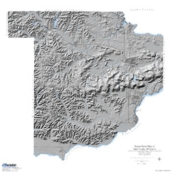
Preliminary Depth to Bedrock Map of Walworth, Racine, Kenosha, Milwaukee, Waukesha, Ozaukee, and Washington Counties
Open-file report; contains unpublished data that has not yet been peer-reviewed.-
Preliminary Depth to Bedrock Map of Walworth, Racine, Kenosha, Milwaukee, Waukesha, Ozaukee, and Washington Counties
2004
Map: 34.75 in x 52 in, scale 1:100,000
-
-
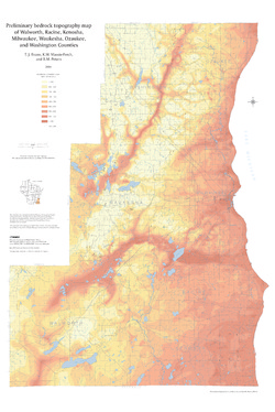
Preliminary Bedrock Topography Map of Walworth, Racine, Kenosha, Milwaukee, Waukesha, Ozaukee, and Washington Counties
Open-file report; contains unpublished data that has not yet been peer-reviewed.-
Preliminary Bedrock Topography Map of Walworth, Racine, Kenosha, Milwaukee, Waukesha, Ozaukee, and Washington Counties
2004
Map: 34.75 in x 52 in, scale 1:100,000
-
-
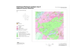
Preliminary Pleistocene Geologic Map of Walworth County, Wisconsin
Open-file report; contains unpublished data that has not yet been peer-reviewed.-
Preliminary Pleistocene Geologic Map of Walworth County, Wisconsin
2004
Map: 50 in x 28 in, scale 1:100,000
-
-
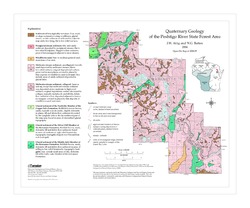
Quaternary Geology of the Peshtigo River State Forest Area
Open-file report; contains unpublished data that has not yet been peer-reviewed. -
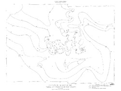
Preliminary Quaternary Geologic Map of the Central Fox River Lowland, Wisconsin
Open-file report; contains unpublished data that has not yet been peer-reviewed.-
Preliminary Quaternary Geologic Map of the Central Fox River Lowland, Wisconsin
2004
Map: 39 in x 32 in, scale 1:100,000
-
-
Shaded Relief Map of Sauk County, Wisconsin
Open-file report; contains unpublished data that has not yet been peer-reviewed. -
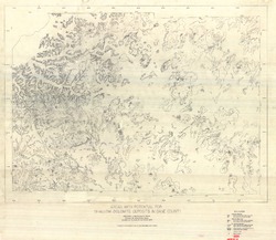
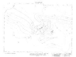
Areas with Potential for Shallow Dolomite Deposits in Dane County
Open-file report; contains unpublished data that has not yet been peer-reviewed.-
Areas with Potential for Shallow Dolomite Deposits in Dane County
1974
Map: 47.4 in x 41.1 in, scale 1:62,500
-
-
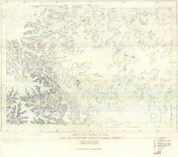
Areas with Potential for Shallow Sandstone Deposits in Dane County
Open-file report; contains unpublished data that has not yet been peer-reviewed.-
Areas with Potential for Shallow Sandstone Deposits in Dane County
1974
Map: 45.8 in x 40.3 in, scale 1:62,500
-
-
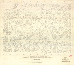
Elevation of the Water Table and Areas of Shallow Groundwater of Dane County
Open-file report; contains unpublished data that has not yet been peer-reviewed.-
Elevation of the Watertable and Areas of Shallow Groundwater of Dane County
1973
Map: 46.3 in x 40.5 in, scale 1:62,500
-
-
Thickness of Unconsolidated Deposits and Areas of Shallow Bedrock in Dane County
Open-file report; contains unpublished data that has not yet been peer-reviewed.-
Thickness of Unconsolidated Deposits and Areas of Shallow Bedrock in Dane County (revised 1993)
1973
Map: 49.5 in x 36 in, scale 1:62,500
-
-
Surficial Materials of Dane County
Open-file report; contains unpublished data that has not yet been peer-reviewed. -
Contours on the Surface of the Precambrian Rocks in Dane County
Open-file report; contains unpublished data that has not yet been peer-reviewed. -
Contours on the Base of the Eau Claire Sandstone in Dane County
Open-file report; contains unpublished data that has not yet been peer-reviewed. -
Contours on the Base of the Tunnel City Formation in Dane County
Open-file report; contains unpublished data that has not yet been peer-reviewed. -
Bedrock Geology of Dane County
Open-file report; contains unpublished data that has not yet been peer-reviewed.

Publications Catalog
Wisconsin Geological and Natural History Survey