-
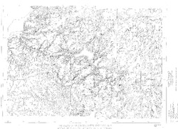
Land Use and the Geologic and Hydrologic Environment in Parts of Middleton, Verona, Madison, and Fitchburg Townships, Dane County, Wisconsin
Open-file report; contains unpublished data that has not yet been peer-reviewed. See WOFR1975-02 for companion plates. -
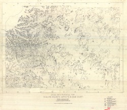
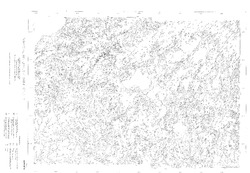
Areas with Potential for Shallow Dolomite Deposits in Dane County
Open-file report; contains unpublished data that has not yet been peer-reviewed.-
Areas with Potential for Shallow Dolomite Deposits in Dane County
1974
Map: 47.4 in x 41.1 in, scale 1:62,500
-
-
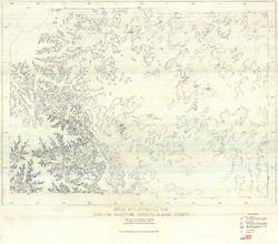
Areas with Potential for Shallow Sandstone Deposits in Dane County
Open-file report; contains unpublished data that has not yet been peer-reviewed.-
Areas with Potential for Shallow Sandstone Deposits in Dane County
1974
Map: 45.8 in x 40.3 in, scale 1:62,500
-
-
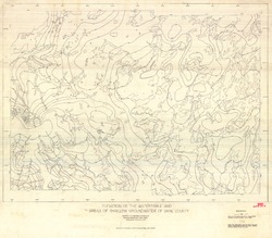
Elevation of the Water Table and Areas of Shallow Groundwater of Dane County
Open-file report; contains unpublished data that has not yet been peer-reviewed.-
Elevation of the Watertable and Areas of Shallow Groundwater of Dane County
1973
Map: 46.3 in x 40.5 in, scale 1:62,500
-
-
Thickness of Unconsolidated Deposits and Areas of Shallow Bedrock in Dane County
Open-file report; contains unpublished data that has not yet been peer-reviewed.-
Thickness of Unconsolidated Deposits and Areas of Shallow Bedrock in Dane County (revised 1993)
1973
Map: 49.5 in x 36 in, scale 1:62,500
-
-
Surficial Materials of Dane County
Open-file report; contains unpublished data that has not yet been peer-reviewed. -
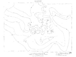
Contours on the Surface of the Precambrian Rocks in Dane County
Open-file report; contains unpublished data that has not yet been peer-reviewed. -
Contours on the Base of the Eau Claire Sandstone in Dane County
Open-file report; contains unpublished data that has not yet been peer-reviewed. -
Contours on the Base of the Tunnel City Formation in Dane County
Open-file report; contains unpublished data that has not yet been peer-reviewed. -
Bedrock Geology of Dane County
Open-file report; contains unpublished data that has not yet been peer-reviewed. -
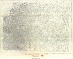
Bedrock Topography of Dane County
Open-file report; contains unpublished data that has not yet been peer-reviewed. -
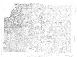
Land Surface Topography of Dane County
Open-file report; contains unpublished data that has not yet been peer-reviewed. -
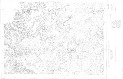
Dane County, Wisconsin (Base Map)
Open-file report; contains unpublished data that has not yet been peer-reviewed. -
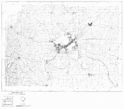
Geology Field Trip Southwestern Dane County
Open-file report; contains unpublished data that has not yet been peer-reviewed. -
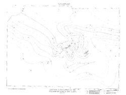
Geologic Structure in the Yahara Hills Golf Course Area in Southeast Madison, Wisconsin
Open-file report; contains unpublished data that has not yet been peer-reviewed. -
Log of Field Trip for Western Dane County, Wisconsin
Open-file report; contains unpublished data that has not yet been peer-reviewed. -
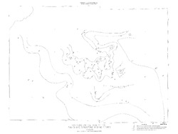
Location of Quarry Sites in the City of Madison
Open-file report; contains unpublished data that has not yet been peer-reviewed. -
A Weathering Study of the University Buildings
Open-file report; contains unpublished data that has not yet been peer-reviewed. -
Hydrogeology of Dane County, Wisconsin
Open-file report; contains unpublished data that has not yet been peer-reviewed.-
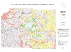
Water-Table Elevation and Unlithified Aquifers in Dane County, Wisconsin [plate 1]
1999
Map: 34.5 in x 25.5 in, scale 1:100,000
-
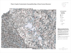
Aquifer Contamination Susceptibility Map of Dane County, Wisconsin [plate 2]
1999
Map: 34.5 in x 25.5 in, scale 1:100,000
-
Distributed Temperature Sensing (DTS) as a Hydrostratigraphic Characterization Tool
Open-file report; contains unpublished data that has not yet been peer-reviewed.

Publications Catalog
Wisconsin Geological and Natural History Survey