-
An Introduction to Wisconsin Wetlands
Description of the different types of wetlands in Wisconsin and their importance to the surrounding landscape. Illustrated with black and white photographs. -
Wisconsin Lakes Levels--Their Ups and Downs
This booklet examines lake-level fluctuations by lake type for 28 Wisconsin lakes. Records span a period of 20 years or longer. -
Stones Used in State Capitol
Brief descriptions of the various kinds of marbles, granites, and limestones that make up different parts of the State Capitol building in Madison. No illustrations. -
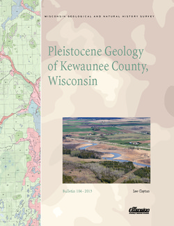
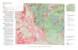
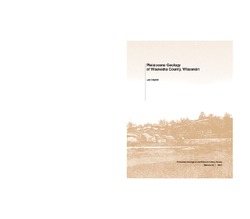
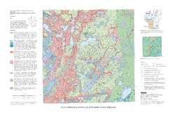
Pleistocene Geology of Kewaunee County, Wisconsin
Kewaunee County, at the southern end of the Door Peninsula, was overrun by glaciers many times. Author Lee Clayton describes the county's complex glacial geology, from the surface soil down to solid rock. The accompanying map shows the placement of glacial sediments as well as glacial and post-glacial stream and lake sediments.-
Pleistocene Geology of Kewaunee County, Wisconsin [plate 1]
2013
Map: Scale 1:100,000, 21.5 in x 18 in
-
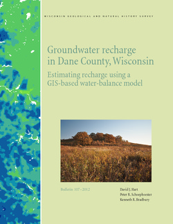
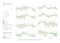
Groundwater Recharge in Dane County, Wisconsin: Estimating Recharge Using a GIS-Based Water-Balance Model
Hydrogeologists at the Survey developed a groundwater management tool to help guide land-use decisions in Dane County. The publication describes the inputs used to calculate recharge and includes a reduced-scale version of the recharge map. A full-scale version of the recharge data has been subsequently added as Dataset 1.-
GIS Data for Groundwater Recharge in Dane County, Wisconsin [dataset 1]
2012
GIS Data: File geodatabase, metadata
-
Quaternary Geology of Sheboygan County, Wisconsin
This report traces the advances and retreats of glaciers through Sheboygan County in eastern Wisconsin. Available as a bulletin, map, cross sections, and GIS data.-
Quaternary Geology of Sheboygan County, Wisconsin [plate 1]
2011
Map: Scale 1:100,000, 29 in x 23 in
-
Geologic Cross Sections of Sheboygan County, Wisconsin [plate 2]
2011
Plate: Scale 1:100,000, 33 in x 24 in
-
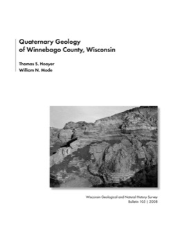
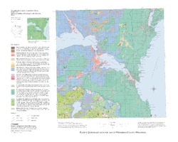
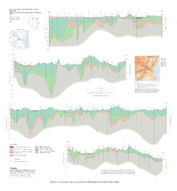
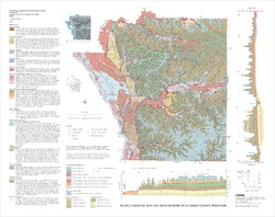
Quaternary Geology of Winnebago County, Wisconsin
-
Quaternary Geology of Winnebago County, Wisconsin (version 2) [GIS data]
2008
GIS Data: GeMS Level 3 file geodatabase and metadata. Supersedes previous shapefile format (DI version 1).
-
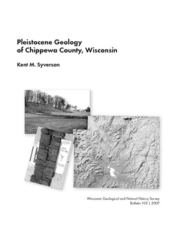
Pleistocene Geology of Chippewa County, Wisconsin
-
Pleistocene Geology of Chippewa County, Wisconsin
2007
Report: 53 p. + map and cross sections (scale 1:100,000)
-
Pleistocene Geology of Chippewa County, Wisconsin (version 2) [GIS data]
2007
GIS Data: GeMS file geodatabase and metadata; supersedes previous coverage format
-
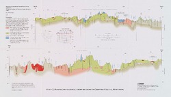
Pleistocene Geologic Cross Sections of Chippewa County, Wisconsin [plate 2]
2007
Plate: Scale 1:100,000
-
-
Geology of La Crosse County, Wisconsin
-
Geology of La Crosse County, Wisconsin
2003
Report: 33 p. + map and cross sections (scale 1:100,000)
-
Geology of La Crosse County, Wisconsin (version 2) [GIS Data]
2003
GIS Data: GeMS file geodatabase and metadata, supersedes previous coverage format (DI version 1)
-
-
Pleistocene Geology of Waukesha County, Wisconsin
-
Pleistocene Geology of Waukesha County, Wisconsin
2001
Report: 33 p. + map and cross sections (scale 1:100,000)
-
Pleistocene Geology of Waukesha County, Wisconsin (version 2) [GIS data]
2001
GIS Data: GeMS file geodatabase and metadata, supersedes previous coverage format (DI version 1)
-
Pleistocene Geologic Cross Sections of Waukesha County, Wisconsin [plate 2]
2001
Plate: Scale 1:200,000
-
-
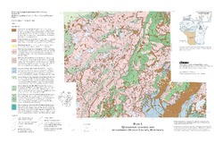
Quaternary Geology of Northern Oconto County, Wisconsin
-
Quaternary Geology of Northern Oconto County, Wisconsin (version 2) [GIS data]
1999
GIS Data: GeMS file geodatabase and metadata, supersedes previous coverage format (DI version 1)
-
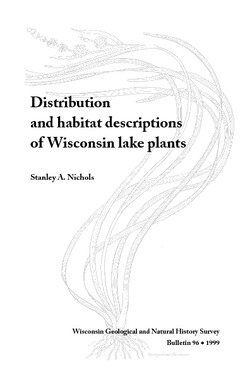
Distribution and Habitat Descriptions of Wisconsin Lake Plants
A catalog that features technical information and detailed drawings for more than 100 species of lake plants that range from the rare to the commonplace. Wire bound with plastic cover.

Publications Catalog
Wisconsin Geological and Natural History Survey