-
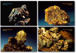
Minerals of Wisconsin Postcards (set of 4)
Set of 4 postcards featuring exquisite specimens of phenakite, galena, marcasite, and chalcocite. (To learn more about these and other minerals, visit our Minerals of Wisconsin database.)-
Minerals of Wisconsin
2015
Item: 4 in x 6 in, set of 4 cards (phenakite, galena, marcasite, chalcocite)
-
-
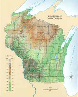
Landscapes of Wisconsin Postcard
Postcard showing Wisconsin in shaded relief. Also available as a poster and page-size map. -
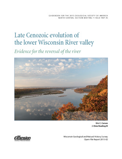
Late Cenozoic Evolution of the Lower Wisconsin River Valley: Evidence for the Reversal of the River
Field trip guidebook describes the evidence suggesting that the Wisconsin River once flowed from west to east. (Prepared for the 2015 Geological Society of America North-Central Section Meeting.) -
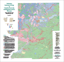
Preliminary Quaternary Geology of Columbia, Green Lake, and Marquette Counties, Wisconsin
This open-file report contains a map (PDF), GIS data (shapefiles), and metadata for Columbia, Green Lake, and Marquette Counties in central Wisconsin.-
Preliminary Quaternary Geology of Columbia, Green Lake, and Marquette Counties, Wisconsin [plate 1]
2015
Map: 35 in x 34 in, scale 1:100,000
-
Preliminary Quaternary Geology of Columbia, Green Lake, and Marquette Counties, Wisconsin [GIS data]
2015
GIS Data: Shapefiles
-
-
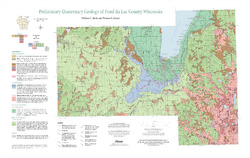
Preliminary Quaternary Geology of Fond du Lac County, Wisconsin
Open-file report-
Preliminary Quaternary Geology of Fond du Lac County, Wisconsin [plate 1]
2014
Map: 32 in x 20.25 in, scale 1:100,000
-
Preliminary Quaternary Geology of Fond du Lac County, Wisconsin [GIS data]
2014
GIS Data: Shapefiles, metadata
-
-
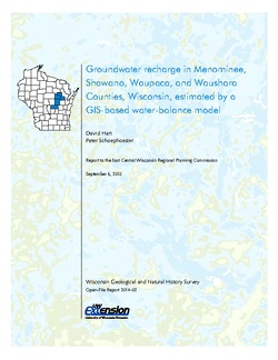
Groundwater Recharge in Menominee, Shawano, Waupaca, and Waushara Counties, Wisconsin, Estimated by a GIS-Based Water-Balance Model
This open-file report documents the recharge model created for the East Central Wisconsin Regional Planning Commission. Includes the resulting recharge map, a useful tool for land-use planners interested in identifying important groundwater recharge areas. -
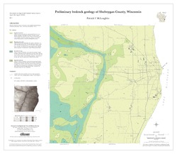
Preliminary Bedrock Geology of Sheboygan County, Wisconsin
Open-file report; contains unpublished data that has not yet been peer-reviewed.-
Preliminary Bedrock Geology of Sheboygan County, Wisconsin (version 2) [GIS data]
2013
GIS Data: GeMS file geodatabase and metadata, supersedes previous shapefile format (DI version 1). Map supersedes WOFR2012-07
-
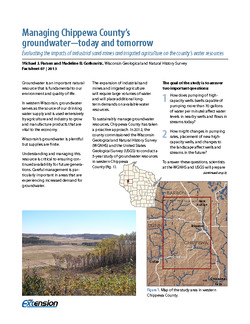
Managing Chippewa County's Groundwater--Today and Tomorrow: Evaluating the Impacts of Industrial Sand Mines and Irrigated Agriculture on the County's Water Resources
In 2012, Chippewa County commissioned the Wisconsin Geological Survey and the U.S. Geological Survey to conduct a 5-year study of the groundwater resources in the western part of the county. This 4-page publication describes the study and the computer models being developed for it. -
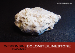
Wisconsin Rocks (set of 6 cards)
Trading cards profile five rocks (dolomite, granite, quartzite, shale, and sandstone) and one fossil (trilobite). Learn when and how the rocks formed, how the trilobite lived, plus a handful of interesting facts for each. -
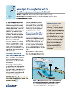
Municipal Drinking Water Safety: The Link Between Groundwater, Pathogens, and Public Health
Most Wisconsin municipalities already disinfect their water supply. For those that don't, this publication describes how viruses from untreated sewage can contaminate groundwater, causing acute gastrointestinal illness. It also identifies available technology for treating water. -
Industrial Sand Potential in Wisconsin: Sandstone at or near the Surface
Shows where sandstone can be found within 100 ft (30 m) of the surface.-
Industrial Sand Potential in Wisconsin: Sandstone at or Near the Surface
2013
Map: 21 in x 22.5 in, scale 1:1,000,000
-
-
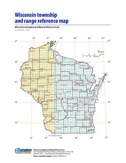
Wisconsin Township and Range Reference Map
Page-size map showing township and range numbers for the state, along with a brief explanation of how to use the map. -
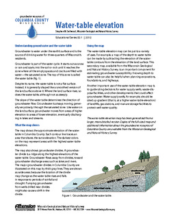
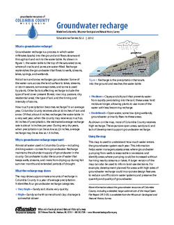
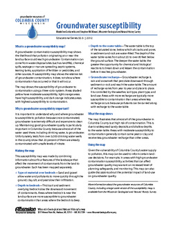
Groundwater Resources of Columbia County, Wisconsin
Three-part series describes the results of a comprehensive inventory and assessment of Columbia County's groundwater resources. Covers water-table elevation, groundwater recharge, and groundwater susceptibility. -
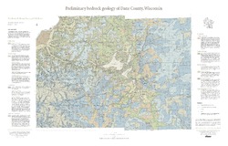
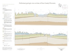
Preliminary Bedrock Geology of Dane County, Wisconsin
This map, produced at a scale of 1:100,000, reveals the intricate layers of bedrock below Dane County. Available as a map (plate 1), cross sections (plate 2), and GIS data. Open-file report; contains unpublished data that has not yet been peer-reviewed.-
Preliminary Bedrock Geology of Dane County, Wisconsin [plate 1]
2013
Map: 39 in x 25 in, scale 1:100,000
-
-
Sources of naturally occurring chromium in bedrock aquifers underlying Madison, Wisconsin
Open-file report; contains unpublished data that has not yet been peer-reviewed.-
Sources of Naturally Occurring Chromium in Bedrock Aquifers Underlying Madison, Wisconsin [appendices]
2012
Data: Data files (tab-delimited)
-
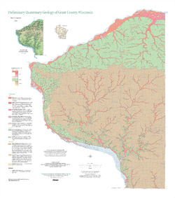
Preliminary Quaternary Geology of Grant County, Wisconsin
Open-file report; contains unpublished data that has not yet been peer-reviewed. -
Evaluation of Groundwater Pumping to Reduce the Level of Crystal Lake in Columbia County, Wisconsin
Open-file report; contains unpublished data that has not yet been peer-reviewed.-
Evaluation of Groundwater Pumping to Reduce the Level of Crystal Lake, Columbia County, Wisconsin [appendices]
2012
Data: Multiple PDF files + data files (comma-delimited)
-
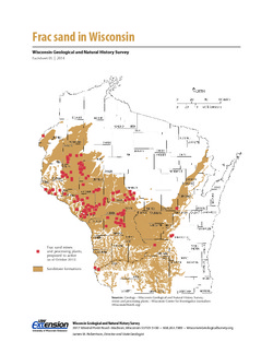
Frac Sand in Wisconsin
The state's golden sands have inspired Wisconsin's version of a gold rush. This 2-page fact sheet shows where sandstone formations occur in Wisconsin, where frac sand is being mined and processed, why our sand is so popular, and how it's being used.

Publications Catalog
Wisconsin Geological and Natural History Survey