-
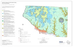
Preliminary Geology of the Buried Bedrock Surface, Pierce County, Wisconsin
Open-file report; contains unpublished data that has not yet been peer-reviewed.-
Preliminary Geology of the Buried Bedrock Surface, Pierce County, Wisconsin
2007
Map: 34 in x 22 in, scale 1:100,000
-
-
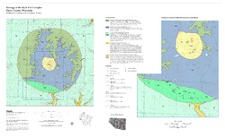
Geology of the Rock Elm Complex, Pierce County, Wisconsin
Open-file report; contains unpublished data that has not yet been peer-reviewed. -
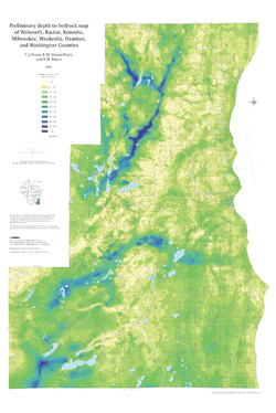
Preliminary Depth to Bedrock Map of Walworth, Racine, Kenosha, Milwaukee, Waukesha, Ozaukee, and Washington Counties
Open-file report; contains unpublished data that has not yet been peer-reviewed.-
Preliminary Depth to Bedrock Map of Walworth, Racine, Kenosha, Milwaukee, Waukesha, Ozaukee, and Washington Counties
2004
Map: 34.75 in x 52 in, scale 1:100,000
-
-
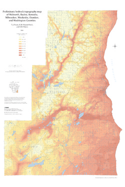
Preliminary Bedrock Topography Map of Walworth, Racine, Kenosha, Milwaukee, Waukesha, Ozaukee, and Washington Counties
Open-file report; contains unpublished data that has not yet been peer-reviewed.-
Preliminary Bedrock Topography Map of Walworth, Racine, Kenosha, Milwaukee, Waukesha, Ozaukee, and Washington Counties
2004
Map: 34.75 in x 52 in, scale 1:100,000
-
-
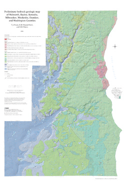
Preliminary Bedrock Geologic Map of Walworth, Racine, Kenosha, Milwaukee, Waukesha, Ozaukee, and Washington Counties
Open-file report; contains unpublished data that has not yet been peer-reviewed.-
Preliminary Bedrock Geologic Map of Walworth, Racine, Kenosha, Milwaukee, Waukesha, Ozaukee, and Washington Counties
2004
Map: 34.75 in x 52 in, scale 1:100,000
-
Preliminary Bedrock Geologic Map of Walworth, Racine, Kenosha, Milwaukee, Waukesha, Ozaukee, and Washington Counties [GIS data]
2004
GIS Data: GeMS file geodatabase (.gdb file format)
-
-
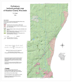
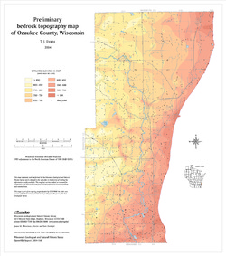
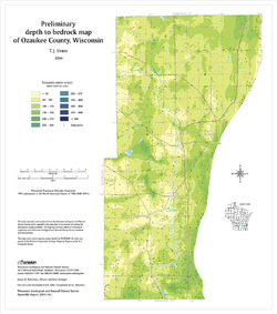
Preliminary Bedrock Geology of Ozaukee County, Wisconsin
Open-file report; contains unpublished data that has not yet been peer-reviewed.-
Preliminary Bedrock Geologic Map of Ozaukee County, Wisconsin
2004
Map: 15 in x 17 in, scale 1:100,000
-
Preliminary Bedrock Topography Map of Ozaukee County, Wisconsin
2004
Map: 15 in x 17 in, scale 1:100,000
-
Preliminary Depth to Bedrock Map of Ozaukee County, Wisconsin
2004
Map: 15 in x 17 in, scale 1:100,000
-
-
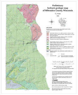
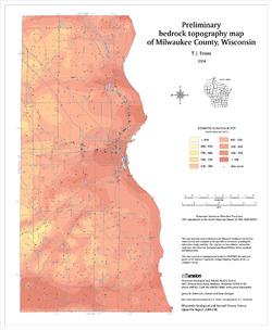
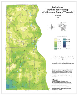
Preliminary Bedrock Geology of Milwaukee County, Wisconsin
Open-file report; contains unpublished data that has not yet been peer-reviewed.-
Preliminary Bedrock Geologic Map of Milwaukee County, Wisconsin
2004
Map: 14 in x 17 in, scale 1:100,000
-
Preliminary Bedrock Topography Map of Milwaukee County, Wisconsin
2004
Map: 14 in x 17 in, scale 1:100,000
-
Preliminary Depth to Bedrock Map of Milwaukee County, Wisconsin
2004
Map: 14 in x 17 in, scale 1:100,000
-
-
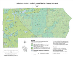
Preliminary Bedrock Geology of Racine County, Wisconsin
Open-file report; contains unpublished data that has not yet been peer-reviewed.-
Preliminary Bedrock Geologic Map of Racine County, Wisconsin
2004
Map: 19 in x 15 in, scale 1:100,000
-
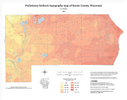
Preliminary Bedrock Topography Map of Racine County, Wisconsin
2004
Map: 19 in x 15 in, scale 1:100,000
-
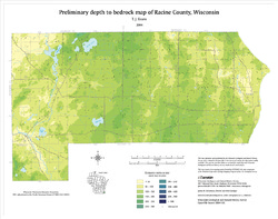
Preliminary Depth to Bedrock Map of Racine County, Wisconsin
2004
Map: 19 in x 15 in, scale 1:100,000
-
-
Metallic Mineral Occurrence Map
Open-file report; contains unpublished data that has not yet been peer-reviewed. -
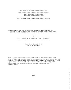
Investigation of the Effects of Recent Mine Closings on Ground-Water Quality and Quantity in the Shullsburg Area
Open-file report; contains unpublished data that has not yet been peer-reviewed. -
Geoscience Wisconsin Volume 11
Precambrian petroleum potential in Wisconsin and Michigan-
Precambrian Petroleum: Worldwide Distribution of Precambrian Hydrocarbon Deposits
1986
Journal Article: p. 8-13
-
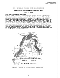
Setting and Evolution of the Midcontinent Rift: Midcontinent Rift as a Frontier Hydrocarbon Target
1986
Journal Article: p. 15-19
-
Setting and Evolution of the Midcontinent Rift: Lithospheric Flexure and Evolution of the Midcontinent Rift
1986
Journal Article: p. 19-21
-
Upper Keweenawan Stratigraphy: Reservoir Characteristics of the Keweenawan Supergroup, Lake Superior Region
1986
Journal Article: p. 25-31
-
Local Geologic Issues Impacting Exploration: Nature of the Northern Boundary of the St. Croix Horst
1986
Journal Article: p. 39-44
- 5 more...
-
Three Billion Years of Geology
Prepared for 47th Annual Tri-State Geology Conference, Black River Falls, Wisconsin. -
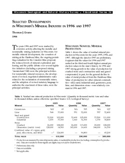
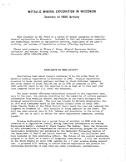
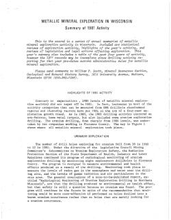
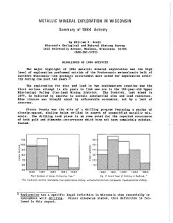
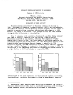
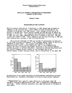
Metallic Mineral Exploration in Wisconsin [1980-1987]
Annual summaries of metallic mineral exploration in Wisconsin for 1980-1987. Each summary includes statistical reviews of exploration activity, highlights of the year's activity, and reviews of legislative actions affecting exploration.

Publications Catalog
Wisconsin Geological and Natural History Survey