-
Depth to Silurian Bedrock in Eastern Wisconsin
Silurian-aged bedrock in eastern Wisconsin is shallow, fractured, and contains groundwater that is susceptible to surface water contamination. Revisions to Wisconsin state rules ATCP50 and NR151 to regulate manure spreading over this Silurian-aged bedrock create the need for a depth-to-bedrock map of eastern WI. The Wisconsin Geological and Natural...-
Depth to Silurian Bedrock in Eastern Wisconsin [dataset 1]
2025
GIS Data: File geodatabase (.gdb file format)
-
-
Wisconsin Groundwater-Level Monitoring Network Improvements, 2020-2022
This report documents work completed as part of a grant from the U.S. Geological Survey's National Groundwater Monitoring Network (NGWMN) program. It provides an overview of the Wisconsin Groundwater-Level Monitoring Network (WGLMN) and provides detailed description of well evaluation and repair activities, and drilling of new monitoring wells across the... -
Wisconsin Groundwater-Level Monitoring Network Improvements, 2018-2021
This report documents work completed as part of a grant from the U.S. Geological Survey’s National Groundwater Monitoring Network (NGWMN) program. It provides an overview of the Wisconsin Groundwater-Level Monitoring Network (WGLMN) and provides detailed description of well evaluation and repair activities, and drilling of new monitoring wells across the... -
Wisconsin Groundwater-Level Monitoring Network Improvement
The Wisconsin Groundwater-Level Monitoring Network consists of 93 wells and 2 spring gaging stations. This report documents work performed on seven of the wells between August 1, 2016 and July 31, 2017, and appendices provide historical reference documents. -
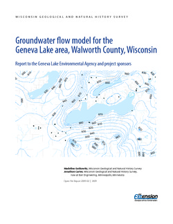
Groundwater Flow Model for the Geneva Lake Area, Walworth County, Wisconsin
Open-file report; contains unpublished data that has not yet been peer-reviewed. -
Mechanisms of Groundwater Flow Across the Maquoketa Formation
Open-file report; contains unpublished data that has not yet been peer-reviewed. -
Groundwater Data Compilation for the Geneva Lake, Wisconsin, Area
Open-file report; contains unpublished data that has not yet been peer-reviewed.-
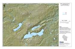
Regional Overview, Geneva Lake Area, Walworth County, Wisconsin [plate 1]
2006
Map: 11 in x 17 in, scale 1:100,000
-
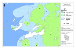
Bedrock Geology, Geneva Lake Area, Walworth County, Wisconsin [plate 2]
2006
Map: 11 in x 17 in, scale 1:100,000
-
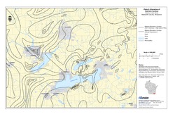
Elevation of Bedrock Surface, Geneva Lake Area, Walworth County, Wisconsin [plate 3]
2006
Map: 11 in x 17 in, scale 1:100,000
-
Depth to Bedrock (Thickness of Surficial Materials), Geneva Lake Area, Walworth County, Wisconsin [plate 4]
2006
Map: 11 in x 17 in, scale 1:100,000
-
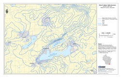
Water Table Elevation, Geneva Lake Area, Walworth County, Wisconsin [plate 5]
2006
Map: 11 in x 17 in, scale 1:100,000
-
The Waukesha Fault and its Relationship to the Michigan Basin: A Literature Compilation
Open-file report; contains unpublished data that has not yet been peer-reviewed. -
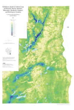
Preliminary Depth to Bedrock Map of Walworth, Racine, Kenosha, Milwaukee, Waukesha, Ozaukee, and Washington Counties
Open-file report; contains unpublished data that has not yet been peer-reviewed.-
Preliminary Depth to Bedrock Map of Walworth, Racine, Kenosha, Milwaukee, Waukesha, Ozaukee, and Washington Counties
2004
Map: 34.75 in x 52 in, scale 1:100,000
-
-
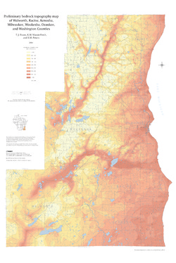
Preliminary Bedrock Topography Map of Walworth, Racine, Kenosha, Milwaukee, Waukesha, Ozaukee, and Washington Counties
Open-file report; contains unpublished data that has not yet been peer-reviewed.-
Preliminary Bedrock Topography Map of Walworth, Racine, Kenosha, Milwaukee, Waukesha, Ozaukee, and Washington Counties
2004
Map: 34.75 in x 52 in, scale 1:100,000
-
-
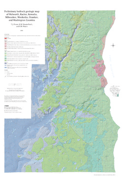
Preliminary Bedrock Geologic Map of Walworth, Racine, Kenosha, Milwaukee, Waukesha, Ozaukee, and Washington Counties
Open-file report; contains unpublished data that has not yet been peer-reviewed.-
Preliminary Bedrock Geologic Map of Walworth, Racine, Kenosha, Milwaukee, Waukesha, Ozaukee, and Washington Counties
2004
Map: 34.75 in x 52 in, scale 1:100,000
-
Preliminary Bedrock Geologic Map of Walworth, Racine, Kenosha, Milwaukee, Waukesha, Ozaukee, and Washington Counties [GIS data]
2004
GIS Data: GeMS file geodatabase (.gdb file format)
-
-
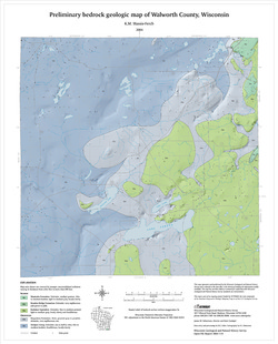
Preliminary Bedrock Geology of Walworth County, Wisconsin
Open-file report; contains unpublished data that has not yet been peer-reviewed.-
Preliminary Bedrock Geologic Map of Walworth County, Wisconsin
2004
Map: 17.75 in x 22 in, scale 1:100,000
-
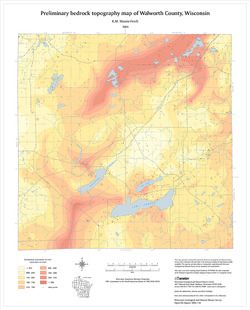
Preliminary Bedrock Topography Map of Walworth County, Wisconsin
2004
Map: 17.75 in x 22 in, scale 1:100,000
-
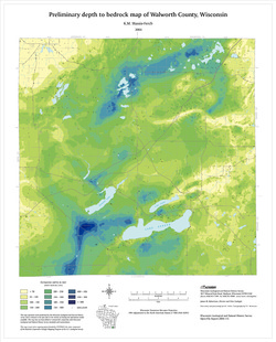
Preliminary Depth to Bedrock Map of Walworth County, Wisconsin
2004
Map: 17.75 in x 22 in, scale 1:100,000
-
-
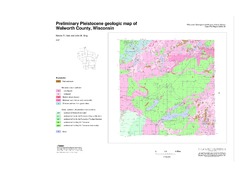
Preliminary Pleistocene Geologic Map of Walworth County, Wisconsin
Open-file report; contains unpublished data that has not yet been peer-reviewed.-
Preliminary Pleistocene Geologic Map of Walworth County, Wisconsin
2004
Map: 40 in x 28 in, scale 1:100,000
-
-
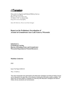
Report on the Preliminary Investigation of Arsenic in Groundwater near Lake Geneva, Wisconsin
Open-file report; contains unpublished data that has not yet been peer-reviewed. -
Aggregate Resources of the Sinnipee Group in Eastern and Southern Wisconsin
Open-file report; contains unpublished data that has not yet been peer-reviewed. -
Merging Pleistocene Lithostratigraphy with Geotechnical and Hydrogeologic Data--Examples from Eastern Wisconsin
Open-file report; contains unpublished data that has not yet been peer-reviewed. -
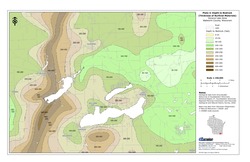
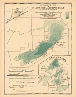
Hydrographic Map of Delavan and Lauderdale Lakes, Walworth County, Wisconsin
-
Hydrographic Map of Delavan and Lauderdale Lakes, Walworth County, Wisconsin
1898
Map: 18.8 in x 23.8 in, scale 1 in = 1/4 mile
-
-
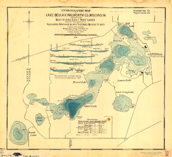
Hydrographic Map of Lake Beulah, Walworth County, Wisconsin, together with Booth and East Troy Lakes
-
Hydrographic Map of Lake Beulah, Walworth County, Wisconsin, Together With Booth and East Troy Lakes
1898
Map: 24.5 in x 22.4 in, scale 1 in = 1/6 mile
-

Publications Catalog
Wisconsin Geological and Natural History Survey