-
Copper Bearing Formations of Bayfield and Southeast Douglas Counties
Open-file report; contains unpublished data that has not yet been peer-reviewed.-
Copper Bearing Formations of Bayfield and Southeast Douglas Counties
1928
Map: 38.3 in x 22.1 in, scale 1 in = 1 mile
-
-
Fault on Property of Mr. Harry Grant in Whitefish Bay
Open-file report; contains unpublished data that has not yet been peer-reviewed. -
The Need for Completing Our Wisconsin Topographic Mapping
Open-file report; contains unpublished data that has not yet been peer-reviewed. -
Geology of Central Plain Area of Juneau, Jackson, Adams, Wood, Portage, Waushara, and Marquette Counties
Open-file report; contains unpublished data that has not yet been peer-reviewed. -
The Economic Possibilities of Manufacturing Portland Cement in Wisconsin
Open-file report; contains unpublished data that has not yet been peer-reviewed. -
Report on Mattison Bros. Granite Quarry, Amberg, Wisconsin
Open-file report; contains unpublished data that has not yet been peer-reviewed. -
Report on the Allwood Quarry
Open-file report; contains unpublished data that has not yet been peer-reviewed. -
Stones Used in State Capitol
Brief descriptions of the various kinds of marbles, granites, and limestones that make up different parts of the State Capitol building in Madison. No illustrations. -
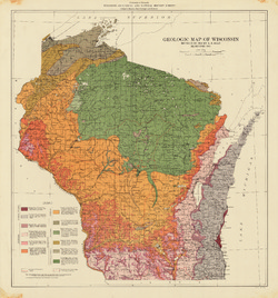
Limestones and Marls of Wisconsin
-
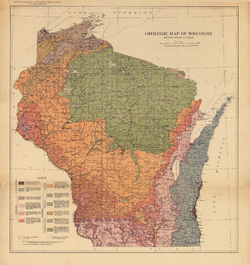
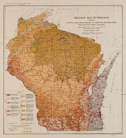
Geologic Map of Wisconsin Showing Locations From Which Samples of Limestone, Dolomite, Marl, Shale or Clay Were Analyzed [plate 6]
1924
Map: 15.5 in x 16.9 in, scale 1:1,000,000
-
Mineral Land Classification, Showing Indications of Iron Formation in Parts of Ashland, Bayfield, Washburn, Sawyer, Price, Oneida, Forest, Rusk, Barron, and Chippewa Counties
-
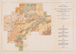
Map Showing Geology of Part of Northwestern Wisconsin Including Parts of Ashland, Bayfield, Washburn, Sawyer, Price, Oneida, Barron, Rusk, and Chippewa Counties [plate 1]
1915
Map: 20.7 in x 13.5 in, scale 1 in = 6 miles

Publications Catalog
Wisconsin Geological and Natural History Survey