-
Three Billion Years of Geology
Prepared for 47th Annual Tri-State Geology Conference, Black River Falls, Wisconsin. -
Quaternary History of the Driftless Area with Special Papers
Prepared for 29th Annual Meeting, Midwest Friends of the Pleistocene. -
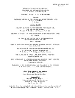
Glaciation of Wisconsin
Brief technical description of Wisconsin’s geologic history, glacial phases and lobes, and correlation and distribution of Pleistocene units. Heavily illustrated. -
The Ice Age Geology of Devils Lake State Park
Devils Lake State Park is a place of striking geologic contrasts, where some of the oldest rock exposed in southern Wisconsin lies next to some of the youngest geologic materials in the state. The purple rock (called Baraboo quartzite) in the walls of Devils Lake gorge is more than 1.7 billion years old; the glacially deposited ridges that block both ends...-
The Ice Age Geology of Devils Lake State Park
1990
Report: 28 p., 1 plate, 18 in x 24 in, scale 1:24,000
-
-
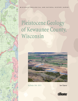
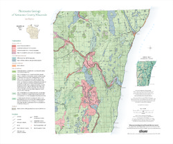
Pleistocene Geology of Kewaunee County, Wisconsin
Kewaunee County, at the southern end of the Door Peninsula, was overrun by glaciers many times. Author Lee Clayton describes the county's complex glacial geology, from the surface soil down to solid rock. The accompanying map shows the placement of glacial sediments as well as glacial and post-glacial stream and lake sediments.-
Pleistocene Geology of Kewaunee County, Wisconsin [GIS data]
2013
GIS Data: Shapefiles (.shp file format)
-
Pleistocene Geology of Kewaunee County, Wisconsin [plate 1]
2013
Map: 21.5 in x 18 in, scale 1:100,000
-
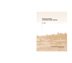
Pleistocene Geology of Waukesha County, Wisconsin
-
Pleistocene Geology of Waukesha County, Wisconsin (version 2) [GIS data]
2001
GIS Data: GeMS file geodatabase (.gdb file format)
-
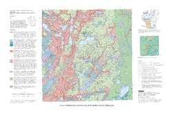
Pleistocene Geologic Map of Waukesha County, Wisconsin [plate 1]
2001
Map: 29 in x 19 in, scale 1:100,000
-
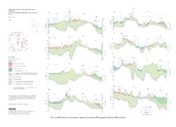
Pleistocene Geologic Cross Sections of Waukesha County, Wisconsin [plate 2]
2001
Plate: 25 in x 18 in, scale 1:200,000
-
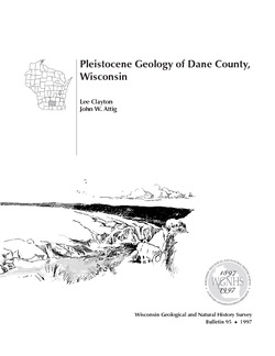
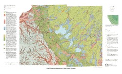
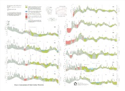
Pleistocene Geology of Dane County, Wisconsin
Description of the geologic history of Dane County. The preface points out the significance of glacial landscape research at WGNHS over the past century. Many pictures and diagrams and a four-color map and cross sections show the striking differences between glaciated and unglaciated regions of the county. Map and cross sections are folded.-
Pleistocene Geology of Dane County, Wisconsin (version 2) [GIS data]
1997
GIS Data: GeMS file geodatabase (.gdb file format)
-
Pleistocene Geologic Map of Dane County, Wisconsin [plate 1]
1997
Map: 39 in x 23.5 in, scale 1:100,000

Publications Catalog
Wisconsin Geological and Natural History Survey