-
Inventory and Analysis of Flowing Artesian Wells in Bayfield County, Wisconsin
This report presents a county-wide inventory of flowing artesian wells in Bayfield County. Flowing artesian wells are a remarkable resource of high-quality water that both community members and tourists value. This report provides baseline water quality data that are a valuable resource for future assessments. Data collection occurred in 2022. Includes... -
Groundwater Data Compilation for the Geneva Lake, Wisconsin, Area
Open-file report; contains unpublished data that has not yet been peer-reviewed.-
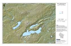
Regional Overview, Geneva Lake Area, Walworth County, Wisconsin [plate 1]
2006
Map: 11 in x 17 in, scale 1:100,000
-
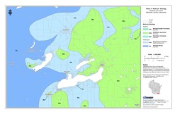
Bedrock Geology, Geneva Lake Area, Walworth County, Wisconsin [plate 2]
2006
Map: 11 in x 17 in, scale 1:100,000
-
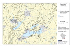
Elevation of Bedrock Surface, Geneva Lake Area, Walworth County, Wisconsin [plate 3]
2006
Map: 11 in x 17 in, scale 1:100,000
-
Depth to Bedrock (Thickness of Surficial Materials), Geneva Lake Area, Walworth County, Wisconsin [plate 4]
2006
Map: 11 in x 17 in, scale 1:100,000
-
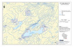
Water Table Elevation, Geneva Lake Area, Walworth County, Wisconsin [plate 5]
2006
Map: 11 in x 17 in, scale 1:100,000
-
Hydrogeologic Atlas of Bayfield County, Wisconsin
Analysis of the groundwater resources in Bayfield County, Wisconsin. Includes report, five plates, and digital data.-
Generalized Water-Table Elevation Map of Bayfield County, Wisconsin [plate 1]
2019
Plate: 29.5 in x 39.5 in, scale 1:100,000
-
Depth to Water Table Map of Bayfield County, Wisconsin [plate 2]
2019
Plate: 29.5 in x 39.5 in, scale 1:100,000
-
Depth to Bedrock Map of Bayfield County, Wisconsin [plate 3]
2019
Plate: 29.5 in x 39.5 in, scale 1:100,000
-
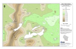
Groundwater Recharge Map of Bayfield County, Wisconsin [plate 4]
2019
Plate: 29.5 in x 39.5 in, scale 1:100,000
-
Groundwater Susceptibility Map of Bayfield County, Wisconsin [plate 5]
2019
Plate: 29.5 in x 39.5 in, scale 1:100,000
-
Depth to Bedrock in Grant County, Wisconsin
Depth-to-bedrock mapping of Grant County provides baseline information on unconsolidated surficial sediment thickness across the county. Bedrock aquifers in Grant County are susceptible to contamination from various land use activities, and depth to bedrock represents one of several factors affecting aquifer susceptibility. The results of this study...-
Depth to Bedrock in Grant County, Wisconsin [dataset 1]
2025
GIS Data: File geodatabase (.gdb file format)
-
-
Preliminary Hydrogeologic Maps of Iowa County, Wisconsin
Open-file report; contains unpublished data that has not yet been peer-reviewed.-
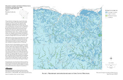
Preliminary Hydrogeologic Maps of Iowa County, Wisconsin: Preliminary Groundwater Recharge in Iowa County, Wisconsin [figure 1]
2010
Map: 28 in x 22 in, scale 1:225,000
-
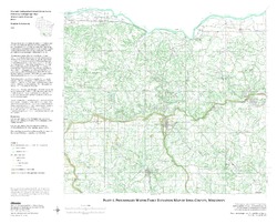
Preliminary Hydrogeologic Maps of Iowa County, Wisconsin: Preliminary Water-Table Elevation Map of Iowa County, Wisconsin [plate 1]
2010
Map: 26 in x 21 in, scale 1:100,000
-
Preliminary Hydrogeologic Maps of Iowa County, Wisconsin: Preliminary Groundwater Susceptibility Map of Iowa County, Wisconsin [plate 2]
2010
Map: 26 in x 21 in, scale 1:100,000
-
-
Hydrologic Assessment of the Kickapoo Watershed, Southwestern Wisconsin
Open-file report; contains unpublished data that has not yet been peer-reviewed.-
Hydrologic Assessment of the Kickapoo Watershed, Southwestern Wisconsin
1998
Report: 81 p. + 4 plates
-
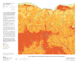
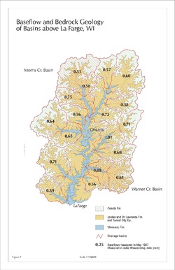
Baseflow and Bedrock Geology of Basins Above La Farge, WI [figure 7]
1998
Map: 11 in x 17 in, scale 1:150,000
-
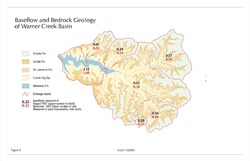
Baseflow and Bedrock Geology of Warner Creek Basin [figure 8]
1998
Map: 17 in x 11 in, scale 1:50,000
-
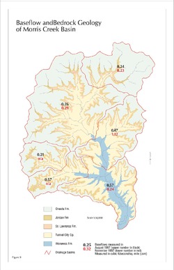
Baseflow and Bedrock Geology of Morris Creek Basin [figure 9]
1998
Map: 11 in x 17 in, scale 1:50,000
-
-
Hydrogeology of the Wisconsin River Valley in Marathon County, Wisconsin
-
Hydrogeology of the Wisconsin River Valley in Marathon County, Wisconsin
1988
Report: 66 p. + maps (scale 1:100,000)
-
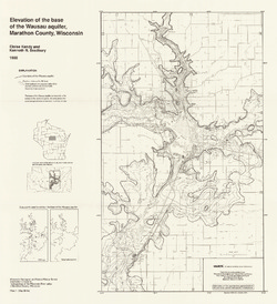
Elevation of the Base of the Wausau Aquifer, Marathon County, Wisconsin [plate 1]
1988
Map: Scale 1:62,500
-
Elevation of the Water Table in the Wisconsin River Valley, Marathon County, Wisconsin [plate 2]
1988
Map: Scale 1:62,500
-

Publications Catalog
Wisconsin Geological and Natural History Survey