-
Ground-Water Resources and Geology of Walworth County, Wisconsin
-
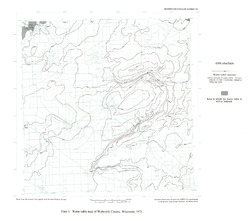
Water-Table Map of Walworth County, Wisconsin, 1973 [plate 1]
1976
Map: 18 in x 15.9 in, scale 1:125,000
-
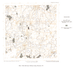
Ground-Water Resources and Geology of Jefferson County, Wisconsin
-
Water-Table Map of Jefferson County, Wisconsin, 1973 [plate 1]
1976
Map: 18 in x 16 in, scale 1 in = 2 miles
-
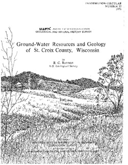
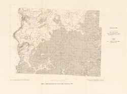
Ground-Water Resources and Geology of St. Croix County, Wisconsin
-
Water-Table Map of St. Croix County, Wisconsin, 1974 [plate 1]
1976
Map: 23.6 in x 17.5 in, scale 1:125,000
-
Ground-Water Resources of Waukesha County, Wisconsin
-
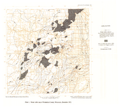
Water Table Map of Waukesha County, Wisconsin, December 1972 [plate 1]
1975
Map: 18 in x 16 in, scale 1:125,000
-
Trends in Ground-Water Levels in Wisconsin, 1967-71
Supplement to Information Circular 9, Trends in Ground-Water Levels in Wisconsin through 1966. -
Pleistocene Geology of Southern Wisconsin
Field trip guide with special papers by R.F. Black, N.K. Bleuer, F.D. Hole, N.P. Lasca, and L.J. Maher, Jr., 1970, 175 p.

Publications Catalog
Wisconsin Geological and Natural History Survey