-
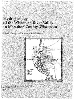
Hydrogeology of the Wisconsin River Valley in Marathon County, Wisconsin
-
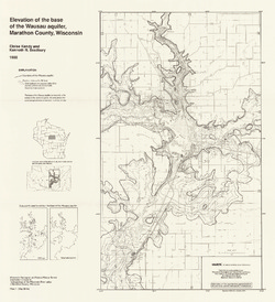
Elevation of the Base of the Wausau Aquifer, Marathon County, Wisconsin [plate 1]
1988
Map: 21.3 in x 23.3 in, scale 1:100,000
-
Elevation of the Water Table in the Wisconsin River Valley, Marathon County, Wisconsin [plate 2]
1988
Map: 21.3 in x 23.4 in, scale 1:100,000
-
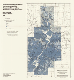
Attenuation Potential of Soils Overlying Parts of the Wisconsin River Valley, Marathon County, Wisconsin [plate 3]
1988
Map: 21.4 in x 23.3 in, scale 1:100,000
-
Geoscience Wisconsin Volume 20
Vulnerability of spring systems to groundwater withdrawals in southern Wisconsin-
Assessing the Vulnerability of Spring Systems to Groundwater Withdrawals in Southern Wisconsin
2009
Journal Article: p. 1-13
-
Groundwater Recharge in Dane County, Wisconsin: Estimating Recharge Using a GIS-Based Water-Balance Model
Hydrogeologists at the Survey developed a groundwater management tool to help guide land-use decisions in Dane County. The publication describes the inputs used to calculate recharge and includes a reduced-scale version of the recharge map. A full-scale version of the recharge data has been subsequently added as Dataset 1.-
GIS Data for Groundwater Recharge in Dane County, Wisconsin [dataset 1]
2012
GIS Data: File geodatabase (.gdb file format)

Publications Catalog
Wisconsin Geological and Natural History Survey