-
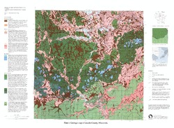
Geology of La Crosse County, Wisconsin
-
Geology of La Crosse County, Wisconsin (version 2) [GIS Data]
2003
GIS Data: GeMS file geodatabase (.gdb file format)
-
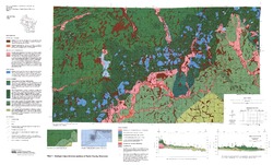
Geologic Map and Cross Sections of La Crosse County, Wisconsin [plate 1]
2003
Map: 29 in x 23 in, scale 1:100,000
-
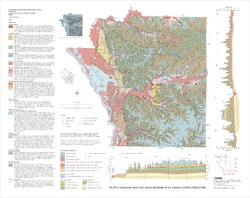
Pleistocene Geology of Waukesha County, Wisconsin
-
Pleistocene Geology of Waukesha County, Wisconsin (version 2) [GIS data]
2001
GIS Data: GeMS file geodatabase (.gdb file format)
-
Pleistocene Geologic Map of Waukesha County, Wisconsin [plate 1]
2001
Map: 29 in x 19 in, scale 1:100,000
-
Pleistocene Geologic Cross Sections of Waukesha County, Wisconsin [plate 2]
2001
Plate: 25 in x 18 in, scale 1:200,000
-
Quaternary Geology of Northern Oconto County, Wisconsin
-
Quaternary Geology of Northern Oconto County, Wisconsin (version 2) [GIS data]
1999
GIS Data: GeMS file geodatabase (.gdb file format)
-
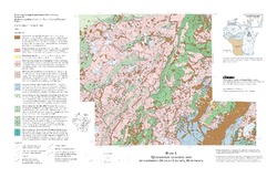
Quaternary Geologic Map of Northern Oconto County, Wisconsin [plate 1]
1999
Map: 24 in x 15.5 in, scale 1:100,000
-
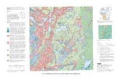
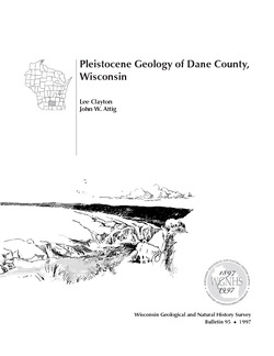
Pleistocene Geology of Dane County, Wisconsin
Description of the geologic history of Dane County. The preface points out the significance of glacial landscape research at WGNHS over the past century. Many pictures and diagrams and a four-color map and cross sections show the striking differences between glaciated and unglaciated regions of the county. Map and cross sections are folded.-
Pleistocene Geology of Dane County, Wisconsin (version 2) [GIS data]
1997
GIS Data: GeMS file geodatabase (.gdb file format)
-
Pleistocene Geologic Map of Dane County, Wisconsin [plate 1]
1997
Map: 39 in x 23.5 in, scale 1:100,000
-
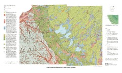
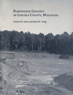
Pleistocene Geology of Lincoln County, Wisconsin
-
Pleistocene Geology of Lincoln County, Wisconsin (version 2) [GIS data]
1997
GIS Data: GeMS file geodatabase (.gdb file format)
-
Pleistocene Geology of Polk County, Wisconsin
-
Pleistocene Geology of Polk County, Wisconsin [GIS data]
2000
GIS Data: GeMS file geodatabase (.gdb file format)
-
Pleistocene Geology and Cross Sections of Polk County, Wisconsin [plate 1]
1998
Map: 26.1 in x 15.6 in, scale 1:100,000
-
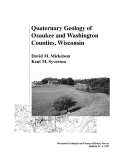
Quaternary Geology of Ozaukee and Washington Counties, Wisconsin
-
Quaternary Geology of Ozaukee and Washington Counties, Wisconsin (version 2) [GIS data]
1997
GIS Data: GeMS Level 3 file geodatabase (.gdb file format)
-
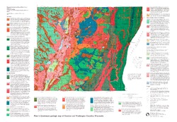
Quaternary Geologic Map of Ozaukee and Washington Counties, Wisconsin [plate 1]
1997
Map: 32.5 in x 22.5 in, scale 1:100,000
-
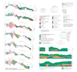
Geologic Cross Sections of Ozaukee and Washington Counties, Wisconsin [plate 2]
1997
Plate: 26 in x 24 in, scale 1:100,000
-
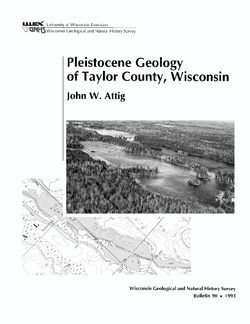
Pleistocene Geology of Taylor County, Wisconsin
-
Pleistocene Geology of Taylor County, Wisconsin (version 2) [GIS data]
1993
GIS Data: GeMS Level 3 file geodatabase (.gdb file format)
-
Geologic Map and Cross Sections of Taylor County, Wisconsin [plate 1]
1993
Map: 36 in x 21.75 in, scale 1:100,000

Publications Catalog
Wisconsin Geological and Natural History Survey