-
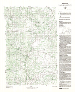
Generalized Water-Table Elevation of Dunn County, Wisconsin
-
GIS Data for the Generalized Water-Table Elevation of Dunn County, Wisconsin [dataset 1]
1988
GIS Data: File geodatabase, metadata
-
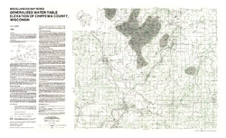
Generalized Water-Table Elevation of Chippewa County, Wisconsin
-
GIS Data for the Generalized Water-Table Elevation of Chippewa County, Wisconsin [dataset 1]
1988
GIS Data: File geodatabase, metadata
-
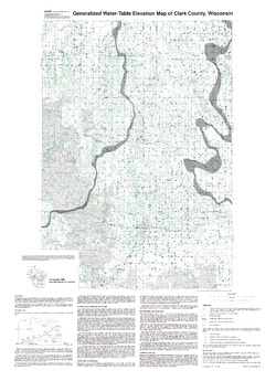
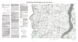
Irrigable Lands Inventory--Phase I Groundwater and Related Information
This paper contains hydrogeologic information for the Golden Sands Resource Conservation and Development Area in central Wisconsin. The set of maps includes water-table elevation maps for the following counties: Adams, Jackson, Juneau, Marathon, Marquette, Monroe, Portage, Waupaca, Waushara, and Wood (scale 1:126,720). It also includes a regional aquifer...-
Irrigable Lands Inventory - Phase I Groundwater and Related Information
1981
Report: 13 p. + 11 maps (scale 1:126,720 and 1:500,000)
- 2 more...
-

Publications Catalog
Wisconsin Geological and Natural History Survey