-
Water-Table Map of Dane County
Open-file report; contains unpublished data that has not yet been peer-reviewed. -
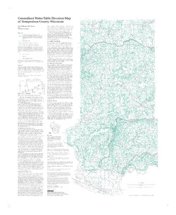
Water-Table Map of the Upper Black Earth Creek Watershed
Open-file report; contains unpublished data that has not yet been peer-reviewed. -
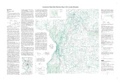
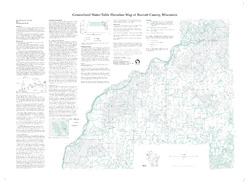
Generalized Water-Table Elevation Map of Burnett County, Wisconsin
-
Generalized Water-Table Elevation Map of Burnett County, Wisconsin
1998
Map: 38 in x 28 in, scale 1:100,000
-
-
Depth to Bedrock in Grant County, Wisconsin
Depth-to-bedrock mapping of Grant County provides baseline information on unconsolidated surficial sediment thickness across the county. Bedrock aquifers in Grant County are susceptible to contamination from various land use activities, and depth to bedrock represents one of several factors affecting aquifer susceptibility. The results of this study...-
Depth to Bedrock in Grant County, Wisconsin [dataset 1]
2025
GIS Data: File geodatabase (.gdb file format)
-

Publications Catalog
Wisconsin Geological and Natural History Survey