-
The Underground and Surface Water Supplies of Wisconsin
-
Geologic Map of Wisconsin Showing Artesian Conditions and Elevations of the Pre-Cambrian [plate 1]
1915
Map: 15.5 in x 16.9 in, scale 1:1,000,000
-
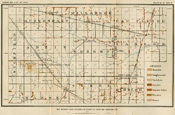
The Geology of North Central Wisconsin
-
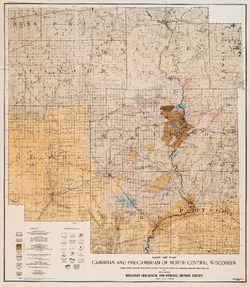
Map of the Cambrian and Pre-Cambrian of North Central Wisconsin: Clark, Wood, Portage, Marathon, Lincoln, Taylor and Parts of Langlade, Rusk and Price Counties [plate 1]
1907
Map: 20.0 in x 22.9 in, scale 1 in = 3 miles
-
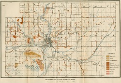
Map of the Pleistocene of North Central Wisconsin: Clark, Wood, Portage, Marathon, Lincoln, Taylor and Parts of Langlade, Rusk and Price Counties [plate 2]
1907
Map: 20.1 in x 23.1 in, scale 1 in = 3 miles
-
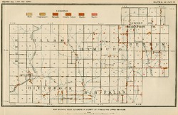
Map Showing Rock Outcrops in Vicinity of Athens and Upper Rib River [plate 8]
1907
Map: 13.6 in x 8.8 in
-
Map Showing Rock Outcrops in Vicinity of Arpin and Junction City [plate 12]
1907
Map: 15.1 in x 9.9 in
-
Map Showing Rock Outcrops in Vicinity of Hewitt and Rozellville [plate 15]
1907
Map: 10.9 in x 7.5 in
-
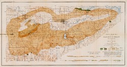
The Baraboo Iron-Bearing District of Wisconsin
-
Geological Map of the Baraboo District, Wisconsin [plate 1]
1904
Map: 19.5 in x 10.3 in, scale 1 in = 1 mile vertical, 2 in = 1 mile horizontal

Publications Catalog
Wisconsin Geological and Natural History Survey