-
Bedrock Geology of Fond du Lac County, Wisconsin
Two plates showing the bedrock geology and depth to bedrock in Fond du Lac County, Wisconsin. Includes GIS data (shapefiles and grid files).-
GIS Data for the Bedrock Geology of Fond du Lac County, Wisconsin (version 2) [dataset 1]
2018
GIS Data: GeMS file geodatabase (.gdb file format), shapefiles (.shp file format)
-
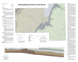
Bedrock Geology Map of Fond du Lac County, Wisconsin [plate 1]
2018
Plate: 35.75 in x 28.75 in, scale 1:100,000
-
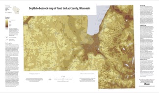
Depth to Bedrock Map of Fond du Lac County, Wisconsin [plate 2]
2018
Plate: 33 in x 19.25 in, scale 1:100,000
-
-
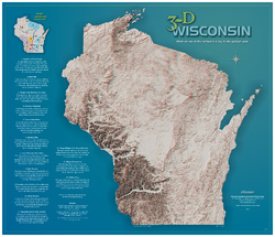
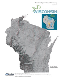
3-D Wisconsin
When viewed with 3-D glasses, Wisconsin’s land features pop off the page. Brief descriptions of major land forms paint the geologic history that shaped the state; expanded descriptions and photos are online. We’ve field-tested this map on fourth graders and can attest to its appeal. Sizes: 27.5 x 32 inches, 8.5 x 11 inches. Requires red-blue 3-D glasses.

Publications Catalog
Wisconsin Geological and Natural History Survey