-
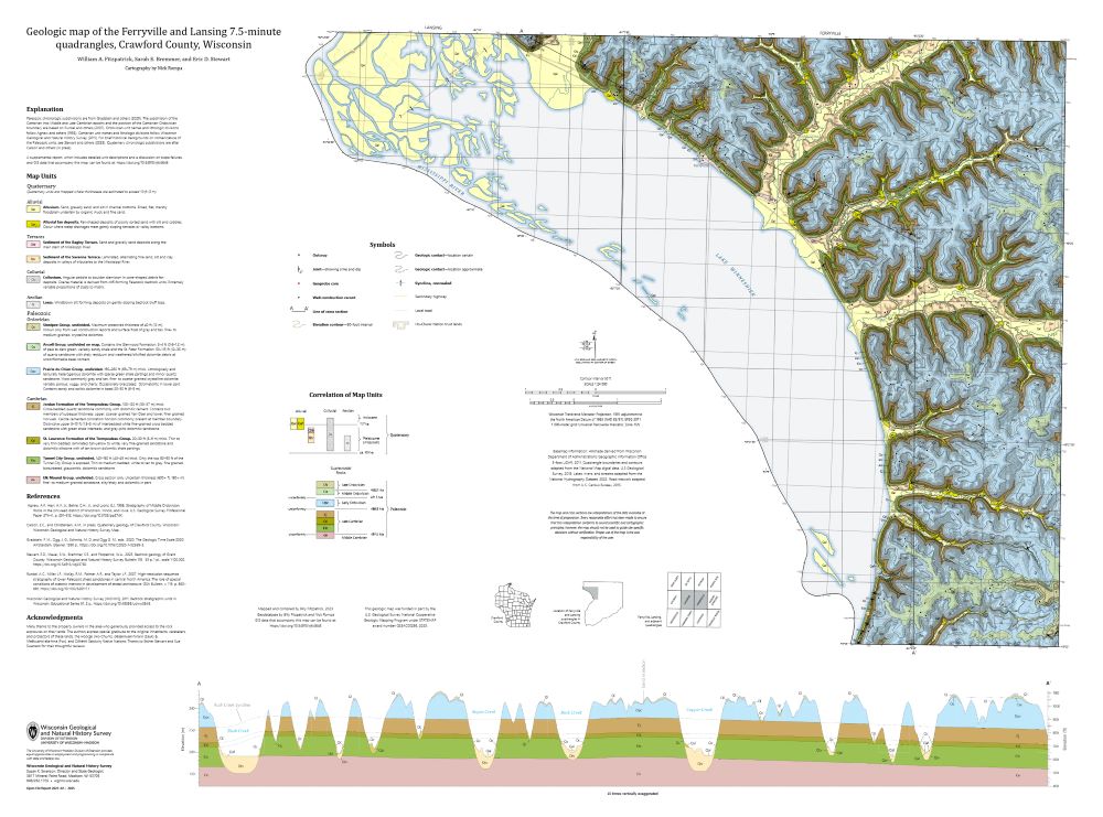
Geologic Map of the Ferryville and Lansing 7.5-Minute Quadrangles, Crawford County, Wisconsin
The geologic map of the Ferryville and Lansing 7.5-minute quadrangles (Crawford County), located in the Driftless Area of southwestern Wisconsin, provides new observations and lithologic descriptions of the area's geology. This work supports the Wisconsin Department of Transportation's ongoing efforts to mitigate slope failures along the Wisconsin State...-
Geologic Map of the Ferryville and Lansing 7.5-Minute Quadrangles, Crawford County, Wisconsin
2025
Map: 41.5 in x 30.75 in, scale 1:24,000
-
GIS Data for the Geologic Map of the Ferryville and Lansing 7.5-Minute Quadrangles, Crawford County, Wisconsin [dataset 1]
2025
GIS Data: GeMS Level 3 file geodatabase (.gdb file format) and GeoPackage (.gpkg file format)
-
-
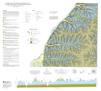
Geologic Map of the Eastman and Harpers Ferry 7.5-Minute Quadrangles, Crawford County, Wisconsin
The geologic map of the Eastman and Harpers Ferry 7.5-minute quadrangles (Crawford County), located in the Driftless Area of southwestern Wisconsin, provides new observations and lithologic descriptions of the area's geology. This work supports the Wisconsin Department of Transportation's ongoing efforts to mitigate slope failures along the Wisconsin...-
Geologic Map of the Eastman and Harpers Ferry 7.5-Minute Quadrangles, Crawford County, Wisconsin
2025
Map: 36 in x 32.5 in, scale 1:24,000
-
GIS Data for the Geologic Map of the Eastman and Harpers Ferry 7.5-Minute Quadrangles, Crawford County, Wisconsin [dataset 1]
2025
GIS Data: GeMS Level 3 file geodatabase (.gdb file format) and GeoPackage (.gpkg file format)
-
-
Geologic Map of the Durwards Glen 7.5-Minute Quadrangle, Columbia and Sauk Counties, Wisconsin
The Durwards Glen 7.5-minute quadrangle map is located in Columbia and Sauk counties, southeast of the city of Baraboo. This geologic map includes Precambrian through Quaternary units. New mapping has focused on subdividing the Baraboo Quartzite into four separate members and delineating Quaternary deposits in greater detail than prior work.-
Geologic Map of the Durwards Glen 7.5-Minute Quadrangle, Columbia and Sauk Counties, Wisconsin
2024
Map: 35 x 40 in, scale 1:24,000
-
GIS Data for the Geologic Map of the Durwards Glen 7.5-Minute Quadrangle, Columbia and Sauk Counties, Wisconsin [dataset 1]
2024
GIS Data: GeMS Level 3 file geodatabase (.gdb file format), shapefiles (.shp file format), GeoPackage (.gpkg file format)
-

Publications Catalog
Wisconsin Geological and Natural History Survey