-
Laurentide Ice Sheet: Ice-Margin Positions in Wisconsin
Series of 43 page-size maps showing the chronology of the last glaciation's advances and retreats across Wisconsin. Includes a brief discussion about how the maps were made, how lake positions were determined, as well as a list of selected references. -
Landscapes of Dane County, Wisconsin
Explains the geologic causes of the county’s natural landscape and follows each description with an exploration of the parts of the county that showcase specific geologic features. Includes a folded color map that shows the surface geology and locations of parks. Heavily illustrated.-
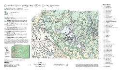
Generalized Glacial Geologic Map of Dane County, Wisconsin
2007
Map: 14.5 in x 24 in, scale 1:200,000
-
Glaciation of Wisconsin
Brief technical description of Wisconsin’s geologic history, glacial phases and lobes, and correlation and distribution of Pleistocene units. Heavily illustrated.

Publications Catalog
Wisconsin Geological and Natural History Survey