-
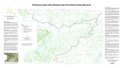
Preliminary Water-Table Elevation Map of Columbia County, Wisconsin
Open-file report; contains unpublished data that has not yet been peer-reviewed.-
Preliminary Water-Table Elevation Map of Columbia County, Wisconsin
2012
Map: 36 in x 20 in, scale 1:100,000
-
Preliminary Water-Table Elevation Map of Columbia County, Wisconsin [GIS data]
2012
GIS Data: Shapefiles (.shp file format)
-

Publications Catalog
Wisconsin Geological and Natural History Survey