-
Geologic Map of the Highland West and Highland East 7.5-Minute Quadrangles, Grant and Iowa Counties, Wisconsin
The geologic map of the Highland West and Highland East 7.5-minute quadrangles includes 1:24,000-scale mapping of both surficial and bedrock geology. Highland was a long-lived and important sub-district of the Upper Mississippi lead-zinc mining area in the 19th and 20th centuries. Recent and renewed interest in the presence and distrubution of critical...-
Geologic Map of the Highland West and Highland East 7.5-Minute Quadrangles, Grant and Iowa Counties, Wisconsin
2024
Map: 46 in x 36 in, scale 1:24,000
-
GIS Data for the Geologic Map of the Highland West and Highland East 7.5-Minute Quadrangles, Grant and Iowa Counties, Wisconsin [dataset 1]
2024
GIS Data: GeMS file geodatabase (.gdb file format), shapefiles (.shp file format)
-
-
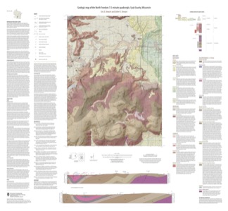
Geologic Map of the North Freedom 7.5-Minute Quadrangle, Sauk County, Wisconsin
The North Freedom quadrangle is located on the South Range of the Baraboo Hills in south-central Wisconsin. The Baraboo Hills are recognized for their ecologic and geologic significance, with superb exposure of Precambrian and Paleozoic rocks and Quaternary sediments. Mapping focused on the Precambrian section, building on past work by subdividing and...-
Geologic Map of the North Freedom 7.5-Minute Quadrangle, Sauk County, Wisconsin
2020
Map: 40 in x 37 in, scale 1:100,000
-
GIS Data for the Geologic Map of the North Freedom 7.5-Minute Quadrangle, Sauk County, Wisconsin (version 2) [dataset 1]
2020
GIS Data: GeMS file geodatabase (.gdb file format), shapefiles (.shp file format)
-

Publications Catalog
Wisconsin Geological and Natural History Survey