-
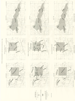
Pleistocene Geology of Portage County, Wisconsin
-
GIS Data for the Pleistocene Geology of Portage County, Wisconsin (version 2) [dataset 1]
1986
GIS Data: GeMS Level 3 file geodatabase (.gdb file format), shapefiles (.shp file format), GeoPackage (.gpkg file format)
-
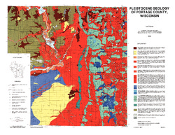
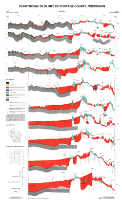
Pleistocene Geology of Portage County, Wisconsin [plate 1]
1986
Map: 28.5 in x 22 in, scale 1:100,000
-
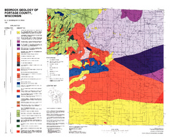
Bedrock Geology of Portage County, Wisconsin
-
GIS Data for Bedrock Geology of Portage County, Wisconsin (version 2) [dataset 1]
1986
GIS Data: GeMS Level 3 file geodatabase (.gdb file format)
-
-
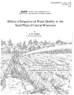
Effects of Irrigation on Water Quality in the Sand Plain of Central Wisconsin
-
Water-Table Maps of the Kellner, Meehan, and Bancroft Subareas, Wisconsin [plate 1]
1978
Map: 32.5 in x 24 in, scale 1:24,000
-
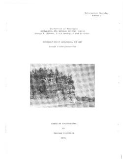
Cambrian Stratigraphy in Western Wisconsin
Notes accompanying a 1966 conference field trip covering geology between Chippewa Falls and Trempealeau and between Elroy and Portage. Routes shown.

Publications Catalog
Wisconsin Geological and Natural History Survey