Skip to content
University of Wisconsin–Madison
University of Wisconsin-Madison Crest

Publications Catalog

Wisconsin Geological and Natural History Survey
  • WGNHS Home
  • Catalog
  • Browse Publications
  1. Home
  2. Series
  3. Map
map

Map

Counties

  • Calumet - 1

Tags

  • Groundwater - 1

Resource Types

  • Map - 1

Authors

  • Gaffield, S.J. - 1
  • Gotkowitz, M.B. - 1

Series

  • Map - 1
close

1 publication found

Series: Map Authors: Gaffield, S.J.

Filter Results
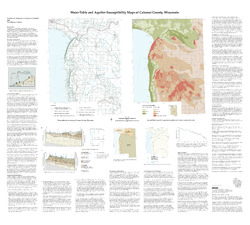
  • Water-Table and Aquifer Susceptibility Maps of Calumet County, Wisconsin

    • PDF M147

      Water-Table and Aquifer-Susceptibility Maps of Calumet County, Wisconsin

      Gotkowitz, M.B.; Gaffield, S.J.;

      2006

      Map: Scale 1:100,000

    • ZIP M147-DI

      Water-Table and Aquifer-Susceptibility Maps of Calumet County, Wisconsin [GIS data]

      Gaffield, S.J.; Gotkowitz, M.B.;

      2006

      Map: Coverage files

University logo that links to main university website Part of the Universities of Wisconsin

Accessibility

  • Non-Discrimination Statement & How to File a Complaint
  • Disability Accommodation Requests

Quick Links

  • Wisconsin Geological and Natural History Survey
  • Find an Expert
  • Jobs at WGNHS
  • Make a Donation

Contact Us

  • 3817 Mineral Point Rd.
    Madison, WI 53705-5100
  • Email: info@wgnhs.wisc.edu
  • Phone: (608) 262-1705
    • facebook
    • x twitter
    • instagram
    • youtube
    • pinterest
    • linkedin

Website feedback, questions or accessibility issues: website@wgnhs.wisc.edu | Learn more about accessibility at UW–Madison.

Powered by CKAN | Privacy Notice | © 2025 Board of Regents of the University of Wisconsin System.

Site icons More open menu close search search search envelope pinterest-p twitter youtube facebook instagram Collapse Expand next slide previous slide Footer Crest