-
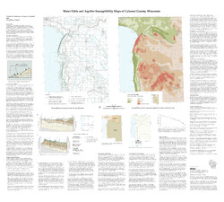
Water-Table and Aquifer Susceptibility Maps of Calumet County, Wisconsin
-
Water-Table and Aquifer-Susceptibility Maps of Calumet County, Wisconsin
2006
Map: 40.3 in x 36.3 in, scale 1:100,000
-
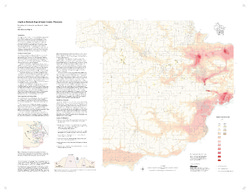
Water-Table and Aquifer-Susceptibility Maps of Calumet County, Wisconsin [GIS data]
2006
Map: Coverage (.e00 file format)
-
-
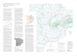
Water-Table Elevation Map of Sauk County, Wisconsin
-
Water-Table Elevation Map of Sauk County, Wisconsin [GIS data]
2002
Map: Coverage (.e00 file format)

Publications Catalog
Wisconsin Geological and Natural History Survey