-
Bedrock Topography of Dane County
Open-file report; contains unpublished data that has not yet been peer-reviewed. -
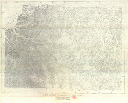
Land Surface Topography of Dane County
Open-file report; contains unpublished data that has not yet been peer-reviewed. -
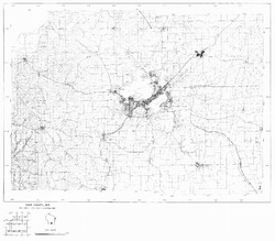
Dane County, Wisconsin (Base Map)
Open-file report; contains unpublished data that has not yet been peer-reviewed. -
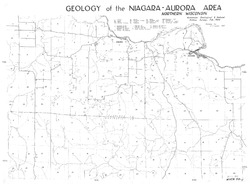
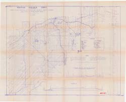
Geology of the Niagara-Aurora Area
Open-file report; contains unpublished data that has not yet been peer-reviewed. -
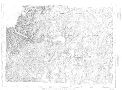
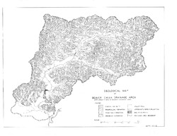
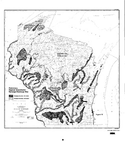
Geological Map of Beaver Creek Drainage Area
Open-file report; contains unpublished data that has not yet been peer-reviewed. -
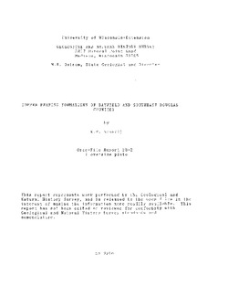
Copper Bearing Formations of Douglas and Northwest Bayfield Counties
Open-file report; contains unpublished data that has not yet been peer-reviewed.-
Copper Bearing Formations of Douglas and Northwest Bayfield Counties
1928
Map: 52.2 in x 42.4 in, scale 1 in = 1 mile
-
-
Copper Bearing Formations of Bayfield and Southeast Douglas Counties
Open-file report; contains unpublished data that has not yet been peer-reviewed.-
Copper Bearing Formations of Bayfield and Southeast Douglas Counties
1928
Map: 38 in x 22 in, scale 1 in = 1 mile
-
-
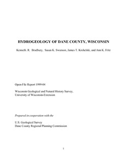
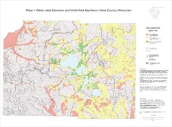
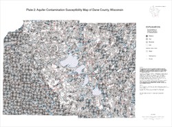
Hydrogeology of Dane County, Wisconsin
Open-file report; contains unpublished data that has not yet been peer-reviewed.-
Water-Table Elevation and Unlithified Aquifers in Dane County, Wisconsin [plate 1]
1999
Map: 34.5 in x 25.5 in, scale 1:100,000
-
Aquifer Contamination Susceptibility Map of Dane County, Wisconsin [plate 2]
1999
Map: 34.5 in x 25.5 in, scale 1:100,000
-
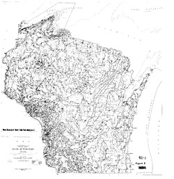
Ground Water Resources of Wisconsin
Open-file report; contains unpublished data that has not yet been peer-reviewed. -
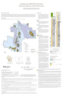
Geologic Map of Mill Bluff State Park, Monroe and Juneau Counties, Wisconsin
The geologic map of the Mill Bluff State Park provides a detailed look at the bedrock geology present at one of Wisconsin's most cherished natural sites. The map and accompanying report present the Paleozoic bedrock stratigraphy of the visible formations, as well as an interpretation of their depositional environment. This map was created as part of an...-
Geologic Map of Mill Bluff State Park, Monroe and Juneau Counties, Wisconsin
2024
Map: 24 x 36 in, scale 1:12,000
-
-
Geologic Map of the Durwards Glen 7.5-Minute Quadrangle, Columbia and Sauk Counties, Wisconsin
The Durwards Glen 7.5-minute quadrangle map is located in Columbia and Sauk counties, southeast of the city of Baraboo. This geologic map includes Precambrian through Quaternary units. New mapping has focused on subdividing the Baraboo Quartzite into four separate members and delineating Quaternary deposits in greater detail than prior work.-
Geologic Map of the Durwards Glen 7.5-Minute Quadrangle, Columbia and Sauk Counties, Wisconsin
2024
Map: 35 x 40 in, scale 1:24,000
-
GIS Data for the Geologic Map of the Durwards Glen 7.5-Minute Quadrangle, Columbia and Sauk Counties, Wisconsin [dataset 1]
2024
GIS Data: GeMS file geodatabase, shapefiles, geopackage, metadata
-
-
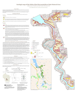
Geologic Map of the Dells of the Wisconsin River State Natural Area
The geologic map of the Dells of the Wisconsin River State Natural Area provides a detailed look at the bedrock geology present at one of Wisconsin's most cherished natural sites. The map and accompanying report present the Paleozoic bedrock stratigraphy of the visible formations, as well as an interpretation of their depositional environment. This map...-
Geologic Map of the Dells of the Wisconsin River State Natural Area
2023
Map: 30 x 36 in, scale 1:12,000
-
-
Geologic map of the Stitzer and western part of the Montfort 7.5-minute quadrangles, Grant County, Wisconsin
The geologic map of the Stitzer and western part of the Montfort quadrangles includes 1:24,000-scale mapping of both surficial and bedrock geology. This area occurs at the northern margin of the historic Upper Mississippi Valley lead and zinc mining district. Paleozoic strata are folded into a regionally-significant anticline, and mapping was initiated to...-
Geologic map of the Stitzer and western part of the Montfort 7.5-minute quadrangles, Grant County, Wisconsin
2023
Map: 46.15 in x 36 in, scale 1:24,000
-
GIS data for geologic map of the Stitzer and western part of the Montfort 7.5-minute quadrangles, Grant County, Wisconsin [dataset 1]
2023
GIS Data: GeMS file geodatabase, shapefiles, metadata
-
-
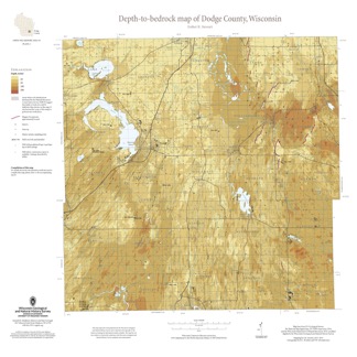
Depth-to-Bedrock Map of Dodge County, Wisconsin
This map shows thicknesses of deposits of unconsolidated materials above the bedrock. Across the county, depth to bedrock ranges from 0 feet, where bedrock is exposed, to over 250 feet within bedrock valleys. Areas with bedrock depths shallower than 20 feet are of particular importance for land-use planning and to the construction stone industry. Such... -
Preliminary Quaternary Geology of Waupaca County, Wisconsin
This open-file report contains a map (PDF) and GIS data (shapefiles) of the glacial and post-glacial deposits of Waupaca County in central Wisconsin. This map and GIS data were superseded by a Map Series publication in 2023: https://doi.org/10.54915/bger3320.-
Preliminary Quaternary Geology of Waupaca County, Wisconsin [plate 1]
2015
Map: 29 in x 23 in, scale 1:100,000
-
-
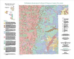
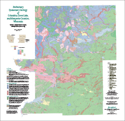
Preliminary Quaternary Geology of Columbia, Green Lake, and Marquette Counties, Wisconsin
This open-file report contains a map (PDF), GIS data (shapefiles), and metadata for Columbia, Green Lake, and Marquette Counties in central Wisconsin.-
Preliminary Quaternary Geology of Columbia, Green Lake, and Marquette Counties, Wisconsin [plate 1]
2015
Map: 35 in x 34 in, scale 1:100,000
-
Preliminary Quaternary Geology of Columbia, Green Lake, and Marquette Counties, Wisconsin [GIS data]
2015
GIS Data: Shapefiles
-
-
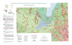
Preliminary Quaternary Geology of Fond du Lac County, Wisconsin
Open-file report-
Preliminary Quaternary Geology of Fond du Lac County, Wisconsin [plate 1]
2014
Map: 32 in x 20.25 in, scale 1:100,000
-
Preliminary Quaternary Geology of Fond du Lac County, Wisconsin [GIS data]
2014
GIS Data: Shapefiles, metadata
-
-
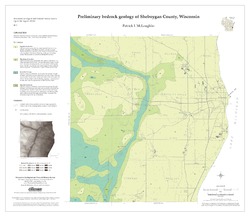
Preliminary Bedrock Geology of Sheboygan County, Wisconsin
Open-file report; contains unpublished data that has not yet been peer-reviewed.-
Preliminary Bedrock Geology of Sheboygan County, Wisconsin (version 2) [GIS data]
2013
GIS Data: GeMS file geodatabase and metadata, supersedes previous shapefile format (DI version 1). Map supersedes WOFR2012-07
-
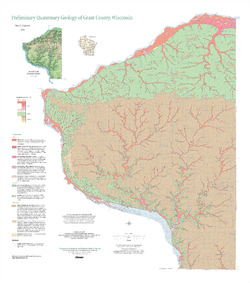
Preliminary Quaternary Geology of Grant County, Wisconsin
Open-file report; contains unpublished data that has not yet been peer-reviewed. -
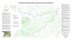
Preliminary Water-Table Elevation Map of Columbia County, Wisconsin
Open-file report; contains unpublished data that has not yet been peer-reviewed.-
Preliminary Water-Table Elevation Map of Columbia County, Wisconsin
2012
Map: 36 in x 20 in, scale 1:100,000
-
Preliminary Water-Table Elevation Map of Columbia County, Wisconsin [GIS data]
2012
GIS Data: Shapefiles
-

Publications Catalog
Wisconsin Geological and Natural History Survey