-
Geoscience Wisconsin Volume 01
-
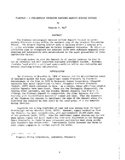
Discovery of the Flambeau Deposit, Rusk County, Wisconsin: A Geophysical Case Study
1977
Journal Article: p. 27-42
-
Atlas of the Geological Survey of Wisconsin
Collection of most of the plates accompanying Chamberlin's four-volume Geology of Wisconsin: Survey of 1873-1879.-
Atlas of the Geological Survey of Wisconsin: General Geological Map of Wisconsin [plate 1]
1882
Map: Scale 1 in = 15 miles, 25.5 in x 30.3 in
-
Atlas of the Geological Survey of Wisconsin: General Map of Quaternary Formations [plate 2]
1882
Map: 28.2 in x 32.4 in
-
Atlas of the Geological Survey of Wisconsin: General Map of Native Vegetation [plate 2A]
1882
Map: 28.2 in x 32.4 in,
-
Atlas of the Geological Survey of Wisconsin: General Map of Soils [plate 2B]
1882
Map: 28.2 in x 32.5 in
-
Atlas of the Geological Survey of Wisconsin: Map of Rainfall and Temperature [plate 2C]
1882
Map: 27.7 in x 32.5 in
-
Atlas of the Geological Survey of Wisconsin: Maps of Subsoils and Native Vegetation of Eastern Wisconsin [plate 3]
1877
Map: 27.82 in x 32.17 in, scale 1 in = 12 miles
-
Atlas of the Geological Survey of Wisconsin: Maps of Topography and Quaternary Formations of Eastern Wisconsin [plate 4]
1877
Map: 27.83 in x 32.06 in, scale 1 in = 12 miles
-
Atlas of the Geological Survey of Wisconsin: Geology and Topography of the Lead Region [plate 5]
1877
Map: 27.68 in x 32.18 in
-
Atlas of the Geological Survey of Wisconsin: Geology and Topography of the Lead Region [plate 6]
1877
Map: 23.98 in x 28.94 in
-
Atlas of the Geological Survey of Wisconsin: Geology and Topography of the Lead Region [plate 8]
1877
Map: 24.03 in x 28.38 in
- 32 more...
-
-
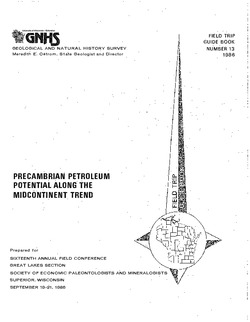
Precambrian Petroleum Potential along the Midcontinent Trend
Companion volume to Geoscience Wisconsin, vol. 11. Prepared for 16th Annual Field Conference Great Lakes Section Society of Economic Paleontologists and Mineralogists. -
The Wolf River Batholith and Baraboo Interval in Central Wisconsin
Prepared for 32nd Annual Meeting Institute on Lake Superior Geology. -
Pleistocene History of West-Central Wisconsin
Special Paper: Uranium-Series Dating of Calcite Cemented Sands and Gravels in Minnesota and Wisconsin, by Richard S. Lively, 1984, 76 p. Prepared for the 31st Annual Midwest Friends of the Pleistocene Field Conference, River Falls, Wisconsin. -
A Voyageur's Guide to the Lower Wisconsin River
This booklet covers the Wisconsin River from Prairie du Sac to the Mississippi River. It is a traveler’s guide, with boating safety tips as well as an educational guide to the history and natural history of the river. -
Three Billion Years of Geology
Prepared for 47th Annual Tri-State Geology Conference, Black River Falls, Wisconsin. -
Late Glacial History and Environmental Geology of Southeastern Wisconsin, Road Log and Geological Stop Descriptions
Companion volume to Geoscience Wisconsin, vol. 7. Prepared for 17th Annual Meeting of Geological Society of America. -
A Guide to the Glacial Landscapes of Dane County, Wisconsin
Two self-guided field trips help the reader explore the origins of Dane County's landscapes. PDF is missing large geologic map. -
Quaternary History of the Driftless Area with Special Papers
Prepared for 29th Annual Meeting, Midwest Friends of the Pleistocene. -
Middle Precambrian Geology of Northern Wisconsin
Prepared for 25th Annual Meeting, Institute on Lake Superior Geology. -
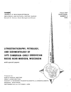
Lithostratigraphy, Petrology, and Sedimentology of Late Cambrian--Early Ordovician Rocks near Madison, Wisconsin
Prepared for 8th Annual Meeting, Great Lakes Section, Society of Economic Paleontologists and Mineralogists. -
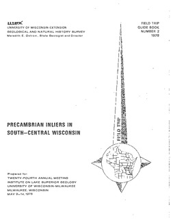
Precambrian Inliers in South-Central Wisconsin
Companion volume to Geoscience Wisconsin, vol. 2. Prepared for 24th Annual Meeting, Institute on Lake Superior Geology. -
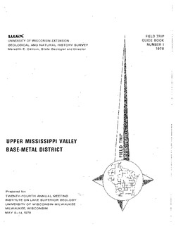
Upper Mississippi Valley Base-Metal District
Companion volume to Information Circular 16 (third edition). Prepared for 24th Annual Meeting, Institute on Lake Superior Geology. -
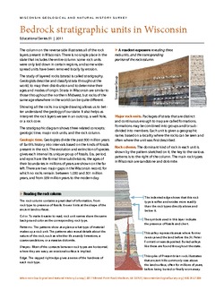
Bedrock Stratigraphic Units in Wisconsin
Chart showing the layers of rock (stratigraphy) present in Wisconsin, their geologic ages, and the associated rock units. The page-size version explains how to read and interpret this complex diagram. (The stratigraphic column is also available as a poster, see WOFR2006-06.) -
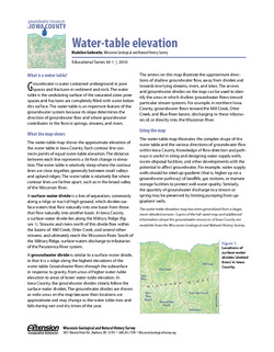
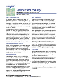
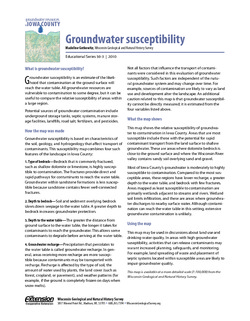
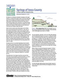
Groundwater Resources in Iowa County
This four-part series describes the results of a comprehensive inventory and assessment of Iowa County's groundwater resources. Covers water-table elevation, groundwater recharge, groundwater susceptibility, and the springs of Iowa County. -
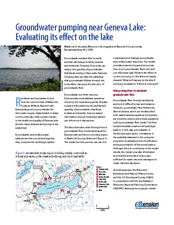
Groundwater Pumping Near Geneva Lake: Evaluating Its Effect on the Lake
A groundwater flow model developed for Geneva Lake and the surrounding region helps answer questions about flow into and out of the lake, and projects scenarios given increased pumping rates and potential long-term changes in climate.

Publications Catalog
Wisconsin Geological and Natural History Survey