-
Atlas of the Geological Survey of Wisconsin
Collection of most of the plates accompanying Chamberlin's four-volume Geology of Wisconsin: Survey of 1873-1879.-
Atlas of the Geological Survey of Wisconsin: General Geological Map of Wisconsin [plate 1]
1882
Map: 25.5 in x 30.3 in, scale 1 in = 15 miles
-
Atlas of the Geological Survey of Wisconsin: General Map of Quaternary Formations [plate 2]
1882
Map: 28.2 in x 32.4 in
-
Atlas of the Geological Survey of Wisconsin: General Map of Native Vegetation [plate 2A]
1882
Map: 28.2 in x 32.4 in
-
Atlas of the Geological Survey of Wisconsin: General Map of Soils [plate 2B]
1882
Map: 28.2 in x 32.5 in
-
Atlas of the Geological Survey of Wisconsin: Map of Rainfall and Temperature [plate 2C]
1882
Map: 27.7 in x 32.5 in
-
Atlas of the Geological Survey of Wisconsin: Maps of Subsoils and Native Vegetation of Eastern Wisconsin [plate 3]
1877
Map: 27.82 in x 32.17 in, scale 1 in = 12 miles
-
Atlas of the Geological Survey of Wisconsin: Maps of Topography and Quaternary Formations of Eastern Wisconsin [plate 4]
1877
Map: 27.83 in x 32.06 in, scale 1 in = 12 miles
-
Atlas of the Geological Survey of Wisconsin: Geology and Topography of the Lead Region [plate 5]
1877
Map: 27.68 in x 32.18 in
-
Atlas of the Geological Survey of Wisconsin: Geology and Topography of the Lead Region [plate 6]
1877
Map: 23.98 in x 28.94 in
-
Atlas of the Geological Survey of Wisconsin: Geology and Topography of the Lead Region [plate 8]
1877
Map: 24.03 in x 28.38 in
- 32 more...
-
-
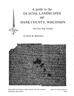
A Guide to the Glacial Landscapes of Dane County, Wisconsin
Two self-guided field trips help the reader explore the origins of Dane County's landscapes. PDF is missing large geologic map. -
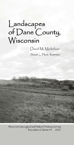
Landscapes of Dane County, Wisconsin
Explains the geologic causes of the county’s natural landscape and follows each description with an exploration of the parts of the county that showcase specific geologic features. Includes a folded color map that shows the surface geology and locations of parks. Heavily illustrated.-
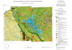
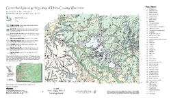
Generalized Glacial Geologic Map of Dane County, Wisconsin
2007
Map: 14.5 in x 24 in, scale 1:200,000
-
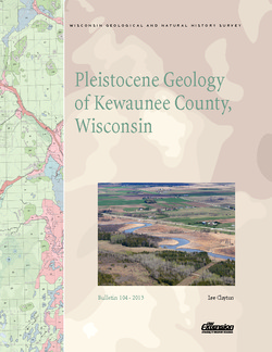
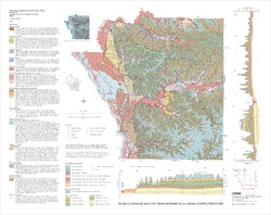
Pleistocene Geology of Kewaunee County, Wisconsin
Kewaunee County, at the southern end of the Door Peninsula, was overrun by glaciers many times. Author Lee Clayton describes the county's complex glacial geology, from the surface soil down to solid rock. The accompanying map shows the placement of glacial sediments as well as glacial and post-glacial stream and lake sediments.-
Pleistocene Geology of Kewaunee County, Wisconsin [GIS data]
2013
GIS Data: Shapefiles (.shp file format)
-
Pleistocene Geology of Kewaunee County, Wisconsin [plate 1]
2013
Map: 21.5 in x 18 in, scale 1:100,000
-
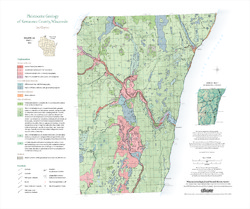
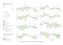
Quaternary Geology of Sheboygan County, Wisconsin
This report traces the advances and retreats of glaciers through Sheboygan County in eastern Wisconsin. Available as a bulletin, map, cross sections, and GIS data.-
Quaternary Geology of Sheboygan County, Wisconsin [GIS data]
2011
GIS Data: Shapefiles (.shp file format), MrSID files (.sid file format)
-
Quaternary Geology of Sheboygan County, Wisconsin [plate 1]
2011
Map: 32 in x 22 in, scale 1:100,000
-
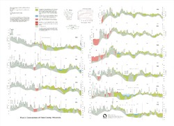
Geologic Cross Sections of Sheboygan County, Wisconsin [plate 2]
2011
Plate: 33 in x 24 in, scale 1:100,000
-
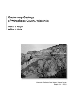
Quaternary Geology of Winnebago County, Wisconsin
-
Quaternary Geology of Winnebago County, Wisconsin (version 2) [GIS data]
2008
GIS Data: GeMS Level 3 file geodatabase (.gdb file format)
-
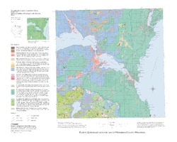
Quaternary Geologic Map of Winnebago County, Wisconsin [plate 1]
2008
Map: 25 in x 20 in, scale 1:100,000
-
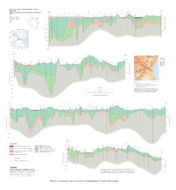
Geologic Cross Sections of Winnebago County, Wisconsin [plate 2]
2008
Plate: 25 in x 27 in, scale 1:100,000
-
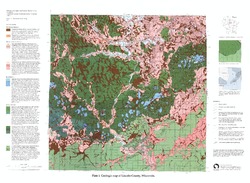
Geology of La Crosse County, Wisconsin
-
Geology of La Crosse County, Wisconsin (version 2) [GIS Data]
2003
GIS Data: GeMS file geodatabase (.gdb file format)
-
Geologic Map and Cross Sections of La Crosse County, Wisconsin [plate 1]
2003
Map: 29 in x 23 in, scale 1:100,000
-
Pleistocene Geology of Waukesha County, Wisconsin
-
Pleistocene Geology of Waukesha County, Wisconsin (version 2) [GIS data]
2001
GIS Data: GeMS file geodatabase (.gdb file format)
-
Pleistocene Geologic Map of Waukesha County, Wisconsin [plate 1]
2001
Map: 29 in x 19 in, scale 1:100,000
-
Pleistocene Geologic Cross Sections of Waukesha County, Wisconsin [plate 2]
2001
Plate: 25 in x 18 in, scale 1:200,000
-
Quaternary Geology of Northern Oconto County, Wisconsin
-
Quaternary Geology of Northern Oconto County, Wisconsin (version 2) [GIS data]
1999
GIS Data: GeMS file geodatabase (.gdb file format)
-
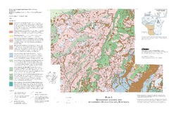
Quaternary Geologic Map of Northern Oconto County, Wisconsin [plate 1]
1999
Map: 24 in x 15.5 in, scale 1:100,000
-
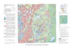
Pleistocene Geology of Dane County, Wisconsin
Description of the geologic history of Dane County. The preface points out the significance of glacial landscape research at WGNHS over the past century. Many pictures and diagrams and a four-color map and cross sections show the striking differences between glaciated and unglaciated regions of the county. Map and cross sections are folded.-
Pleistocene Geology of Dane County, Wisconsin (version 2) [GIS data]
1997
GIS Data: GeMS file geodatabase (.gdb file format)
-
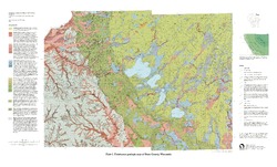
Pleistocene Geologic Map of Dane County, Wisconsin [plate 1]
1997
Map: 39 in x 23.5 in, scale 1:100,000
-
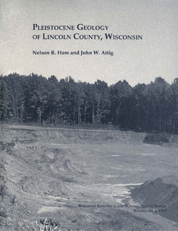
Pleistocene Geology of Lincoln County, Wisconsin
-
Pleistocene Geology of Lincoln County, Wisconsin (version 2) [GIS data]
1997
GIS Data: GeMS file geodatabase (.gdb file format)
-
Pleistocene Geology of Polk County, Wisconsin
-
Pleistocene Geology of Polk County, Wisconsin [GIS data]
2000
GIS Data: GeMS file geodatabase (.gdb file format)
-
Pleistocene Geology and Cross Sections of Polk County, Wisconsin [plate 1]
1998
Map: 26.1 in x 15.6 in, scale 1:100,000
-
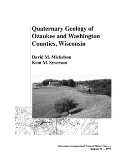
Quaternary Geology of Ozaukee and Washington Counties, Wisconsin
-
Quaternary Geology of Ozaukee and Washington Counties, Wisconsin (version 2) [GIS data]
1997
GIS Data: GeMS Level 3 file geodatabase (.gdb file format)
-
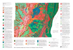
Quaternary Geologic Map of Ozaukee and Washington Counties, Wisconsin [plate 1]
1997
Map: 32.5 in x 22.5 in, scale 1:100,000
-
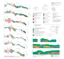
Geologic Cross Sections of Ozaukee and Washington Counties, Wisconsin [plate 2]
1997
Plate: 26 in x 24 in, scale 1:100,000
-
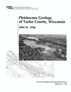
Pleistocene Geology of Taylor County, Wisconsin
-
Pleistocene Geology of Taylor County, Wisconsin (version 2) [GIS data]
1993
GIS Data: GeMS Level 3 file geodatabase (.gdb file format)
-
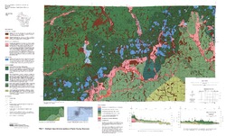
Geologic Map and Cross Sections of Taylor County, Wisconsin [plate 1]
1993
Map: 36 in x 21.75 in, scale 1:100,000

Publications Catalog
Wisconsin Geological and Natural History Survey