-
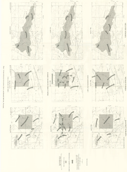
Pleistocene Geology of Barron County, Wisconsin
-
Pleistocene Geology of Barron County, Wisconsin (version 2) [GIS data]
1986
GIS Data: GeMS file geodatabase (.gdb file format)
-
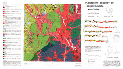
Pleistocene Geology of Barron County, Wisconsin [plate 1]
1986
Map: 40.5 in x 22.8 in, scale 1:100,000
-
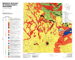
Bedrock Geology of Wood County, Wisconsin
-
Bedrock Geology of Wood County, Wisconsin [GIS data]
1986
GIS Data: Shapefiles (.shp file format), MrSID files (.sid file format)
-
-
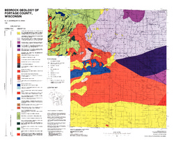
Bedrock Geology of Portage County, Wisconsin
-
GIS Data for Bedrock Geology of Portage County, Wisconsin (version 2) [dataset 1]
1986
GIS Data: GeMS Level 3 file geodatabase (.gdb file format)
-
-
Glacial and Related Deposits of Langlade County, Wisconsin
-
Pleistocene Geology of Langlade County, Wisconsin (version 3) [GIS data]
1986
GIS Data: GeMS Level 3 file geodatabase (.gdb file format)
-
Pleistocene Geology of Langlade County, Wisconsin [plate 1]
1986
Map: 39.6 in x 27.4 in, scale 1:100,000
-
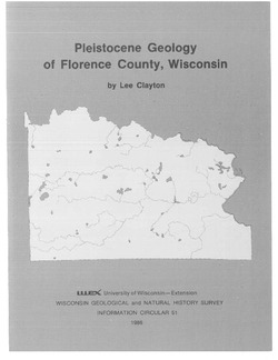
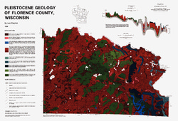
Pleistocene Geology of Florence County, Wisconsin
-
Pleistocene Geology of Florence County, Wisconsin (version 3) [GIS data]
1986
GIS Data: GeMS Level 3 file geodatabase (.gdb file format)
-
Pleistocene Geology of Florence County, Wisconsin [plate 1]
1986
Map: 26.8 in x 18.2 in, scale 1:100,000
-
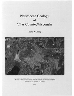
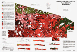
Pleistocene Geology of Vilas County, Wisconsin
-
Pleistocene Geology of Vilas County, Wisconsin (version 3) [GIS data]
1985
GIS Data: GeMS Level 3 file geodatabase (.gdb file format)
-
Pleistocene Geology of Vilas County, Wisconsin [plate 1]
1985
Map: 39.5 in x 26.7 in, scale 1:100,000
-
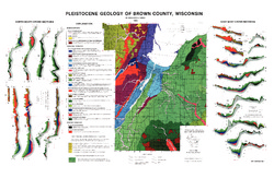
Pleistocene Geology of Brown County, Wisconsin
-
Pleistocene Geology of Brown County, Wisconsin [GIS data]
1985
GIS Data: Shapefiles (.shp file format), MrSID files (.sid file format)
-
A Subsurface Study of the St. Peter Sandstone in Southern and Eastern Wisconsin
-
Structure Contour Map of the Pre-St. Peter Sandstone Erosion Surface in Southern and Eastern Wisconsin [plate 1]
1985
Map: 39.7 in x 23.5 in, scale 1:750,000
-
Paleogeologic Map of the Pre-St. Peter Sandstone Surface in Southern and Eastern Wisconsin & Thickness Map of the St. Peter Sandstone in Southern and Eastern Wisconsin [plate 2]
1985
Map: 39.4 in x 23.6 in, scale 1:750,000
-
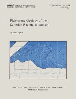
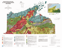
Pleistocene Geology of the Superior Region, Wisconsin
-
Pleistocene Geology of the Superior Region, Wisconsin (version 2) [GIS data]
1985
GIS Data: GeMS Level 3 file geodatabase (.gdb file format)
-
Pleistocene Geology of the Superior Region, Wisconsin [plate 1]
1985
Map: 35.9 in x 27.8 in, scale 1:250,000
-
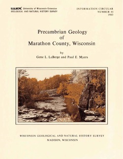
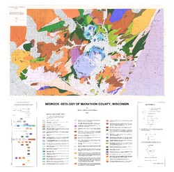
Precambrian Geology of Marathon County, Wisconsin
-
GIS Data for the Precambrian Geology of Marathon County, Wisconsin (version 2) [dataset 1]
1983
GIS Data: GeMS Level 3 file geodatabase (.gdb file format), shapefiles (.shp file format), GeoPackage (.gpkg file format)
-
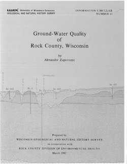
Ground-Water Quality of Rock County, Wisconsin
-
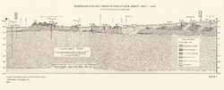
Generalized Geologic Cross Section of Rock County, West-East [plate 1]
1982
Plate: 23.9 in x 9.7 in, scale 1:100,000
-
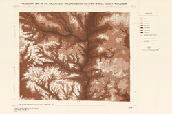
Preliminary Map of the Thickness of Unconsolidated Material in Rock County, Wisconsin [plate 2]
1982
Map: 29.7 in x 19.8 in, scale 1:100,000
-
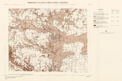
Permeability of Soils in Rock County, Wisconsin [plate 3]
1982
Map: 29.7 in x 19.7 in, scale 1:100,000
-
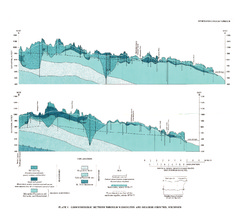
Ground-Water Resources and Geology of Washington and Ozaukee Counties, Wisconsin
-
Geohydrologic Sections Through Washington and Ozaukee Counties, Wisconsin [plate 1]
1980
Plate: 19 in x 16 in
-
Water-Table Map of Washington and Ozaukee Counties, Wisconsin, Winter 1976-77
1980
Map: 20 in x 18 in, scale 1:125,000
-
Ground-Water Resources and Geology of Columbia County, Wisconsin
-
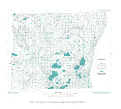
Water-Table Map of Columbia County, Wisconsin, 1974 [plate 1]
1978
Map: 24 in x 18 in, scale 1:24,000
-
Effects of Irrigation on Water Quality in the Sand Plain of Central Wisconsin
-
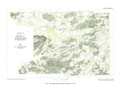
Water-Table Maps of the Kellner, Meehan, and Bancroft Subareas, Wisconsin [plate 1]
1978
Map: 32.5 in x 24 in, scale 1:24,000

Publications Catalog
Wisconsin Geological and Natural History Survey