-
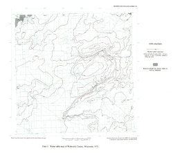
Ground-Water Resources and Geology of Walworth County, Wisconsin
-
Ground-Water Resources and Geology of Walworth County, Wisconsin
1976
Report: 45 p. + map (scale 1:125,000)
-
-
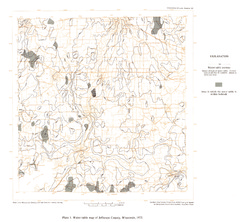
Ground-Water Resources and Geology of Jefferson County, Wisconsin
-
Ground-Water Resources and Geology of Jefferson County, Wisconsin
1976
Report: 31 p. + map (scale 1 in = 2 miles)
-
-
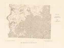
Ground-Water Resources and Geology of St. Croix County, Wisconsin
-
Ground-Water Resources and Geology of St. Croix County, Wisconsin
1976
Report: 30 p. + map (scale 1:125,000)
-
-
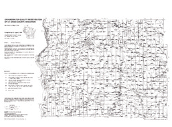
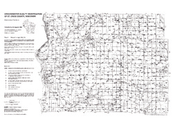
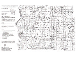
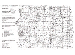
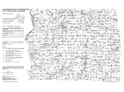
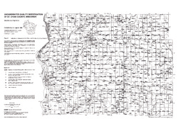
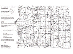
Groundwater Quality Investigation of St. Croix County, Wisconsin
Includes Plate 1: Sample Numbers (map 89-5a). Plate 2: Nitrate-N in mg/L (map 89-5b). Plate 3: Chloride in mg/L (map 89-5c). Plate 4: Laboratory Measurement of pH (map 89-5d). Plate 5: Total Hardness in mg/L (map 89-5e). Plate 6: Laboratory Measurement of Electrical Conductivity in μmhos/cm (map 89-5f). Plate 7: Ferrous Iron in mg/L (map 89-5g).... -
Wisconsin Groundwater-Level Monitoring Network Improvements, 2020-2022
This report documents work completed as part of a grant from the U.S. Geological Survey's National Groundwater Monitoring Network (NGWMN) program. It provides an overview of the Wisconsin Groundwater-Level Monitoring Network (WGLMN) and provides detailed description of well evaluation and repair activities, and drilling of new monitoring wells across the... -
Wisconsin Groundwater-Level Monitoring Network Improvements, 2018-2021
This report documents work completed as part of a grant from the U.S. Geological Survey’s National Groundwater Monitoring Network (NGWMN) program. It provides an overview of the Wisconsin Groundwater-Level Monitoring Network (WGLMN) and provides detailed description of well evaluation and repair activities, and drilling of new monitoring wells across the... -
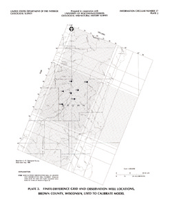
Hydrogeology and Ground-Water Use and Quality, Brown County, Wisconsin
-
Hydrogeology and Ground-Water Use and Quality, Brown County, Wisconsin
1986
Report: 42 p. + maps (scale 1:100,000)
-
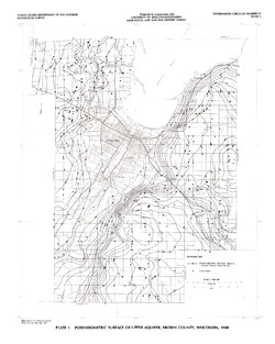
Potentiometric Surface of Upper Aquifer, Brown County, Wisconsin, 1980 [plate 1]
1986
Map: Scale 1:100,000
-
-
Groundwater Data Compilation for the Geneva Lake, Wisconsin, Area
Open-file report; contains unpublished data that has not yet been peer-reviewed.-
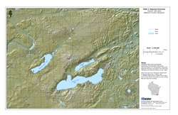
Regional Overview, Geneva Lake Area, Walworth County, Wisconsin [plate 1]
2006
Map: 11 in x 17 in, scale 1:100,000
-
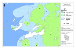
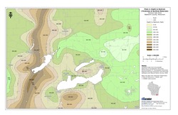
Bedrock Geology, Geneva Lake Area, Walworth County, Wisconsin [plate 2]
2006
Map: 11 in x 17 in, scale 1:100,000
-
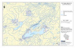
Elevation of Bedrock Surface, Geneva Lake Area, Walworth County, Wisconsin [plate 3]
2006
Map: 11 in x 17 in, scale 1:100,000
-
Depth to Bedrock (Thickness of Surficial Materials), Geneva Lake Area, Walworth County, Wisconsin [plate 4]
2006
Map: 11 in x 17 in, scale 1:100,000
-
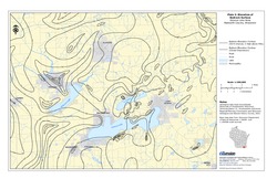
Water Table Elevation, Geneva Lake Area, Walworth County, Wisconsin [plate 5]
2006
Map: 11 in x 17 in, scale 1:100,000
-
Irrigable Lands Inventory--Phase I Groundwater and Related Information
This paper contains hydrogeologic information for the Golden Sands Resource Conservation and Development Area in central Wisconsin. The set of maps includes water-table elevation maps for the following counties: Adams, Jackson, Juneau, Marathon, Marquette, Monroe, Portage, Waupaca, Waushara, and Wood (scale 1:126,720). It also includes a regional aquifer...-
Irrigable Lands Inventory - Phase I Groundwater and Related Information
1981
Report: 13 p. + 11 maps (scale 1:126,720 and 1:500,000)
- 2 more...
-
-
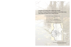
Evaluation of Groundwater Flow Models Used to Simulate the Effects of Proposed Mining on the Groundwater-Surface Water System in the Vicinity of Crandon, Forest County, Wisconsin
Open-file report; contains unpublished data that has not yet been peer-reviewed. -
Summary of Survey on Groundwater Vulnerability Mapping Practices in the United States
Open-file report; contains unpublished data that has not yet been peer-reviewed. -
Municipal Drinking Water Safety: The Link Between Groundwater, Pathogens, and Public Health
Most Wisconsin municipalities already disinfect their water supply. For those that don't, this publication describes how viruses from untreated sewage can contaminate groundwater, causing acute gastrointestinal illness. It also identifies available technology for treating water. -
Geologic and Geochemical Controls on Arsenic in Groundwater in Northeastern Wisconsin
Open-file report; contains unpublished data that has not yet been peer-reviewed. -
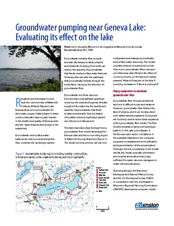
Groundwater Pumping Near Geneva Lake: Evaluating Its Effect on the Lake
A groundwater flow model developed for Geneva Lake and the surrounding region helps answer questions about flow into and out of the lake, and projects scenarios given increased pumping rates and potential long-term changes in climate. -
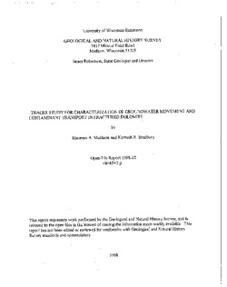
Tracer Study for Characterization of Groundwater Movement and Contaminant Transport in Fractured Dolomite
Open-file report; contains unpublished data that has not yet been peer-reviewed. -
Evaluation of NURE Hydrogeochemical Data for Use in Wisconsin Groundwater Studies
Open-file report; contains unpublished data that has not yet been peer-reviewed.-
Evaluation of NURE Hydrogeochemical Data for Use in Wisconsin Groundwater Studies
1993
Report: 57 p. + data
-

Publications Catalog
Wisconsin Geological and Natural History Survey