-
Groundwater Flow Model for the City of West Bend, Washington County, Wisconsin: Report to the City of West Bend, Wisconsin
Open-file report; contains unpublished data that has not yet been peer-reviewed. -
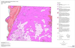
Preliminary Geologic Map of the Buried Bedrock Surface of St. Croix County, Wisconsin
Open-file report; contains unpublished data that has not yet been peer-reviewed.-
Preliminary Geologic Map of the Buried Bedrock Surface of St. Croix County, Wisconsin
2006
Map: 33 in x 21 in, scale 1:100,000
-
-
Statistical Analysis of Indoor Radon Data and Relationships to Geology in Wisconsin
Open-file report; contains unpublished data that has not yet been peer-reviewed. -
Groundwater Data Compilation for the Geneva Lake, Wisconsin, Area
Open-file report; contains unpublished data that has not yet been peer-reviewed.-
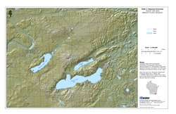
Regional Overview, Geneva Lake Area, Walworth County, Wisconsin [plate 1]
2006
Map: 11 in x 17 in, scale 1:100,000
-
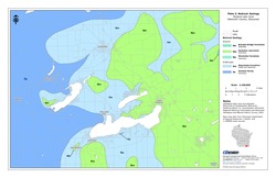
Bedrock Geology, Geneva Lake Area, Walworth County, Wisconsin [plate 2]
2006
Map: 11 in x 17 in, scale 1:100,000
-
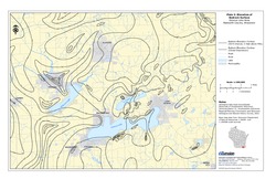
Elevation of Bedrock Surface, Geneva Lake Area, Walworth County, Wisconsin [plate 3]
2006
Map: 11 in x 17 in, scale 1:100,000
-
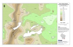
Depth to Bedrock (Thickness of Surficial Materials), Geneva Lake Area, Walworth County, Wisconsin [plate 4]
2006
Map: 11 in x 17 in, scale 1:100,000
-
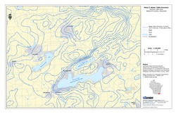
Water Table Elevation, Geneva Lake Area, Walworth County, Wisconsin [plate 5]
2006
Map: 11 in x 17 in, scale 1:100,000
-
A Local Meteoric Water Line for Madison, Wisconsin
Open-file report; contains unpublished data that has not yet been peer-reviewed. -
The Waukesha Fault and its Relationship to the Michigan Basin: A Literature Compilation
Open-file report; contains unpublished data that has not yet been peer-reviewed. -
Hydrostratigraphy of West-Central Wisconsin: A New Approach to Groundwater Management
Open-file report; contains unpublished data that has not yet been peer-reviewed.-
Hydrostratigraphy of West-Central Wisconsin: A New Approach to Groundwater Management [data]
2008
Data: Documents (.pdf file format), data (.grf, .WCL, .ca2 and .AA1 file formats)
-
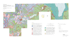
Preliminary Quaternary Geologic Map of the Southern Fox River Lowland, Wisconsin
Open-file report; contains unpublished data that has not yet been peer-reviewed.-
Preliminary Quaternary Geologic Map of the Southern Fox River Lowland, Wisconsin
2005
Map: 48 in x 27 in, scale 1:100,000
-
-
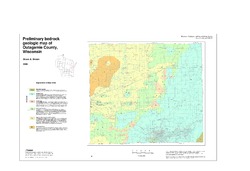
Preliminary Bedrock Geologic Map of Outagamie County, Wisconsin
Open-file report; contains unpublished data that has not yet been peer-reviewed.-
Preliminary Bedrock Geologic Map of Outagamie County, Wisconsin
2005
Map: 38 in x 26 in, scale 1:100,000
-
-
Reflooded Mine Source Term Technical Memoranda for the Proposed Crandon Mine, Forest County, Wisconsin
Open-file report; contains unpublished data that has not yet been peer-reviewed. -
Evaluation of the Reflooded Mine Solute Transport Model Developed for the Proposed Crandon Mine, Forest County, Wisconsin
Open-file report; contains unpublished data that has not yet been peer-reviewed. -
Source Term Review for the Tailings Management Area and Reclaim Pond at the Proposed Crandon Mine, Forest County, Wisconsin
Open-file report; contains unpublished data that has not yet been peer-reviewed. -
Evaluation of Groundwater Flow Models Used to Simulate the Effects of Proposed Mining on the Groundwater-Surface Water System in the Vicinity of Crandon, Forest County, Wisconsin
Open-file report; contains unpublished data that has not yet been peer-reviewed. -
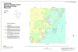
Preliminary Bedrock Geologic Map of Winnebago County, Wisconsin
Open-file report; contains unpublished data that has not yet been peer-reviewed.-
Preliminary Bedrock Geologic Map of Winnebago County, Wisconsin
2004
Map: 33.75 in x 22.5 in, scale 1:100,000
-
-
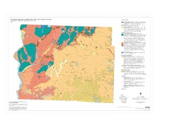
Preliminary Paleozoic Geologic Map of Fond du Lac County, Wisconsin
Open-file report; contains unpublished data that has not yet been peer-reviewed.-
Preliminary Bedrock Geologic Map of Fond du Lac County, Wisconsin [plate 1]
2004
Map: 26 in x 21 in, scale 1:100,000
-
-
Preliminary Quaternary Geologic Map of St. Croix County, Wisconsin
Open-file report; contains unpublished data that has not yet been peer-reviewed.-
Preliminary Quaternary Geologic Map of St. Croix County, Wisconsin
2004
Map: 36 in x 24 in, scale 1:100,000
-
-
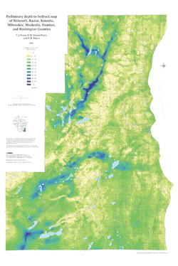
Preliminary Depth to Bedrock Map of Walworth, Racine, Kenosha, Milwaukee, Waukesha, Ozaukee, and Washington Counties
Open-file report; contains unpublished data that has not yet been peer-reviewed.-
Preliminary Depth to Bedrock Map of Walworth, Racine, Kenosha, Milwaukee, Waukesha, Ozaukee, and Washington Counties
2004
Map: 34.75 in x 52 in, scale 1:100,000
-
-
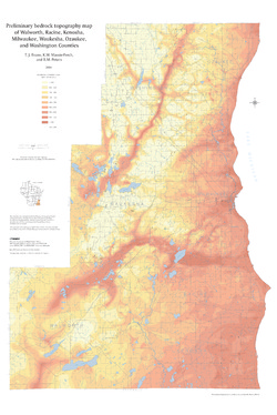
Preliminary Bedrock Topography Map of Walworth, Racine, Kenosha, Milwaukee, Waukesha, Ozaukee, and Washington Counties
Open-file report; contains unpublished data that has not yet been peer-reviewed.-
Preliminary Bedrock Topography Map of Walworth, Racine, Kenosha, Milwaukee, Waukesha, Ozaukee, and Washington Counties
2004
Map: 34.75 in x 52 in, scale 1:100,000
-
-
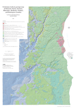
Preliminary Bedrock Geologic Map of Walworth, Racine, Kenosha, Milwaukee, Waukesha, Ozaukee, and Washington Counties
Open-file report; contains unpublished data that has not yet been peer-reviewed.-
Preliminary Bedrock Geologic Map of Walworth, Racine, Kenosha, Milwaukee, Waukesha, Ozaukee, and Washington Counties
2004
Map: 34.75 in x 52 in, scale 1:100,000
-
Preliminary Bedrock Geologic Map of Walworth, Racine, Kenosha, Milwaukee, Waukesha, Ozaukee, and Washington Counties [GIS data]
2004
GIS Data: GeMS file geodatabase (.gdb file format)
-
-
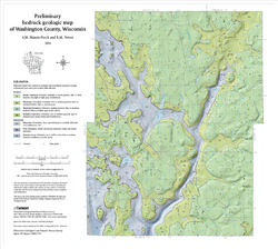
Preliminary Bedrock Geology of Washington County, Wisconsin
Open-file report; contains unpublished data that has not yet been peer-reviewed.-
Preliminary Bedrock Geologic Map of Washington County, Wisconsin
2004
Map: 19 in x 17 in, scale 1:100,000
-
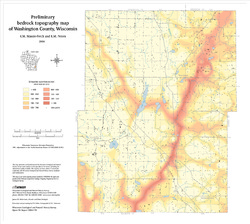
Preliminary Bedrock Topography Map of Washington County, Wisconsin
2004
Map: 19 in x 17 in,scale 1:100,000
-
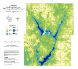
Preliminary Depth to Bedrock Map of Washington County, Wisconsin
2004
Map: 19 in x 17 in, scale 1:100,000
-

Publications Catalog
Wisconsin Geological and Natural History Survey